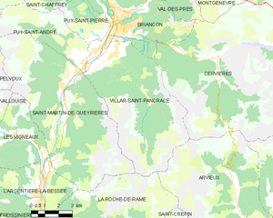
Villar-Saint-Pancrace (Villar-Saint-Pancrace)
- commune in Hautes-Alpes, France
 Hiking in Villar-Saint-Pancrace
Villar-Saint-Pancrace is a charming alpine village located in the Provence-Alpes-Côte d'Azur region of France, near the town of Briançon. The area is known for its stunning landscapes, rich biodiversity, and a variety of hiking trails that cater to different skill levels. Here are some highlights for hiking in this region:
Hiking Trails
-
Le Sentier des Sources: This relatively easy trail allows hikers to explore the natural springs in the area. It offers beautiful views of the surrounding mountains and is suitable for families.
-
Crête de la Montagne: For those looking for a more challenging hike, this trail leads to a stunning viewpoint where you can see the Écrins National Park. The route is steep but rewards hikers with breathtaking panoramic views.
-
Lac de la Clarée: A moderate hike that takes you to a picturesque alpine lake, perfect for a picnic or a relaxing break. It’s a great spot for photography, especially during the summer months when the wildflowers are in bloom.
-
Le Tour des Cerces: This is a longer trek that involves more preparation but offers the chance to fully immerse yourself in the beautiful natural landscapes, featuring glacial lakes, beautiful valleys, and diverse wildlife.
Things to Keep in Mind
-
Seasonal Considerations: The best times for hiking in Villar-Saint-Pancrace are generally from late spring to early autumn. During winter, some trails might be snow-covered and require special equipment or may be less accessible.
-
Wildlife: Be on the lookout for local wildlife including marmots, chamois, and a wide variety of birds, especially if you venture into the more remote areas.
-
Safety: As with all hiking, it’s essential to prepare adequately. Bring plenty of water, wear appropriate footwear, and consider bringing trekking poles for steep sections. Always check the weather forecast before heading out.
-
Local Regulations: It’s a good idea to be aware of any local regulations regarding trail usage and conservation efforts in the area to help preserve the natural beauty.
Conclusion
Villar-Saint-Pancrace offers a fantastic array of hiking opportunities, with trails that provide both scenic beauty and the chance for adventure. Whether you’re a seasoned hiker or a novice, you’ll find trails that suit your interests and ability levels. Enjoy your hike!
- Country:

- Postal Code: 05100
- Coordinates: 44° 52' 23" N, 6° 37' 38" E


- GPS tracks (wikiloc): [Link]
- AboveSeaLevel: 1260 м m
- Area: 42.53 sq km
- Population: 1457
- Wikipedia en: wiki(en)
- Wikipedia: wiki(fr)
- Wikidata storage: Wikidata: Q542509
- Wikipedia Commons Category: [Link]
- Freebase ID: [/m/03mfncm]
- Freebase ID: [/m/03mfncm]
- GeoNames ID: Alt: [2968929]
- GeoNames ID: Alt: [2968929]
- SIREN number: [210501839]
- SIREN number: [210501839]
- BnF ID: [12309949z]
- BnF ID: [12309949z]
- PACTOLS thesaurus ID: [pcrte82bKb48zY]
- PACTOLS thesaurus ID: [pcrte82bKb48zY]
- INSEE municipality code: 05183
- INSEE municipality code: 05183
Shares border with regions:

Arvieux
- commune in Hautes-Alpes, France
Arvieux is a stunning destination situated in the Queyras Regional Natural Park in the French Alps, known for its beautiful landscapes, charming villages, and numerous hiking trails. Here are some highlights and tips for hiking in Arvieux:...
- Country:

- Postal Code: 05350
- Coordinates: 44° 46' 0" N, 6° 44' 20" E


- GPS tracks (wikiloc): [Link]
- Area: 72.62 sq km
- Population: 363

Cervières
- commune in Hautes-Alpes, France
Cervières is a picturesque valley located in the Hautes-Alpes region of France, renowned for its stunning natural beauty, diverse landscapes, and rich cultural heritage. It offers a variety of hiking opportunities suited for all levels, from casual strolls to more challenging treks. Here are some highlights of hiking in this area:...
- Country:

- Postal Code: 05100
- Coordinates: 44° 52' 11" N, 6° 43' 19" E


- GPS tracks (wikiloc): [Link]
- Area: 109.68 sq km
- Population: 183

La Roche-de-Rame
- commune in Hautes-Alpes, France
La Roche-de-Rame is a picturesque commune located in the Hautes-Alpes department in southeastern France. It is nestled in the stunning French Alps, providing a perfect backdrop for hiking enthusiasts. Here are some key points to consider if you're planning a hiking trip to La Roche-de-Rame:...
- Country:

- Postal Code: 05310
- Coordinates: 44° 45' 0" N, 6° 34' 50" E


- GPS tracks (wikiloc): [Link]
- Area: 40.53 sq km
- Population: 837

Puy-Saint-André
- commune in Hautes-Alpes, France
Puy-Saint-André is a charming village located in the Hautes-Alpes region of southeastern France, and it serves as a wonderful base for hiking enthusiasts. Nestled near the Écrins National Park, the area boasts stunning alpine scenery, diverse flora and fauna, and a range of trails suitable for various skill levels....
- Country:

- Postal Code: 05100
- Coordinates: 44° 52' 44" N, 6° 35' 55" E


- GPS tracks (wikiloc): [Link]
- Area: 15.37 sq km
- Population: 466

Saint-Martin-de-Queyrières
- commune in Hautes-Alpes, France
 Hiking in Saint-Martin-de-Queyrières
Saint-Martin-de-Queyrières is a charming village located in the Hautes-Alpes region of France. It's a fantastic starting point for hiking enthusiasts as it offers access to stunning landscapes, diverse trails, and beautiful views of the Écrins National Park and surrounding mountains. Here are some highlights regarding hiking in this area:...
- Country:

- Postal Code: 05120
- Coordinates: 44° 50' 25" N, 6° 35' 7" E


- GPS tracks (wikiloc): [Link]
- AboveSeaLevel: 1200 м m
- Area: 55.52 sq km
- Population: 1131

Briançon
- commune in Hautes-Alpes, France
Briançon, located in the French Alps, is renowned for its stunning natural beauty and rich history. It sits at an elevation of about 1,326 meters (4,347 feet) and is surrounded by impressive mountain ranges, making it an ideal destination for hiking enthusiasts....
- Country:

- Postal Code: 05100
- Coordinates: 44° 53' 45" N, 6° 38' 6" E


- GPS tracks (wikiloc): [Link]
- AboveSeaLevel: 1325 м m
- Area: 28.07 sq km
- Population: 12370
- Web site: [Link]
