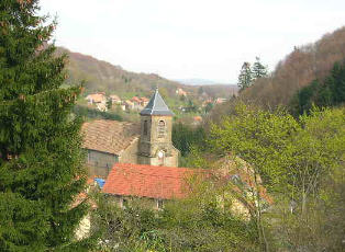
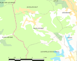
Auxelles-Bas (Auxelles-Bas)
- commune in Territoire de Belfort, France
- Country:

- Postal Code: 90200
- Coordinates: 47° 44' 3" N, 6° 46' 50" E


- GPS tracks (wikiloc): [Link]
- Area: 9.41 sq km
- Population: 474
- Web site: http://auxelles-bas.com/index.php
- Wikipedia en: wiki(en)
- Wikipedia: wiki(fr)
- Wikidata storage: Wikidata: Q119767
- Wikipedia Commons Category: [Link]
- Freebase ID: [/m/03mh8_j]
- Freebase ID: [/m/03mh8_j]
- Freebase ID: [/m/03mh8_j]
- GeoNames ID: Alt: [6452599]
- GeoNames ID: Alt: [6452599]
- GeoNames ID: Alt: [6452599]
- SIREN number: [219000056]
- SIREN number: [219000056]
- SIREN number: [219000056]
- BnF ID: [15279946m]
- BnF ID: [15279946m]
- BnF ID: [15279946m]
- INSEE municipality code: 90005
- INSEE municipality code: 90005
- INSEE municipality code: 90005
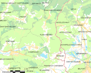
Shares border with regions:


Auxelles-Haut
- commune in Territoire de Belfort, France
- Country:

- Postal Code: 90200
- Coordinates: 47° 44' 36" N, 6° 46' 23" E


- GPS tracks (wikiloc): [Link]
- Area: 6.48 sq km
- Population: 294


Chaux
- commune in Territoire de Belfort, France
- Country:

- Postal Code: 90330
- Coordinates: 47° 42' 20" N, 6° 50' 15" E


- GPS tracks (wikiloc): [Link]
- AboveSeaLevel: 463 м m
- Area: 9.26 sq km
- Population: 1109
- Web site: [Link]


Giromagny
- commune in Territoire de Belfort, France
- Country:

- Postal Code: 90200
- Coordinates: 47° 44' 32" N, 6° 49' 32" E


- GPS tracks (wikiloc): [Link]
- AboveSeaLevel: 470 м m
- Area: 5.65 sq km
- Population: 3130
- Web site: [Link]


Plancher-Bas
- commune in Haute-Saône, France
- Country:

- Postal Code: 70290
- Coordinates: 47° 43' 16" N, 6° 43' 58" E


- GPS tracks (wikiloc): [Link]
- Area: 29.12 sq km
- Population: 1963
- Web site: [Link]


Lachapelle-sous-Chaux
- commune in Territoire de Belfort, France
- Country:

- Postal Code: 90300
- Coordinates: 47° 42' 17" N, 6° 49' 16" E


- GPS tracks (wikiloc): [Link]
- Area: 11.16 sq km
- Population: 718
- Web site: [Link]
