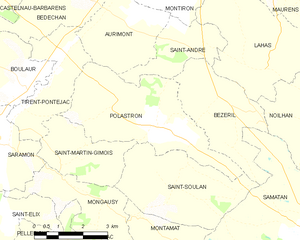
Bézéril (Bézéril)

- commune in Gers, France
- Country:

- Postal Code: 32130
- Coordinates: 43° 32' 37" N, 0° 52' 40" E


- GPS tracks (wikiloc): [Link]
- Area: 9.65 sq km
- Population: 126
- Wikipedia en: wiki(en)
- Wikipedia: wiki(fr)
- Wikidata storage: Wikidata: Q1072031
- Wikipedia Commons Category: [Link]
- Freebase ID: [/m/03nrnw6]
- GeoNames ID: Alt: [6448340]
- SIREN number: [213200512]
- INSEE municipality code: 32051
Shares border with regions:
Saint-André
- commune in Gers, France
- Country:
- Postal Code: 32200
- Coordinates: 43° 33' 45" N, 0° 51' 23" E
- GPS tracks (wikiloc): [Link]
- AboveSeaLevel: 184 м m
- Area: 5.58 sq km
- Population: 115
Saint-Soulan
- commune in Gers, France
- Country:
- Postal Code: 32220
- Coordinates: 43° 30' 29" N, 0° 51' 28" E
- GPS tracks (wikiloc): [Link]
- Area: 12.31 sq km
- Population: 161
Noilhan
- commune in Gers, France
- Country:
- Postal Code: 32130
- Coordinates: 43° 32' 7" N, 0° 55' 57" E
- GPS tracks (wikiloc): [Link]
- Area: 18.03 sq km
- Population: 378
- Web site: [Link]


Samatan
- commune in Gers, France
- Country:
- Postal Code: 32130
- Coordinates: 43° 29' 34" N, 0° 55' 51" E
- GPS tracks (wikiloc): [Link]
- Area: 33.53 sq km
- Population: 2377
- Web site: [Link]
Lahas
- commune in Gers, France
- Country:
- Postal Code: 32130
- Coordinates: 43° 33' 16" N, 0° 53' 30" E
- GPS tracks (wikiloc): [Link]
- Area: 14.54 sq km
- Population: 171

Polastron
- commune in Gers, France
- Country:
- Postal Code: 32130
- Coordinates: 43° 31' 52" N, 0° 50' 41" E
- GPS tracks (wikiloc): [Link]
- AboveSeaLevel: 192 м m
- Area: 15.21 sq km
- Population: 269