Lahas (Lahas)

- commune in Gers, France
- Country:

- Postal Code: 32130
- Coordinates: 43° 33' 16" N, 0° 53' 30" E


- GPS tracks (wikiloc): [Link]
- Area: 14.54 sq km
- Population: 171
- Wikipedia en: wiki(en)
- Wikipedia: wiki(fr)
- Wikidata storage: Wikidata: Q733148
- Wikipedia Commons Category: [Link]
- Freebase ID: [/m/03nrqb_]
- GeoNames ID: Alt: [6431948]
- SIREN number: [213201825]
- BnF ID: [152557680]
- INSEE municipality code: 32182
Shares border with regions:
Saint-André
- commune in Gers, France
- Country:
- Postal Code: 32200
- Coordinates: 43° 33' 45" N, 0° 51' 23" E
- GPS tracks (wikiloc): [Link]
- AboveSeaLevel: 184 м m
- Area: 5.58 sq km
- Population: 115


Montiron
- commune in Gers, France
- Country:
- Postal Code: 32200
- Coordinates: 43° 35' 9" N, 0° 50' 51" E
- GPS tracks (wikiloc): [Link]
- Area: 10.54 sq km
- Population: 134
Noilhan
- commune in Gers, France
- Country:
- Postal Code: 32130
- Coordinates: 43° 32' 7" N, 0° 55' 57" E
- GPS tracks (wikiloc): [Link]
- Area: 18.03 sq km
- Population: 378
- Web site: [Link]
Frégouville
- commune in Gers, France
- Country:
- Postal Code: 32490
- Coordinates: 43° 35' 20" N, 0° 57' 15" E
- GPS tracks (wikiloc): [Link]
- Area: 12.32 sq km
- Population: 339
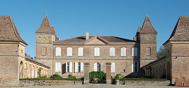
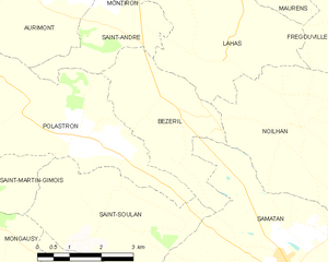
Bézéril
- commune in Gers, France
- Country:
- Postal Code: 32130
- Coordinates: 43° 32' 37" N, 0° 52' 40" E
- GPS tracks (wikiloc): [Link]
- Area: 9.65 sq km
- Population: 126
Maurens
- commune in Gers, France
- Country:
- Postal Code: 32200
- Coordinates: 43° 35' 42" N, 0° 54' 59" E
- GPS tracks (wikiloc): [Link]
- AboveSeaLevel: 260 м m
- Area: 13.03 sq km
- Population: 310