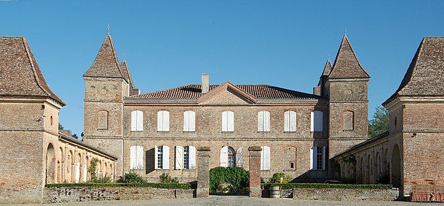
Saint-André (Saint-André)

- commune in Gers, France
- Country:

- Postal Code: 32200
- Coordinates: 43° 33' 45" N, 0° 51' 23" E


- GPS tracks (wikiloc): [Link]
- AboveSeaLevel: 184 м m
- Area: 5.58 sq km
- Population: 115
- Wikipedia en: wiki(en)
- Wikipedia: wiki(fr)
- Wikidata storage: Wikidata: Q1004036
- Wikipedia Commons Category: [Link]
- Freebase ID: [/m/03nrt8w]
- GeoNames ID: Alt: [6616522]
- SIREN number: [213203565]
- BnF ID: [15255942v]
- INSEE municipality code: 32356
Shares border with regions:


Montiron
- commune in Gers, France
- Country:
- Postal Code: 32200
- Coordinates: 43° 35' 9" N, 0° 50' 51" E
- GPS tracks (wikiloc): [Link]
- Area: 10.54 sq km
- Population: 134
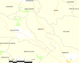
Bézéril
- commune in Gers, France
- Country:
- Postal Code: 32130
- Coordinates: 43° 32' 37" N, 0° 52' 40" E
- GPS tracks (wikiloc): [Link]
- Area: 9.65 sq km
- Population: 126
Lahas
- commune in Gers, France
- Country:
- Postal Code: 32130
- Coordinates: 43° 33' 16" N, 0° 53' 30" E
- GPS tracks (wikiloc): [Link]
- Area: 14.54 sq km
- Population: 171


Aurimont
- commune in Gers, France
- Country:
- Postal Code: 32450
- Coordinates: 43° 34' 24" N, 0° 49' 15" E
- GPS tracks (wikiloc): [Link]
- Area: 8.07 sq km
- Population: 201

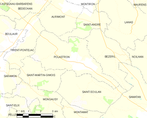
Polastron
- commune in Gers, France
- Country:
- Postal Code: 32130
- Coordinates: 43° 31' 52" N, 0° 50' 41" E
- GPS tracks (wikiloc): [Link]
- AboveSeaLevel: 192 м m
- Area: 15.21 sq km
- Population: 269