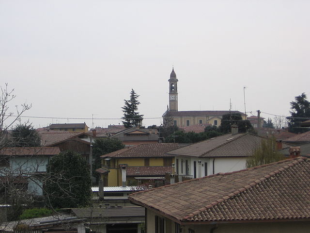
Calcinate (Calcinate)
.svg)
- Italian comune
 Hiking in Calcinate
Calcinate, located in the province of Bergamo in Italy, is not particularly known as a prime hiking destination, but it offers access to the scenic landscapes and trails in the surrounding regions of Lombardy. Here are some suggestions and information about hiking in and around Calcinate:
Nearby Hiking Areas:
-
Valle Seriana: Located to the north of Calcinate, Valle Seriana features numerous trails suitable for different levels of hikers. You can explore paths leading through lush forests, along rivers, and up to panoramic viewpoints.
-
Orobie Alps: A bit further north, the Orobie Alps are a fantastic hiking destination with trails ranging from easy strolls to challenging climbs. The area is well-marked and provides stunning views of the mountains and valleys.
-
Parco dei Colli di Bergamo: This regional park, close to Calcinate, offers various trails that meander through hills, forests, and vineyards. It's particularly nice for day hikes and has numerous picnic spots along the way.
Tips for Hiking in Calcinate:
-
Trail Maps: Make sure to acquire local trail maps or use a hiking app to navigate the paths, as signage can vary.
-
Weather Considerations: The weather can change rapidly in mountainous regions, so check forecasts and be prepared with appropriate clothing and gear.
-
Local Resources: Visit local tourist information centers for recommendations on trails, guided tours, or other essential information.
-
Respect Nature: Always follow the “Leave No Trace” principles, ensuring you respect wildlife and the natural environment during your hikes.
Gear Suggestions:
- Footwear: Sturdy hiking boots with good tread for uneven terrains.
- Hydration: Carry adequate water, as some trails may lack water sources.
- Snacks: High-energy snacks like nuts, fruits, or granola bars are great for longer hikes.
- First Aid Kit: Always a good idea to have on hand for minor injuries.
While Calcinate itself may not have notable hiking trails, its proximity to various natural attractions makes it a suitable base for exploring the beautiful landscapes of Lombardy. Enjoy your hiking adventures!
- Country:

- Postal Code: 24050
- Local Dialing Code: 035
- Licence Plate Code: BG
- Coordinates: 45° 37' 16" N, 9° 48' 1" E


- GPS tracks (wikiloc): [Link]
- AboveSeaLevel: 186 м m
- Area: 15.08 sq km
- Population: 5985
- Web site: http://www.comune.calcinate.bg.it
- Wikipedia en: wiki(en)
- Wikipedia: wiki(it)
- Wikidata storage: Wikidata: Q100123
- Wikipedia Commons Gallery: [Link]
- Wikipedia Commons Category: [Link]
- Freebase ID: [/m/0drr00]
- GeoNames ID: Alt: [6541420]
- VIAF ID: Alt: [234366499]
- OSM relation ID: [45469]
- WOEID: [711711]
- UN/LOCODE: [ITCCT]
- ISTAT ID: 016043
- Italian cadastre code: B393
Shares border with regions:


Cavernago
- Italian comune
Hiking in Cavernago
Cavernago is a charming village located in the Lombardy region of Italy, close to Bergamo. While it may not be as widely recognized for hiking as some other areas in the region, it does offer opportunities for outdoor activities and exploration of the surrounding countryside....
- Country:
- Postal Code: 24050
- Local Dialing Code: 035
- Licence Plate Code: BG
- Coordinates: 45° 38' 0" N, 9° 46' 0" E
- GPS tracks (wikiloc): [Link]
- AboveSeaLevel: 199 м m
- Area: 7.65 sq km
- Population: 2587
- Web site: [Link]


Costa di Mezzate
- Italian comune
Hiking in Costa di Mezzate
Costa di Mezzate is a charming location in Italy, located in the province of Bergamo in Lombardy. It's a great spot for hiking, particularly for those who enjoy scenic trails and beautiful landscapes. Here are some details about hiking in Costa di Mezzate:...
- Country:
- Postal Code: 24060
- Local Dialing Code: 035
- Licence Plate Code: BG
- Coordinates: 45° 40' 0" N, 9° 48' 0" E
- GPS tracks (wikiloc): [Link]
- AboveSeaLevel: 218 м m
- Area: 5.22 sq km
- Population: 3374
- Web site: [Link]


Ghisalba
- Italian comune
Hiking in Ghisalba
Ghisalba is a small town located in the province of Bergamo in northern Italy. While it may not be widely recognized as a prominent hiking destination, its surrounding areas offer opportunities for nature walks and outdoor activities. Here’s what you can expect when hiking near Ghisalba:...
- Country:
- Postal Code: 24050
- Local Dialing Code: 0363
- Licence Plate Code: BG
- Coordinates: 45° 36' 0" N, 9° 45' 0" E
- GPS tracks (wikiloc): [Link]
- AboveSeaLevel: 170 м m
- Area: 10.59 sq km
- Population: 6170
- Web site: [Link]


Mornico al Serio
- Italian comune
Hiking in Mornico al Serio
Mornico al Serio is a quaint village located in the province of Bergamo in Lombardy, Italy. While it may not be a well-known hiking destination, it is surrounded by beautiful landscapes that offer opportunities for outdoor activities, including hiking....
- Country:
- Postal Code: 24050
- Local Dialing Code: 035
- Licence Plate Code: BG
- Coordinates: 45° 35' 33" N, 9° 48' 32" E
- GPS tracks (wikiloc): [Link]
- AboveSeaLevel: 162 м m
- Area: 6.92 sq km
- Population: 2942
- Web site: [Link]

Palosco
- Italian comune
Hiking in Palosco
Palosco is a small town in the Lombardy region of Italy, located near the foothills of the Alps and within striking distance of a variety of natural landscapes. While it may not be as famous as other hiking destinations in Italy, it offers some beautiful trails and opportunities for outdoor activities....
- Country:
- Postal Code: 24050
- Local Dialing Code: 035
- Licence Plate Code: BG
- Coordinates: 45° 35' 0" N, 9° 50' 0" E
- GPS tracks (wikiloc): [Link]
- AboveSeaLevel: 157 м m
- Area: 10.79 sq km
- Population: 5808
- Web site: [Link]


Seriate
- Italian comune
Hiking in Seriate
Seriate is a town located in the Lombardy region of northern Italy, close to the city of Bergamo. While it may not be as widely recognized for hiking as some other locations in the Italian Alps, it does have access to several beautiful hiking trails and natural landscapes that outdoor enthusiasts can enjoy....
- Country:
- Postal Code: 24068
- Local Dialing Code: 035
- Licence Plate Code: BG
- Coordinates: 45° 41' 5" N, 9° 43' 4" E
- GPS tracks (wikiloc): [Link]
- AboveSeaLevel: 247 м m
- Area: 12.53 sq km
- Population: 25358
- Web site: [Link]


Bagnatica
- Italian comune
Hiking in Bagnatica
Bagnatica is a small municipality located in the Lombardy region of Italy, near the province of Bergamo. While it may not be as well-known as some other hiking destinations in Italy, there are several opportunities for outdoor activities in and around this area....
- Country:
- Postal Code: 24060
- Local Dialing Code: 035
- Licence Plate Code: BG
- Coordinates: 45° 39' 43" N, 9° 46' 52" E
- GPS tracks (wikiloc): [Link]
- AboveSeaLevel: 220 м m
- Area: 6.55 sq km
- Population: 4317
- Web site: [Link]


Bolgare
- Italian comune
Hiking in Bolgare
Bolgare is a small town in the province of Bergamo, Lombardy, Italy. Nestled in a beautiful region that offers access to the stunning landscapes of the Italian Alps, Bolgare is a great starting point for various hiking adventures....
- Country:
- Postal Code: 24060
- Local Dialing Code: 035
- Licence Plate Code: BG
- Coordinates: 45° 38' 3" N, 9° 49' 1" E
- GPS tracks (wikiloc): [Link]
- AboveSeaLevel: 199 м m
- Area: 8.59 sq km
- Population: 6183
- Web site: [Link]