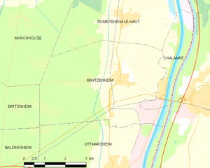
Battenheim (Battenheim)

- commune in Haut-Rhin, France
 Hiking in Battenheim
Battenheim, located in the Alsace region of France, offers a variety of scenic landscapes and hiking opportunities for outdoor enthusiasts. Its proximity to the Vosges Mountains and the Rhine River makes it an attractive destination for nature lovers. Here are some key points about hiking in the Battenheim area:
Trails and Routes
-
Local Trails: The region usually has well-marked hiking trails ranging from easy walks to more challenging hikes. You can explore lush forests, vineyards, and picturesque villages.
-
Vosges Mountains: A short drive from Battenheim, the Vosges offer more rugged trails with stunning views. These hikes can range from day trips to longer treks.
-
GR Paths: France has a network of long-distance trails, known as GR (Grande Randonnée) paths. There may be segments nearby that you can incorporate into your hikes.
Scenic Highlights
- Nature Reserves: Look for nearby nature reserves that may feature diverse wildlife and plant species.
- Vineyards: The Alsace wine route is famous, and many trails pass through vineyards where you can stop for tastings of local wines.
- Historical Sites: You can combine your hiking with visits to historical sites, such as old castles or traditional Alsace houses.
Preparation & Safety
- Weather: Check the local weather conditions before heading out, as the weather can change quickly, especially in mountainous areas.
- Gear: Wear durable hiking boots and bring appropriate clothing based on the season. A map or GPS device is also advisable.
- Hydration & Snacks: Carry enough water and some snacks to keep your energy up on the trails.
Local Amenities
- Accommodations: Battenheim has several guesthouses and hotels if you're looking to make a multi-day trip.
- Restaurants: Enjoy local cuisine after your hikes at nearby restaurants that often serve traditional Alsatian dishes.
Before you head out, it’s a good idea to check local resources or tourist information centers for updated trail information and recommendations tailored to your ability and interests. Happy hiking!
- Country:

- Postal Code: 68390
- Coordinates: 47° 49' 11" N, 7° 22' 54" E


- GPS tracks (wikiloc): [Link]
- Area: 16.88 sq km
- Population: 1508
- Wikipedia en: wiki(en)
- Wikipedia: wiki(fr)
- Wikidata storage: Wikidata: Q326411
- Wikipedia Commons Category: [Link]
- Freebase ID: [/m/03nph23]
- Freebase ID: [/m/03nph23]
- GeoNames ID: Alt: [3034595]
- GeoNames ID: Alt: [3034595]
- SIREN number: [216800227]
- SIREN number: [216800227]
- BnF ID: [15271726h]
- BnF ID: [15271726h]
- VIAF ID: Alt: [238796009]
- VIAF ID: Alt: [238796009]
- INSEE municipality code: 68022
- INSEE municipality code: 68022
Shares border with regions:


Ottmarsheim
- commune in Haut-Rhin, France
Hiking in Ottmarsheim
Ottmarsheim, located in the Alsace region of France near the border with Germany, offers a charming setting for outdoor enthusiasts. While it is primarily known for its historical significance and beautiful architecture, particularly the Abbey of Ottmarsheim, the surrounding areas provide opportunities for hiking and nature walks....
- Country:
- Postal Code: 68490
- Coordinates: 47° 47' 14" N, 7° 30' 37" E
- GPS tracks (wikiloc): [Link]
- AboveSeaLevel: 217.235 м m
- Area: 25.67 sq km
- Population: 1760
- Web site: [Link]


Ruelisheim
- commune in Haut-Rhin, France
Hiking in Ruelisheim
Ruelisheim, located in the Alsace region of France, offers a charming setting for hiking enthusiasts. While it may not be as widely known as some larger hiking destinations, the area has its own unique appeal....
- Country:
- Postal Code: 68270
- Coordinates: 47° 49' 23" N, 7° 21' 30" E
- GPS tracks (wikiloc): [Link]
- Area: 7.27 sq km
- Population: 2278
- Web site: [Link]


Munchhouse
- commune in Haut-Rhin, France
Hiking in Munchhouse
Munchhouse is a quaint and lesser-known destination for hiking enthusiasts, nestled in the natural beauty of the surrounding landscapes. While it may not be as popular as other hiking areas, it offers a unique experience for those willing to explore its trails. Here are some key points to consider when hiking in Munchhouse:...
- Country:
- Postal Code: 68740
- Coordinates: 47° 52' 6" N, 7° 27' 3" E
- GPS tracks (wikiloc): [Link]
- Area: 24.05 sq km
- Population: 1574


Baldersheim
- commune in Haut-Rhin, France
Hiking in Baldersheim
Baldersheim is a picturesque area known for its scenic landscapes and outdoor activities, but specific hiking trails and options can vary based on local geography and development. Since Baldersheim may refer to several different locations, you’ll want to clarify which one you’re interested in, often it relates to places in Europe, such as in France or Germany....
- Country:
- Postal Code: 68390
- Coordinates: 47° 48' 1" N, 7° 22' 49" E
- GPS tracks (wikiloc): [Link]
- Area: 12.76 sq km
- Population: 2608

Bantzenheim
- commune in Haut-Rhin, France
Hiking in Bantzenheim
Bantzenheim is a small commune in the Alsace region of France, known for its charming countryside and scenic landscapes. While it may not be as widely recognized as some larger hiking destinations, there are still opportunities for enjoyable hikes in and around Bantzenheim. Here are some aspects to consider for hiking in this area:...
- Country:
- Postal Code: 68490
- Coordinates: 47° 49' 29" N, 7° 30' 56" E
- GPS tracks (wikiloc): [Link]
- Area: 21.22 sq km
- Population: 1637
- Web site: [Link]


Ensisheim
- commune in Haut-Rhin, France
- Country:
- Postal Code: 68190
- Coordinates: 47° 51' 56" N, 7° 21' 9" E
- GPS tracks (wikiloc): [Link]
- Area: 36.59 sq km
- Population: 7423
- Web site: [Link]