
Baume-les-Dames (Baume-les-Dames)
- commune in Doubs, France
Baume-les-Dames, located in the Doubs department of eastern France, is surrounded by scenic landscapes that offer a variety of hiking opportunities. Here are some key highlights about hiking in this charming area:
Natural Beauty
- Forests and Hills: The region is characterized by lush forests, rolling hills, and the Doubs River, which provide stunning views and a rich environment for wildlife.
- Riverside Trails: Many hiking routes follow the banks of the Doubs River, allowing hikers to enjoy the calming sound of flowing water and picturesque river views.
Popular Hiking Routes
- Sentiers de Grande Randonnée (GR Routes): There are several long-distance hiking trails (GR) that pass through or near Baume-les-Dames. These trails offer well-marked paths that are suitable for experienced hikers and provide opportunities to explore the surrounding countryside.
- Local Trails: There are also numerous shorter trails that are great for family hikes or less experienced hikers, especially around the town and nearby natural parks.
Flora and Fauna
- Biodiversity: The area is rich in biodiversity, with opportunities to spot various species of birds, mammals, and plant life unique to the region. Look out for local wildlife, especially in the quieter forested areas.
Cultural Points
- Historical Sites: While hiking, you might come across historical sites, including old chapels and ruins, adding a cultural dimension to your outdoor experience.
- Town of Baume-les-Dames: The town itself is worth exploring, with quaint streets, local shops, and cafes where hikers can rest and enjoy regional specialties.
Seasonal Considerations
- Spring and Summer: Ideal for hiking with mild temperatures and blooming flora.
- Fall: Offers stunning autumn colors, making it a picturesque time to hike.
- Winter: Snow can limit hiking options, but the area can be beautiful in winter as well, for those interested in winter hiking or snowshoeing.
Preparation Tips
- Gear: Ensure you have appropriate hiking gear, including comfortable footwear, weather-appropriate clothing, and plenty of water and snacks.
- Maps and Guides: It's advisable to carry a hiking map or guidebook to navigate the trails safely, as well as to inform someone of your hiking plans.
Baume-les-Dames is a hidden gem for hiking enthusiasts, offering routes that cater to different skill levels while providing an opportunity to immerse oneself in nature and local culture.
- Country:

- Postal Code: 25110
- Coordinates: 47° 21' 8" N, 6° 21' 36" E


- GPS tracks (wikiloc): [Link]
- Area: 24.79 sq km
- Population: 5241
- Web site: http://www.baume-les-dames.org
- Wikipedia en: wiki(en)
- Wikipedia: wiki(fr)
- Wikidata storage: Wikidata: Q733784
- Wikipedia Commons Category: [Link]
- Freebase ID: [/m/03mgc53]
- Freebase ID: [/m/03mgc53]
- GeoNames ID: Alt: [6447832]
- GeoNames ID: Alt: [6447832]
- SIREN number: [212500474]
- SIREN number: [212500474]
- BnF ID: [15252273g]
- BnF ID: [15252273g]
- VIAF ID: Alt: [126388768]
- VIAF ID: Alt: [126388768]
- GND ID: Alt: [4603150-9]
- GND ID: Alt: [4603150-9]
- archINFORM location ID: [6889]
- archINFORM location ID: [6889]
- Library of Congress authority ID: Alt: [n86067337]
- Library of Congress authority ID: Alt: [n86067337]
- WOEID: [578453]
- WOEID: [578453]
- INSEE municipality code: 25047
- INSEE municipality code: 25047
Shares border with regions:


Val-de-Roulans
- commune in Doubs, France
Val-de-Roulans, located in the Doubs department of France, offers a variety of hiking opportunities amidst beautiful natural landscapes. The region is characterized by its rolling hills, lush forests, and scenic views, making it an excellent destination for both novice and experienced hikers....
- Country:

- Postal Code: 25640
- Coordinates: 47° 21' 42" N, 6° 15' 52" E


- GPS tracks (wikiloc): [Link]
- Area: 2.99 sq km
- Population: 189


Breconchaux
- commune in Doubs, France
It seems you might be referring to the Brecon Beacons, a stunning National Park located in South Wales known for its beautiful landscapes, rolling hills, and diverse wildlife. Here are some details about hiking there:...
- Country:

- Postal Code: 25640
- Coordinates: 47° 20' 25" N, 6° 16' 0" E


- GPS tracks (wikiloc): [Link]
- Area: 3.26 sq km
- Population: 97
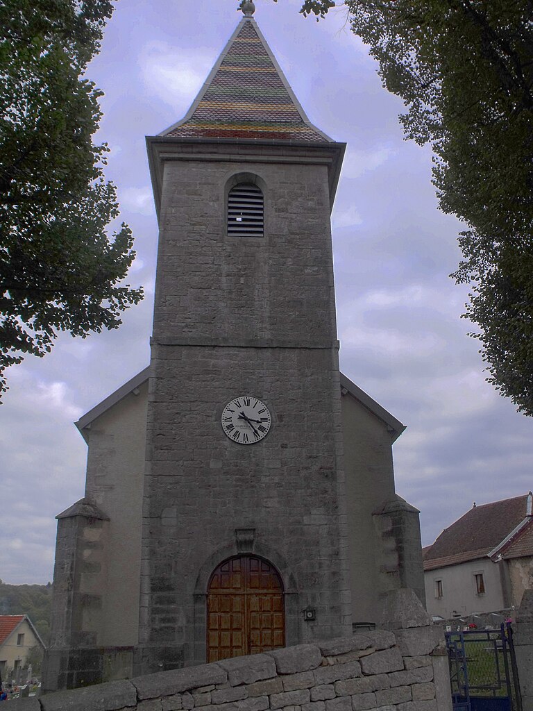
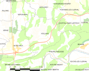
Voillans
- commune in Doubs, France
Voillans is a picturesque village located in the Franche-Comté region of eastern France, known for its beautiful landscapes and serene natural surroundings. Hiking in and around Voillans offers a great opportunity to explore the scenic beauty of the area, including rolling hills, forests, and small rivers....
- Country:

- Postal Code: 25110
- Coordinates: 47° 23' 12" N, 6° 24' 47" E


- GPS tracks (wikiloc): [Link]
- Area: 10.12 sq km
- Population: 207


Villers-Saint-Martin
- commune in Doubs, France
 Hiking in Villers-Saint-Martin
Villers-Saint-Martin is a charming area located in the Walloon region of Belgium, which offers various opportunities for hiking enthusiasts. While it may not be as widely known as some major hiking destinations, it has its own unique allure with scenic landscapes, charming rural paths, and a peaceful atmosphere....
- Country:

- Postal Code: 25110
- Coordinates: 47° 20' 35" N, 6° 24' 34" E


- GPS tracks (wikiloc): [Link]
- Area: 8.9 sq km
- Population: 222
- Web site: [Link]

Esnans
- commune in Doubs, France
Esnans is a small commune located in the Doubs department of eastern France, and while it may not be as widely known for hiking as some larger areas, it can offer scenic landscapes and relatively quiet trails suitable for hiking enthusiasts....
- Country:

- Postal Code: 25110
- Coordinates: 47° 20' 20" N, 6° 19' 28" E


- GPS tracks (wikiloc): [Link]
- Area: 3.72 sq km
- Population: 64


Autechaux
- commune in Doubs, France
Autechaux, located in the Doubs department of France, offers a variety of scenic hiking opportunities. The region is characterized by its rolling hills, dense forests, and picturesque views, making it an excellent destination for nature enthusiasts....
- Country:

- Postal Code: 25110
- Coordinates: 47° 22' 40" N, 6° 23' 7" E


- GPS tracks (wikiloc): [Link]
- AboveSeaLevel: 437 м m
- Area: 6.59 sq km
- Population: 418
- Web site: [Link]

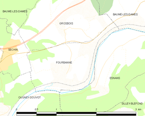
Fourbanne
- commune in Doubs, France
Fourbanne is not a widely recognized hiking destination, and there might be some regional variations or lesser-known trails in that area. However, I can provide you with general guidelines on what to expect when hiking in less-populated or rural areas, which might be applicable to Fourbanne or similar regions....
- Country:

- Postal Code: 25110
- Coordinates: 47° 19' 51" N, 6° 18' 12" E


- GPS tracks (wikiloc): [Link]
- Area: 1.97 sq km
- Population: 173

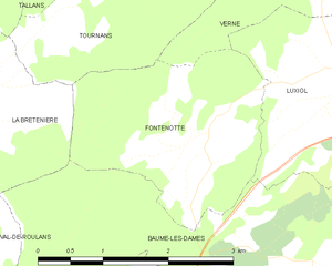
Fontenotte
- commune in Doubs, France
Hiking in Fontenotte, a picturesque area often associated with its natural beauty, can offer a delightful experience for outdoor enthusiasts. While specific trail details may vary, here are some general aspects you can expect:...
- Country:

- Postal Code: 25110
- Coordinates: 47° 22' 35" N, 6° 19' 21" E


- GPS tracks (wikiloc): [Link]
- Area: 5.65 sq km
- Population: 59


La Bretenière
- commune in Doubs, France
La Bretenière, located in the Doubs department of France, offers a picturesque setting for hiking enthusiasts. The area is characterized by its beautiful natural landscapes, including rolling hills, lush forests, and meandering rivers, making it a great spot for both casual walkers and more experienced hikers....
- Country:

- Postal Code: 25640
- Coordinates: 47° 22' 52" N, 6° 16' 28" E


- GPS tracks (wikiloc): [Link]
- Area: 4.16 sq km
- Population: 70


Hyèvre-Paroisse
- commune in Doubs, France
Hyèvre-Paroisse is a charming village located in the Jura department of eastern France, nestled in the stunning Jura Mountains. This area is known for its beautiful landscapes, rich biodiversity, and a variety of outdoor activities, including hiking....
- Country:

- Postal Code: 25110
- Coordinates: 47° 22' 17" N, 6° 25' 49" E


- GPS tracks (wikiloc): [Link]
- Area: 8.79 sq km
- Population: 186


Grosbois
- commune in Doubs, France
Grosbois is a picturesque area located in France, typically recognized for its natural beauty and opportunities for outdoor activities, including hiking. The region is characterized by lush landscapes, forests, and scenic views, making it an excellent destination for hikers of all skill levels....
- Country:

- Postal Code: 25110
- Coordinates: 47° 20' 38" N, 6° 18' 23" E


- GPS tracks (wikiloc): [Link]
- Area: 2.96 sq km
- Population: 237


Séchin
- commune in Doubs, France
Hiking in Séchin, a region or area that might refer to various locations depending on context, can provide an exciting experience for outdoor enthusiasts. However, since "Séchin" may not be a widely recognized hiking destination, let me provide some general tips on what you might expect and consider when planning a hike in any scenic or rural area, assuming it has similar natural features:...
- Country:

- Postal Code: 25110
- Coordinates: 47° 20' 13" N, 6° 17' 4" E


- GPS tracks (wikiloc): [Link]
- Area: 1.09 sq km
- Population: 121

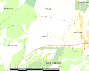
Luxiol
- commune in Doubs, France
It seems there might be some confusion with the name "Luxiol," as it doesn't correspond to a well-known hiking destination or national park. If you are referring to a specific location or have a typo, please provide more details so I can assist you accurately....
- Country:

- Postal Code: 25110
- Coordinates: 47° 22' 52" N, 6° 20' 57" E


- GPS tracks (wikiloc): [Link]
- Area: 6.44 sq km
- Population: 161


Hyèvre-Magny
- commune in Doubs, France
Hyèvre-Magny is a small commune located in the Doubs department of France. While it might not be as widely known as some larger hiking destinations, it offers some scenic spots and trails that are worth exploring, especially for those looking for a quieter, rural hiking experience....
- Country:

- Postal Code: 25110
- Coordinates: 47° 21' 58" N, 6° 26' 15" E


- GPS tracks (wikiloc): [Link]
- Area: 3.41 sq km
- Population: 76

Silley-Bléfond
- commune in Doubs, France
Silley-Bléfond, located in the Doubs department of France, offers a beautiful natural setting for hiking enthusiasts. The area is characterized by its lush forests, rolling hills, and stunning landscapes, ideal for both casual walkers and more experienced hikers....
- Country:

- Postal Code: 25110
- Coordinates: 47° 19' 24" N, 6° 19' 34" E


- GPS tracks (wikiloc): [Link]
- Area: 4.34 sq km
- Population: 49


Pont-les-Moulins
- commune in Doubs, France
Pont-les-Moulins, located in the scenic region of France, offers a variety of hiking opportunities suitable for different skill levels. The area is characterized by its beautiful landscapes, including rolling hills, lush forests, and charming rural vistas....
- Country:

- Postal Code: 25110
- Coordinates: 47° 19' 25" N, 6° 21' 49" E


- GPS tracks (wikiloc): [Link]
- Area: 4.95 sq km
- Population: 179
