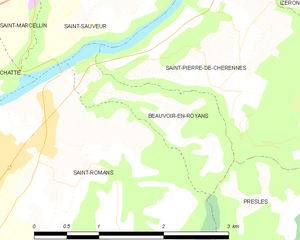
Beauvoir-en-Royans (Beauvoir-en-Royans)
- commune in Isère, France
Beauvoir-en-Royans is a charming village located in the Drôme department in southeastern France, nestled in the picturesque landscapes of the Vercors Regional Natural Park. This area is known for its stunning natural beauty, making it an excellent destination for hiking enthusiasts.
Hiking Options:
-
Scenic Trails: The region offers a variety of trails that cater to different skill levels, from easy walks suitable for families to more challenging climbs for experienced hikers.
-
Vercors Massif: The Vercors Massif is a major area for hiking. Trails here often lead through forests, along cliffs, and eventually to breathtaking viewpoints overlooking the surrounding valleys.
-
Local Highlights:
- Gorges du Nan: A popular hiking area where trails can take you through narrow gorges with stunning rock formations and views.
- Forests and Meadows: Many hikes in this region will walk you through lush forests and beautiful meadows, especially vibrant in spring and summer.
-
Wildlife Watching: While hiking, you might encounter a variety of wildlife, including deer, chamois, and diverse bird species. Keep your eyes peeled!
-
Cultural Sites: Some trails may lead you to historical or cultural sites, such as old farms, chapels, or ruins, where you can learn more about the local history.
Practical Tips:
- Maps and Guides: It’s advisable to have a hiking map or a guidebook, as trails can sometimes be poorly marked.
- Weather Considerations: Always check the weather forecast before heading out, as conditions can change rapidly in mountainous areas.
- Suitable Gear: Wear sturdy hiking boots and appropriate clothing for changing weather conditions. Don’t forget your water and snacks!
Nearby Attractions:
After a day of hiking, you can explore the village of Beauvoir-en-Royans, enjoying its quaint atmosphere, local cuisine, and perhaps a visit to nearby towns such as Romans-sur-Isère or Saint-Jean-en-Royans for more cultural experiences.
Overall, hiking in Beauvoir-en-Royans offers a wonderful combination of natural beauty, outdoor activities, and a touch of cultural heritage, making it a great destination for hikers of all levels.
- Country:

- Postal Code: 38160
- Coordinates: 45° 7' 15" N, 5° 20' 17" E


- GPS tracks (wikiloc): [Link]
- AboveSeaLevel: 281 м m
- Area: 2.1 sq km
- Population: 89
- Wikipedia en: wiki(en)
- Wikipedia: wiki(fr)
- Wikidata storage: Wikidata: Q475832
- Wikipedia Commons Category: [Link]
- Freebase ID: [/m/03g_738]
- GeoNames ID: Alt: [6616648]
- SIREN number: [213800360]
- BnF ID: [15257865q]
- PACTOLS thesaurus ID: [pcrtU9ey6RGZvA]
- INSEE municipality code: 38036
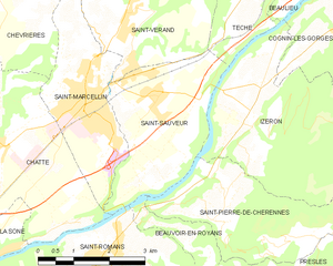
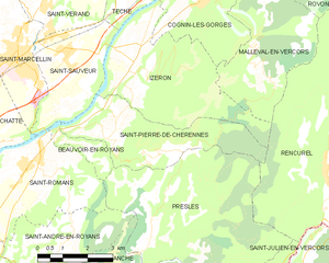
Shares border with regions:


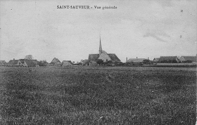
Saint-Sauveur
- commune in Isère, France
Saint-Sauveur is a charming village located in the Isère department of the Auvergne-Rhône-Alpes region in southeastern France. It's known for its beautiful natural landscapes, making it a great destination for hiking enthusiasts....
- Country:

- Postal Code: 38160
- Coordinates: 45° 9' 9" N, 5° 20' 31" E


- GPS tracks (wikiloc): [Link]
- Area: 9.42 sq km
- Population: 2100
- Web site: [Link]


Presles
- commune in Isère, France
Presles is a charming village located in the Grand Chartreuse mountain range in the Isère department of the Auvergne-Rhône-Alpes region of France. It's known for its stunning natural beauty, making it a great destination for hiking enthusiasts. Here are some key points about hiking in and around Presles:...
- Country:

- Postal Code: 38680
- Coordinates: 45° 5' 28" N, 5° 22' 59" E


- GPS tracks (wikiloc): [Link]
- Area: 25.68 sq km
- Population: 89


Saint-Romans
- commune in Isère, France
Saint-Romans is a picturesque village located in the Isère department of the Auvergne-Rhône-Alpes region in southeastern France. This location offers various hiking opportunities for both novice and experienced hikers. Here are some highlights to consider when hiking in and around Saint-Romans:...
- Country:

- Postal Code: 38160
- Coordinates: 45° 6' 57" N, 5° 19' 37" E


- GPS tracks (wikiloc): [Link]
- Area: 17.04 sq km
- Population: 1786
- Web site: [Link]


Saint-Pierre-de-Chérennes
- commune in Isère, France
 Hiking in Saint-Pierre-de-Chérennes
Saint-Pierre-de-Chérennes, located in the Isère department of the Auvergne-Rhône-Alpes region in southeastern France, offers a picturesque setting for hiking enthusiasts. The surrounding landscapes are characterized by rolling hills, lush forests, and stunning views of the nearby mountains, making it an ideal location for outdoor activities....
- Country:

- Postal Code: 38160
- Coordinates: 45° 7' 15" N, 5° 21' 44" E


- GPS tracks (wikiloc): [Link]
- Area: 12.03 sq km
- Population: 477
- Web site: [Link]
