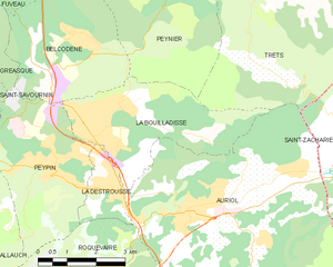
Belcodène (Belcodène)

- commune in Bouches-du-Rhône, France
 Hiking in Belcodène
Belcodène is a charming commune located in the Bouches-du-Rhône department in southern France, near the Sainte-Baume mountain range. The natural scenery around Belcodène offers a wonderful setting for hiking enthusiasts, combining picturesque landscapes with diverse flora and fauna.
Hiking Trails
-
GR 2013: This long-distance trail passes near Belcodène and allows hikers to explore the scenic beauty of the region, including views of the surrounding hills and vineyards.
-
Local Trails: There are several shorter paths that are suitable for day hikes, many of which traverse wooded areas, rocky terrain, and offer stunning views of the countryside.
-
Sainte-Baume: Just a short drive away, the Sainte-Baume massif boasts various trails that lead to the famous cave of Marie-Madeleine and provide panoramic views of the surrounding landscape.
Tips for Hiking in Belcodène
-
Best Time to Hike: Spring and autumn are ideal for hiking in the region, as temperatures are moderate and the flora is in full bloom or displaying fall colors.
-
Weather: Be prepared for varying weather conditions, especially in winter when it can get chilly. Always check forecasts and plan accordingly.
-
Gear: Wear comfortable hiking shoes and bring a backpack with essentials such as water, snacks, a map, and a first-aid kit.
-
Local Regulations: Respect the local environment by sticking to marked trails and following any posted guidelines or regulations to protect wildlife and habitats.
Points of Interest
-
Vineyards: The area around Belcodène is known for its wine production. Consider stopping by a local vineyard to sample regional wines.
-
Cultural Sites: Explore local historical points of interest, such as chapels and old houses that reflect the rich history of the region.
Conclusion
Hiking in Belcodène offers a unique opportunity to experience the natural beauty and cultural richness of southern France. Whether you’re an experienced hiker or a casual walker, you’ll find trails that match your interest and fitness level. Prepare accordingly, and enjoy the breathtaking landscapes the region has to offer!
- Country:

- Postal Code: 13720
- Coordinates: 43° 25' 35" N, 5° 35' 21" E


- GPS tracks (wikiloc): [Link]
- Area: 12.97 sq km
- Population: 1906
- Web site: http://www.belcodene.com
- Wikipedia en: wiki(en)
- Wikipedia: wiki(fr)
- Wikidata storage: Wikidata: Q384306
- Wikipedia Commons Category: [Link]
- Freebase ID: [/m/028191v]
- Freebase ID: [/m/028191v]
- GeoNames ID: Alt: [6447106]
- GeoNames ID: Alt: [6447106]
- SIREN number: [211300132]
- SIREN number: [211300132]
- BnF ID: [15247295s]
- BnF ID: [15247295s]
- INSEE municipality code: 13013
- INSEE municipality code: 13013
Shares border with regions:

La Bouilladisse
- commune in Bouches-du-Rhône, France
Hiking in La Bouilladisse
La Bouilladisse is a charming commune located in the Bouches-du-Rhône department in southeastern France, nestled in the picturesque region of Provence. It offers a variety of hiking opportunities, characterized by beautiful landscapes, scenic views, and a mild Mediterranean climate....
- Country:
- Postal Code: 13720
- Coordinates: 43° 23' 43" N, 5° 35' 43" E
- GPS tracks (wikiloc): [Link]
- Area: 12.61 sq km
- Population: 6079
- Web site: [Link]

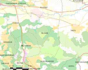
Peynier
- commune in Bouches-du-Rhône, France
Hiking in Peynier
Peynier is a charming village located in the Provence-Alpes-Côte d'Azur region of France. It's surrounded by beautiful landscapes, making it an excellent spot for hiking enthusiasts. Here are some highlights and tips for hiking in and around Peynier:...
- Country:
- Postal Code: 13790
- Coordinates: 43° 26' 49" N, 5° 38' 29" E
- GPS tracks (wikiloc): [Link]
- Area: 24.76 sq km
- Population: 3368
- Web site: [Link]

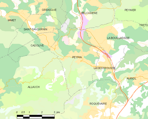
Peypin
- commune in Bouches-du-Rhône, France
Hiking in Peypin
Peypin is a charming commune located in the Bouches-du-Rhône department in the Provence-Alpes-Côte d'Azur region of France. It offers beautiful landscapes and a variety of hiking opportunities, making it a great destination for outdoor enthusiasts....
- Country:
- Postal Code: 13124
- Coordinates: 43° 23' 9" N, 5° 34' 42" E
- GPS tracks (wikiloc): [Link]
- Area: 13.35 sq km
- Population: 5454
- Web site: [Link]


Fuveau
- commune in Bouches-du-Rhône, France
Hiking in Fuveau
Fuveau is a charming commune located in the Bouches-du-Rhône department of the Provence-Alpes-Côte d'Azur region in southeastern France. It's surrounded by beautiful landscapes that offer a variety of hiking opportunities....
- Country:
- Postal Code: 13710
- Coordinates: 43° 27' 8" N, 5° 33' 42" E
- GPS tracks (wikiloc): [Link]
- Area: 30.02 sq km
- Population: 9756
- Web site: [Link]


Gréasque
- commune in Bouches-du-Rhône, France
Hiking in Gréasque
Gréasque, a charming commune in the Bouches-du-Rhône department of southern France, offers various hiking opportunities that showcase its beautiful landscapes and rich natural heritage. Nestled near the Sainte-Victoire mountain range, the area is characterized by picturesque hills, limestone formations, and Mediterranean vegetation. Here are some notable aspects of hiking in and around Gréasque:...
- Country:
- Postal Code: 13850
- Coordinates: 43° 25' 50" N, 5° 32' 21" E
- GPS tracks (wikiloc): [Link]
- Area: 6.15 sq km
- Population: 4111
- Web site: [Link]