Bettlach (Bettlach)
- commune in Haut-Rhin, France
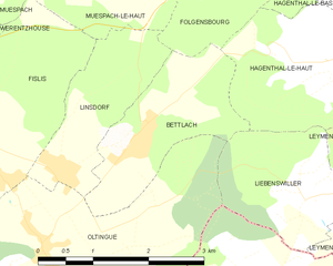
Bettlach is a charming commune located in the Haut-Rhin department in the Grand Est region of France. While it may be a smaller and less known area compared to some larger hiking destinations, the surrounding region offers beautiful landscapes, scenic views, and a variety of outdoor activities.
Hiking Trails
-
Local Trails: Bettlach is likely to have several local trails that can take you through beautiful forests and farmland. These paths may not be extensively marked, so it's advisable to have a local map or GPS device.
-
Nearby Natural Parks: As part of the Haut-Rhin department, you have access to the nearby Parc Naturel Régional des Ballons des Vosges. This vast natural park is known for its diverse flora and fauna, rolling hills, and stunning vistas. It's perfect for both seasoned hikers and beginners.
-
Scenic Routes: The area is characterized by its vineyards, hills, and picturesque villages. You might find routes that meander through vineyards, offering delicious local wine tasting opportunities along the way.
Hiking Tips
- Preparation: Make sure to wear proper hiking shoes and bring enough water and snacks. The weather can change quickly, so dressing in layers is recommended.
- Navigation: Download maps or guide apps that can help you navigate the trails. Some trails may not have extensive signage.
- Wildlife: Keep an eye out for local wildlife. The region is home to various bird species and other animals.
Local Attractions
- Wine Tours: After a day of hiking, consider enjoying a wine tour in the Alsace region, famed for its white wines and beautiful vineyards.
- Cultural Sites: Explore nearby historical towns and villages, which often have charming architecture and local cultural experiences.
Overall, while Bettlach may not be a well-known hiking destination, the surrounding areas and natural beauty provide ample opportunity for enjoyable hikes and outdoor activities. Make sure to check local resources for the latest trail information and maps.
- Country:

- Postal Code: 68480
- Coordinates: 47° 30' 32" N, 7° 24' 51" E


- GPS tracks (wikiloc): [Link]
- Area: 4.09 sq km
- Population: 308
- Wikipedia en: wiki(en)
- Wikipedia: wiki(fr)
- Wikidata storage: Wikidata: Q392043
- Wikipedia Commons Category: [Link]
- Freebase ID: [/m/03nph81]
- Freebase ID: [/m/03nph81]
- Freebase ID: [/m/03nph81]
- GeoNames ID: Alt: [6450657]
- GeoNames ID: Alt: [6450657]
- GeoNames ID: Alt: [6450657]
- SIREN number: [216800342]
- SIREN number: [216800342]
- SIREN number: [216800342]
- BnF ID: [15271738h]
- BnF ID: [15271738h]
- BnF ID: [15271738h]
- VIAF ID: Alt: [152236239]
- VIAF ID: Alt: [152236239]
- VIAF ID: Alt: [152236239]
- INSEE municipality code: 68034
- INSEE municipality code: 68034
- INSEE municipality code: 68034
Shares border with regions:


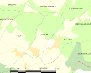
Linsdorf
- commune in Haut-Rhin, France
Linsdorf isn't widely known as a major hiking destination, which suggests it may be a smaller or less commercialized area. If Linsdorf is a rural region or a small village, it may offer some local trails suitable for hiking, often featuring picturesque landscapes, natural beauty, and potential wildlife sightings....
- Country:

- Postal Code: 68480
- Coordinates: 47° 30' 18" N, 7° 23' 49" E


- GPS tracks (wikiloc): [Link]
- Area: 3.36 sq km
- Population: 317


Leymen
- commune in Haut-Rhin, France
Leymen is a charming village located in the Alsace region of northeastern France, near the Swiss border. It provides a wonderful base for hiking enthusiasts, as it is surrounded by picturesque landscapes and diverse trails suitable for various skill levels. Here are some highlights for hiking in and around Leymen:...
- Country:

- Postal Code: 68220
- Coordinates: 47° 29' 41" N, 7° 29' 0" E


- GPS tracks (wikiloc): [Link]
- Area: 11.64 sq km
- Population: 1198


Liebenswiller
- commune in Haut-Rhin, France
Liebenswiller is a charming village located in the Alsace region of northeastern France, near the borders of Switzerland and Germany. The area is surrounded by beautiful landscapes, making it a great spot for hiking enthusiasts. Here’s what you can expect when hiking in and around Liebenswiller:...
- Country:

- Postal Code: 68220
- Coordinates: 47° 29' 54" N, 7° 27' 18" E


- GPS tracks (wikiloc): [Link]
- Area: 3.87 sq km
- Population: 207


Oltingue
- commune in Haut-Rhin, France
Oltingue is a small commune located in the Haut-Rhin department of eastern France, near the border with Switzerland. Hiking in this area can be quite rewarding, as it offers beautiful landscapes and the chance to experience the unique flora and fauna of the region....
- Country:

- Postal Code: 68480
- Coordinates: 47° 29' 29" N, 7° 23' 30" E


- GPS tracks (wikiloc): [Link]
- Area: 13.42 sq km
- Population: 721
- Web site: [Link]


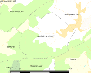
Hagenthal-le-Haut
- commune in Haut-Rhin, France
Hagenthal-le-Haut is a charming village located in the Alsace region of France, near the border with Switzerland. It offers a variety of hiking opportunities for enthusiasts looking to explore the beautiful landscapes of the area. Here are some aspects to consider when hiking in and around Hagenthal-le-Haut:...
- Country:

- Postal Code: 68220
- Coordinates: 47° 31' 10" N, 7° 28' 4" E


- GPS tracks (wikiloc): [Link]
- Area: 4.92 sq km
- Population: 641


Folgensbourg
- commune in Haut-Rhin, France
Folgensbourg, located in the Alsace region of France near the border with Switzerland, offers a charming setting for hiking enthusiasts. The area is characterized by its lush landscapes, rolling hills, and views of the Rhine Valley, making it a picturesque destination for outdoor activities....
- Country:

- Postal Code: 68220
- Coordinates: 47° 33' 1" N, 7° 26' 42" E


- GPS tracks (wikiloc): [Link]
- Area: 6.72 sq km
- Population: 902

