Bisel (Bisel)
- commune in Haut-Rhin, France
Bisel, a small town located in the Alsace region of France, offers a unique hiking experience with its picturesque landscapes and scenic trails. The area is characterized by its rolling hills, vineyards, and proximity to natural reserves, making it an attractive destination for outdoor enthusiasts.
Hiking Trails
-
Local Trails: Bisel has several local trails that typically range from easy to moderate difficulty. These trails often weave through vineyards, forested areas, and offer lovely views of the surrounding Alsace countryside.
-
The Alsace Wine Route: One of the most famous routes in the region is the Alsace Wine Route, which connects many charming villages including Bisel. Hiking this route allows you to experience the beautiful vineyards, quaint villages, and local culinary delights.
-
Regional Nature Parks: The nearby regional natural parks, such as the Ballons des Vosges Regional Nature Park, provide more extensive and challenging hiking options with well-marked trails that showcase the region's diverse flora and fauna.
Preparing for Your Hike
-
Best Time to Hike: Late spring and early fall are often considered the best times for hiking in this region. During these seasons, the weather is generally mild, and the landscapes are particularly beautiful.
-
Essential Gear: Comfortable hiking shoes, weather-appropriate clothing, a map of the trails, and enough water and snacks are essential. Always check the weather forecast before setting out.
Hiking Tips
-
Stay on Marked Trails: To preserve the natural beauty and environment, stick to marked trails.
-
Local Knowledge: Consider joining a local guided hike to gain insights about the flora, fauna, and history of the area.
-
Respect Wildlife: Be aware of the local wildlife and maintain a respectful distance, especially during nesting seasons.
Overall, hiking in Bisel provides a great combination of natural beauty, cultural experiences, and culinary delights, making it an excellent destination for outdoor adventures in France.
- Country:

- Postal Code: 68580
- Coordinates: 47° 32' 7" N, 7° 13' 6" E


- GPS tracks (wikiloc): [Link]
- Area: 8.1 sq km
- Population: 540
- Wikipedia en: wiki(en)
- Wikipedia: wiki(fr)
- Wikidata storage: Wikidata: Q325837
- Wikipedia Commons Category: [Link]
- Freebase ID: [/m/03ns347]
- Freebase ID: [/m/03ns347]
- Freebase ID: [/m/03ns347]
- GeoNames ID: Alt: [6450662]
- GeoNames ID: Alt: [6450662]
- GeoNames ID: Alt: [6450662]
- SIREN number: [216800391]
- SIREN number: [216800391]
- SIREN number: [216800391]
- BnF ID: [152717433]
- BnF ID: [152717433]
- BnF ID: [152717433]
- INSEE municipality code: 68039
- INSEE municipality code: 68039
- INSEE municipality code: 68039
Shares border with regions:


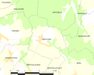
Largitzen
- commune in Haut-Rhin, France
Largitzen is a small town in the Alsace region of France, nestled in the foothills of the Vosges Mountains. This area is known for its stunning natural landscapes, charming villages, and well-maintained hiking trails. Here are some highlights and tips for hiking in and around Largitzen:...
- Country:

- Postal Code: 68580
- Coordinates: 47° 33' 43" N, 7° 11' 13" E


- GPS tracks (wikiloc): [Link]
- Area: 5.6 sq km
- Population: 314


Moernach
- commune in Haut-Rhin, France
Mœrnach, a picturesque village in the Luxembourg Ardennes, offers beautiful hiking opportunities amidst lush landscapes, rolling hills, and dense forests. Here are some highlights to consider when hiking in this region:...
- Country:

- Postal Code: 68480
- Coordinates: 47° 30' 13" N, 7° 15' 19" E


- GPS tracks (wikiloc): [Link]
- Area: 6.79 sq km
- Population: 572


Mooslargue
- commune in Haut-Rhin, France
Mooslargue is a quaint village located in the Alsace region of northeastern France, close to the borders with Switzerland and Germany. It is surrounded by beautiful landscapes, making it an excellent destination for hiking enthusiasts. Here are some highlights of hiking in and around Mooslargue:...
- Country:

- Postal Code: 68580
- Coordinates: 47° 30' 35" N, 7° 13' 5" E


- GPS tracks (wikiloc): [Link]
- AboveSeaLevel: 425 м m
- Area: 5.63 sq km
- Population: 432


Ruederbach
- commune in Haut-Rhin, France
Ruederbach, located in the Alsace region of France, offers various hiking opportunities that showcase the beauty of the surrounding landscape, including vineyards, scenic hills, and the Rhine River. Here are some highlights and tips for hiking in Ruederbach:...
- Country:

- Postal Code: 68560
- Coordinates: 47° 33' 49" N, 7° 16' 10" E


- GPS tracks (wikiloc): [Link]
- Area: 4.46 sq km
- Population: 383


Heimersdorf
- commune in Haut-Rhin, France
Heimersdorf is a small district in the city of Düsseldorf, Germany. While it may not be widely recognized as a major hiking destination, it can serve as a starting point for exploring the nearby natural areas and parks....
- Country:

- Postal Code: 68560
- Coordinates: 47° 34' 20" N, 7° 14' 31" E


- GPS tracks (wikiloc): [Link]
- Area: 7.59 sq km
- Population: 656


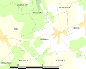
Feldbach
- commune in Haut-Rhin, France
Feldbach is a charming commune located in the Haut-Rhin department of the Alsace region in northeastern France. This area is rich in natural beauty, making it a great destination for hiking enthusiasts. Here are some highlights and tips for hiking in and around Feldbach:...
- Country:

- Postal Code: 68640
- Coordinates: 47° 32' 8" N, 7° 15' 51" E


- GPS tracks (wikiloc): [Link]
- Area: 5.02 sq km
- Population: 439
- Web site: [Link]


Seppois-le-Haut
- commune in Haut-Rhin, France
Seppois-le-Haut, located in the Alsace region of France, is known for its beautiful natural landscapes and hiking opportunities that cater to various skill levels. The area features lush forests, rolling hills, and scenic views of the surrounding countryside, making it an inviting destination for hikers....
- Country:

- Postal Code: 68580
- Coordinates: 47° 32' 0" N, 7° 11' 1" E


- GPS tracks (wikiloc): [Link]
- Area: 6.27 sq km
- Population: 488
- Web site: [Link]

