Seppois-le-Haut (Seppois-le-Haut)

- commune in Haut-Rhin, France
 Hiking in Seppois-le-Haut
Seppois-le-Haut, located in the Alsace region of France, is known for its beautiful natural landscapes and hiking opportunities that cater to various skill levels. The area features lush forests, rolling hills, and scenic views of the surrounding countryside, making it an inviting destination for hikers.
Here are some important aspects to consider when hiking in Seppois-le-Haut:
Trails
-
Marked Trails: There are several well-marked hiking trails in and around Seppois-le-Haut that range from easy to moderate difficulty. Some trails may take you through local forests, while others provide panoramic views of the area.
-
Nature Reserves: The surrounding nature reserves offer a chance to see local wildlife and enjoy the natural beauty of the region. Look out for flora and fauna unique to Alsace.
Difficulty Levels
- Beginners: Opt for the shorter, easier trails that allow you to enjoy the scenery without strenuous effort.
- Intermediate to Advanced: You can find longer and steeper routes that offer a greater challenge, ideal for seasoned hikers looking for an adventure.
Best Times to Hike
- Spring and Fall: These seasons typically offer the best hiking weather, with moderate temperatures and beautiful foliage.
- Summer: While popular, be mindful of hot temperatures and ensure you carry enough water.
Essentials
- Gear: Good hiking boots are essential due to varied terrain. Weather-appropriate clothing is also important, as conditions can change.
- Navigation: Carry a map or use a hiking app, as cell service may be limited in some areas.
Local Tips
- Cultural Sites: Take time to explore local attractions, including small villages, churches, and possibly local wineries.
- Stay Hydrated: Some trails may have limited access to water sources, so carry enough supplies.
Safety
- Wildlife Awareness: Be aware of local wildlife and practice Leave No Trace principles to preserve the natural area.
- Plan Ahead: Always let someone know your itinerary and expected return time, especially if hiking alone.
Hiking in Seppois-le-Haut offers an excellent opportunity to experience the tranquil beauty of the Alsace region while enjoying outdoor activities. Whether you're a beginner or an experienced hiker, there's something for everyone to appreciate in this picturesque area.
- Country:

- Postal Code: 68580
- Coordinates: 47° 32' 0" N, 7° 11' 1" E


- GPS tracks (wikiloc): [Link]
- Area: 6.27 sq km
- Population: 488
- Web site: http://www.seppois-le-haut.eu/
- Wikipedia en: wiki(en)
- Wikipedia: wiki(fr)
- Wikidata storage: Wikidata: Q734220
- Wikipedia Commons Category: [Link]
- Freebase ID: [/m/03nphk0]
- Freebase ID: [/m/03nphk0]
- GeoNames ID: Alt: [6441615]
- GeoNames ID: Alt: [6441615]
- SIREN number: [216803064]
- SIREN number: [216803064]
- BnF ID: [15272008w]
- BnF ID: [15272008w]
- INSEE municipality code: 68306
- INSEE municipality code: 68306
Shares border with regions:

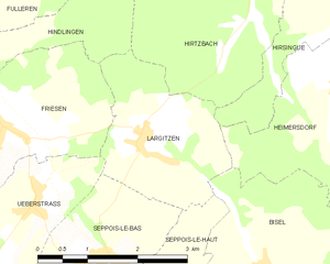
Largitzen
- commune in Haut-Rhin, France
Hiking in Largitzen
Largitzen is a small town in the Alsace region of France, nestled in the foothills of the Vosges Mountains. This area is known for its stunning natural landscapes, charming villages, and well-maintained hiking trails. Here are some highlights and tips for hiking in and around Largitzen:...
- Country:
- Postal Code: 68580
- Coordinates: 47° 33' 43" N, 7° 11' 13" E
- GPS tracks (wikiloc): [Link]
- Area: 5.6 sq km
- Population: 314


Pfetterhouse
- commune in Haut-Rhin, France
Hiking in Pfetterhouse
Pfetterhouse is a charming village located in the Alsace region of France, near the border with Switzerland. While it may not be as widely known for hiking as some larger areas, it offers beautiful landscapes and a chance to enjoy the natural environment. Here are some insights into hiking in and around Pfetterhouse:...
- Country:
- Postal Code: 68480
- Coordinates: 47° 30' 3" N, 7° 9' 59" E
- GPS tracks (wikiloc): [Link]
- Area: 14.28 sq km
- Population: 1019


Mooslargue
- commune in Haut-Rhin, France
Hiking in Mooslargue
Mooslargue is a quaint village located in the Alsace region of northeastern France, close to the borders with Switzerland and Germany. It is surrounded by beautiful landscapes, making it an excellent destination for hiking enthusiasts. Here are some highlights of hiking in and around Mooslargue:...
- Country:
- Postal Code: 68580
- Coordinates: 47° 30' 35" N, 7° 13' 5" E
- GPS tracks (wikiloc): [Link]
- AboveSeaLevel: 425 м m
- Area: 5.63 sq km
- Population: 432


Bisel
- commune in Haut-Rhin, France
Hiking in Bisel
Bisel, a small town located in the Alsace region of France, offers a unique hiking experience with its picturesque landscapes and scenic trails. The area is characterized by its rolling hills, vineyards, and proximity to natural reserves, making it an attractive destination for outdoor enthusiasts....
- Country:
- Postal Code: 68580
- Coordinates: 47° 32' 7" N, 7° 13' 6" E
- GPS tracks (wikiloc): [Link]
- Area: 8.1 sq km
- Population: 540


Seppois-le-Bas
- commune in Haut-Rhin, France
Hiking in Seppois-le-Bas
Seppois-le-Bas, located in the Alsace region of France, offers a variety of hiking opportunities that showcase the beautiful landscapes and natural features of the area. While the village itself is small, it serves as a good starting point for exploring the surrounding countryside, including the nearby Jura Mountains and the picturesque landscapes of Alsace....
- Country:
- Postal Code: 68580
- Coordinates: 47° 32' 11" N, 7° 10' 28" E
- GPS tracks (wikiloc): [Link]
- Area: 6.73 sq km
- Population: 1338
- Web site: [Link]