
Blois (Blois)

- commune in Loir-et-Cher, France
- Country:

- Postal Code: 41000
- Coordinates: 47° 35' 35" N, 1° 19' 38" E


- GPS tracks (wikiloc): [Link]
- AboveSeaLevel: 73 м m
- Area: 37.46 sq km
- Population: 45710
- Web site: https://www.blois.fr/
- Wikipedia en: wiki(en)
- Wikipedia: wiki(fr)
- Wikidata storage: Wikidata: Q160927
- Wikipedia Commons Gallery: [Link]
- Wikipedia Commons Category: [Link]
- Freebase ID: [/m/0n5n1]
- Freebase ID: [/m/0n5n1]
- Freebase ID: [/m/0n5n1]
- Freebase ID: [/m/0n5n1]
- Freebase ID: [/m/0n5n1]
- Freebase ID: [/m/0n5n1]
- GeoNames ID: Alt: [3032213]
- GeoNames ID: Alt: [3032213]
- GeoNames ID: Alt: [3032213]
- GeoNames ID: Alt: [3032213]
- GeoNames ID: Alt: [3032213]
- GeoNames ID: Alt: [3032213]
- SIREN number: [214100182]
- SIREN number: [214100182]
- SIREN number: [214100182]
- SIREN number: [214100182]
- SIREN number: [214100182]
- SIREN number: [214100182]
- BnF ID: [152592944]
- BnF ID: [152592944]
- BnF ID: [152592944]
- BnF ID: [152592944]
- BnF ID: [152592944]
- BnF ID: [152592944]
- VIAF ID: Alt: [124336704]
- VIAF ID: Alt: [124336704]
- VIAF ID: Alt: [124336704]
- VIAF ID: Alt: [124336704]
- VIAF ID: Alt: [124336704]
- VIAF ID: Alt: [124336704]
- GND ID: Alt: [4080438-0]
- GND ID: Alt: [4080438-0]
- GND ID: Alt: [4080438-0]
- GND ID: Alt: [4080438-0]
- GND ID: Alt: [4080438-0]
- GND ID: Alt: [4080438-0]
- archINFORM location ID: [553]
- archINFORM location ID: [553]
- archINFORM location ID: [553]
- archINFORM location ID: [553]
- archINFORM location ID: [553]
- archINFORM location ID: [553]
- Library of Congress authority ID: Alt: [n80125707]
- Library of Congress authority ID: Alt: [n80125707]
- Library of Congress authority ID: Alt: [n80125707]
- Library of Congress authority ID: Alt: [n80125707]
- Library of Congress authority ID: Alt: [n80125707]
- Library of Congress authority ID: Alt: [n80125707]
- MusicBrainz area ID: [098d510e-acd7-44bd-8f5d-084e1ceee8fd]
- MusicBrainz area ID: [098d510e-acd7-44bd-8f5d-084e1ceee8fd]
- MusicBrainz area ID: [098d510e-acd7-44bd-8f5d-084e1ceee8fd]
- MusicBrainz area ID: [098d510e-acd7-44bd-8f5d-084e1ceee8fd]
- MusicBrainz area ID: [098d510e-acd7-44bd-8f5d-084e1ceee8fd]
- MusicBrainz area ID: [098d510e-acd7-44bd-8f5d-084e1ceee8fd]
- Quora topic ID: [Blois]
- Quora topic ID: [Blois]
- Quora topic ID: [Blois]
- Quora topic ID: [Blois]
- Quora topic ID: [Blois]
- Quora topic ID: [Blois]
- Gran Enciclopèdia Catalana ID: [0010529]
- Gran Enciclopèdia Catalana ID: [0010529]
- Gran Enciclopèdia Catalana ID: [0010529]
- Gran Enciclopèdia Catalana ID: [0010529]
- Gran Enciclopèdia Catalana ID: [0010529]
- Gran Enciclopèdia Catalana ID: [0010529]
- Encyclopædia Universalis ID: [blois]
- Encyclopædia Universalis ID: [blois]
- Encyclopædia Universalis ID: [blois]
- Encyclopædia Universalis ID: [blois]
- Encyclopædia Universalis ID: [blois]
- Encyclopædia Universalis ID: [blois]
- EMLO location ID: [6a73ae8d-b54a-4faf-9cd7-5cc0c2af70bc]
- EMLO location ID: [6a73ae8d-b54a-4faf-9cd7-5cc0c2af70bc]
- EMLO location ID: [6a73ae8d-b54a-4faf-9cd7-5cc0c2af70bc]
- EMLO location ID: [6a73ae8d-b54a-4faf-9cd7-5cc0c2af70bc]
- EMLO location ID: [6a73ae8d-b54a-4faf-9cd7-5cc0c2af70bc]
- EMLO location ID: [6a73ae8d-b54a-4faf-9cd7-5cc0c2af70bc]
- Twitter username: Alt: [VilledeBlois]
- Twitter username: Alt: [VilledeBlois]
- Twitter username: Alt: [VilledeBlois]
- Twitter username: Alt: [VilledeBlois]
- Twitter username: Alt: [VilledeBlois]
- Twitter username: Alt: [VilledeBlois]
- Great Russian Encyclopedia Online ID: [1870550]
- Great Russian Encyclopedia Online ID: [1870550]
- Great Russian Encyclopedia Online ID: [1870550]
- Great Russian Encyclopedia Online ID: [1870550]
- Great Russian Encyclopedia Online ID: [1870550]
- Great Russian Encyclopedia Online ID: [1870550]
- Digital Atlas of the Roman Empire ID: [298]
- Digital Atlas of the Roman Empire ID: [298]
- Digital Atlas of the Roman Empire ID: [298]
- Digital Atlas of the Roman Empire ID: [298]
- Digital Atlas of the Roman Empire ID: [298]
- Digital Atlas of the Roman Empire ID: [298]
- INSEE municipality code: 41018
- INSEE municipality code: 41018
- INSEE municipality code: 41018
- INSEE municipality code: 41018
- INSEE municipality code: 41018
- INSEE municipality code: 41018
Shares border with regions:

Chouzy-sur-Cisse
- former commune in Loir-et-Cher, France
- Country:
- Postal Code: 41150
- Coordinates: 47° 31' 31" N, 1° 14' 50" E
- GPS tracks (wikiloc): [Link]
- Area: 22.43 sq km
- Population: 2027
- Web site: [Link]


Saint-Sulpice-de-Pommeray
- commune in Loir-et-Cher, France
- Country:
- Postal Code: 41000
- Coordinates: 47° 36' 28" N, 1° 16' 9" E
- GPS tracks (wikiloc): [Link]
- Area: 11.5 sq km
- Population: 1869


Vineuil
- commune in Loir-et-Cher, France
- Country:
- Postal Code: 41350
- Coordinates: 47° 34' 50" N, 1° 22' 21" E
- GPS tracks (wikiloc): [Link]
- Area: 22.34 sq km
- Population: 7724
- Web site: [Link]


Villebarou
- commune in Loir-et-Cher, France
- Country:
- Postal Code: 41000
- Coordinates: 47° 37' 21" N, 1° 19' 24" E
- GPS tracks (wikiloc): [Link]
- Area: 9.11 sq km
- Population: 2478


Saint-Gervais-la-Forêt
- commune in Loir-et-Cher, France
- Country:
- Postal Code: 41350
- Coordinates: 47° 34' 8" N, 1° 21' 36" E
- GPS tracks (wikiloc): [Link]
- Area: 8.97 sq km
- Population: 3224
- Web site: [Link]
Fossé
- commune in Loir-et-Cher, France
- Country:
- Postal Code: 41330
- Coordinates: 47° 38' 0" N, 1° 17' 3" E
- GPS tracks (wikiloc): [Link]
- Area: 10.2 sq km
- Population: 1321
- Web site: [Link]


La Chaussée-Saint-Victor
- commune in Loir-et-Cher, France
- Country:
- Postal Code: 41260
- Coordinates: 47° 36' 50" N, 1° 21' 55" E
- GPS tracks (wikiloc): [Link]
- Area: 6.63 sq km
- Population: 4510
- Web site: [Link]

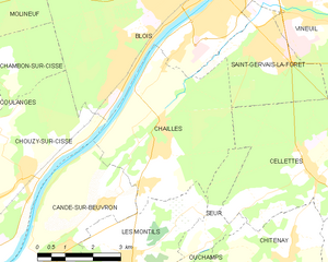
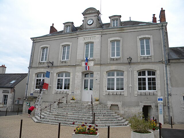
Chailles
- commune in Loir-et-Cher, France
- Country:
- Postal Code: 41120
- Coordinates: 47° 32' 30" N, 1° 18' 37" E
- GPS tracks (wikiloc): [Link]
- Area: 18.54 sq km
- Population: 2673

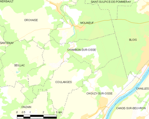
Chambon-sur-Cisse
- former commune in Loir-et-Cher, France
- Country:
- Postal Code: 41190
- Coordinates: 47° 33' 45" N, 1° 12' 57" E
- GPS tracks (wikiloc): [Link]
- Area: 12.71 sq km
- Population: 671