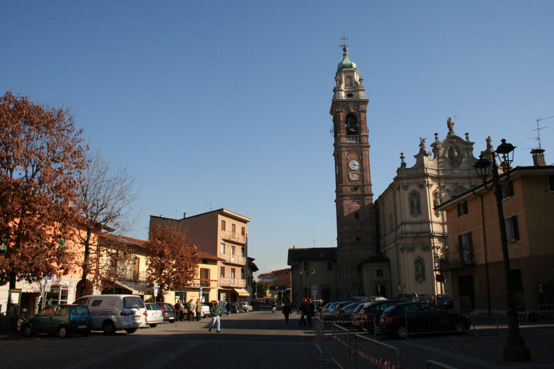
Boltiere (Boltiere)
.svg)
- Italian comune
 Hiking in Boltiere
Boltiere is a small town located in the Lombardy region of Italy, primarily known for its agricultural landscape and proximity to larger cities like Bergamo. While Boltiere itself may not be a major hiking destination, the surrounding areas offer excellent opportunities for outdoor activities, including hiking.
Here are some key points about hiking near Boltiere:
-
Nearby Nature Reserves: The Orobician Alps and various nature reserves in the vicinity, such as Parco dei Colli di Bergamo, provide numerous hiking trails that cater to different skill levels. You can explore beautiful landscapes, forests, and scenic viewpoints.
-
Trail Variety: You can find a variety of trails ranging from easy walks to more challenging hikes. Many trails offer stunning views of the surrounding countryside, valleys, and mountains.
-
Accessibility: Boltiere serves as a good starting point for accessing hiking trails in the nearby hills and mountains. It's advisable to have a means of transportation, such as a car, to reach trailheads.
-
Local Tips: Before you head out, it may be helpful to check local maps and resources for updated trail information and conditions. Local hiking clubs or guides can also provide valuable insights and recommendations.
-
Seasonal Considerations: The best time for hiking in this area is typically in the spring and fall when temperatures are moderate. Summers can be quite warm, while winters may lead to snow-covered trails in higher elevations.
-
Equipment and Safety: Always ensure you have the proper hiking gear, including sturdy shoes, plenty of water, snacks, and a map or GPS device. It's also wise to hike with a companion and let someone know your plans.
If you're looking for more specific trails or detailed routes, I can help with that!
- Country:

- Postal Code: 24040
- Local Dialing Code: 035
- Licence Plate Code: BG
- Coordinates: 45° 36' 0" N, 9° 35' 0" E


- GPS tracks (wikiloc): [Link]
- AboveSeaLevel: 171 м m
- Area: 4.21 sq km
- Population: 6102
- Web site: http://www.comune.boltiere.bg.it
- Wikipedia en: wiki(en)
- Wikipedia: wiki(it)
- Wikidata storage: Wikidata: Q99971
- Wikipedia Commons Gallery: [Link]
- Wikipedia Commons Category: [Link]
- Freebase ID: [/m/0gj8sy]
- GeoNames ID: Alt: [6542943]
- OSM relation ID: [45445]
- UN/LOCODE: [ITBLE]
- ISTAT ID: 016029
- Italian cadastre code: A950
Shares border with regions:


Ciserano
- Italian comune
Hiking in Ciserano
Ciserano is a small town located in the Lombardy region of Italy, not far from Bergamo. While it may not be the first place that comes to mind for hiking, there are several opportunities for outdoor activities in the surrounding areas. Here are some aspects you might consider if you're planning a hiking trip near Ciserano:...
- Country:
- Postal Code: 24040
- Local Dialing Code: 035
- Licence Plate Code: BG
- Coordinates: 45° 35' 0" N, 9° 36' 0" E
- GPS tracks (wikiloc): [Link]
- AboveSeaLevel: 159 м m
- Area: 5.31 sq km
- Population: 5696
- Web site: [Link]

Osio Sotto
- Italian comune
Hiking in Osio Sotto
Osio Sotto, located in the Lombardy region of Italy, is not primarily known as a hiking destination, but it does offer some opportunities for outdoor activities and exploration. Its proximity to the larger city of Bergamo and the magnificent landscapes of the nearby Pre-Alps and the Orobie Alps means that there are many hiking trails available not too far from Osio Sotto....
- Country:
- Postal Code: 24046
- Local Dialing Code: 035
- Licence Plate Code: BG
- Coordinates: 45° 37' 0" N, 9° 36' 0" E
- GPS tracks (wikiloc): [Link]
- AboveSeaLevel: 182 м m
- Area: 7.59 sq km
- Population: 12474
- Web site: [Link]


Pontirolo Nuovo
- Italian comune
Hiking in Pontirolo Nuovo
Pontirolo Nuovo, a small town in the Lombardy region of Italy, is not specifically known as a hiking destination, but it is surrounded by a countryside that offers some opportunities for walking and outdoor activities. Here are some suggestions and information relevant to hiking in and around Pontirolo Nuovo:...
- Country:
- Postal Code: 24040
- Local Dialing Code: 0363
- Licence Plate Code: BG
- Coordinates: 45° 34' 9" N, 9° 34' 2" E
- GPS tracks (wikiloc): [Link]
- AboveSeaLevel: 155 м m
- Area: 11.1 sq km
- Population: 4983
- Web site: [Link]
Verdellino
- Italian comune
Hiking in Verdellino
Verdellino is a village located in the Lombardy region of northern Italy, specifically in the province of Bergamo. While Verdellino itself is more urban and suburban in nature, there are several outdoor and hiking opportunities in the surrounding areas, particularly in the nearby hills and mountains....
- Country:
- Postal Code: 24040
- Local Dialing Code: 035
- Licence Plate Code: BG
- Coordinates: 45° 36' 7" N, 9° 36' 32" E
- GPS tracks (wikiloc): [Link]
- AboveSeaLevel: 172 м m
- Area: 3.82 sq km
- Population: 7569
- Web site: [Link]


Brembate
- Italian comune
Hiking in Brembate
Brembate, located in the province of Bergamo, Italy, is surrounded by beautiful landscapes that offer a variety of hiking opportunities. The area combines natural beauty with historical sites, making it a great destination for both casual hikers and more serious outdoor enthusiasts....
- Country:
- Postal Code: 24041
- Local Dialing Code: 035
- Licence Plate Code: BG
- Coordinates: 45° 36' 0" N, 9° 33' 0" E
- GPS tracks (wikiloc): [Link]
- AboveSeaLevel: 173 м m
- Area: 5.54 sq km
- Population: 8551
- Web site: [Link]