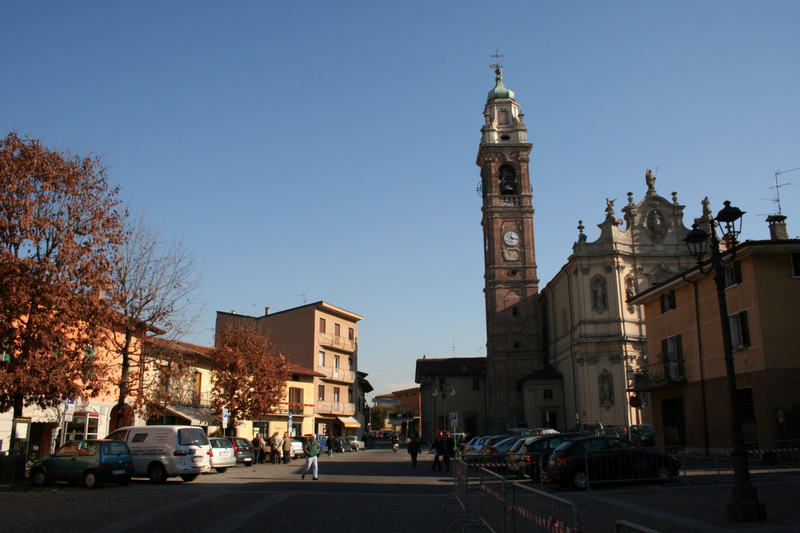
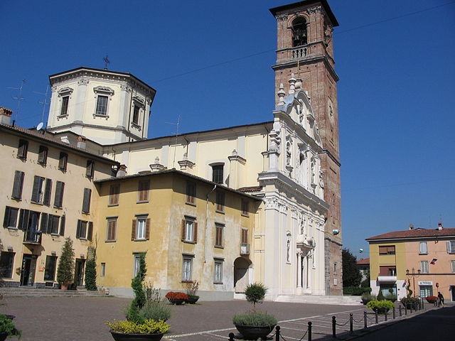
Verdellino (Verdellino)
.svg)
- Italian comune
 Hiking in Verdellino
Verdellino is a village located in the Lombardy region of northern Italy, specifically in the province of Bergamo. While Verdellino itself is more urban and suburban in nature, there are several outdoor and hiking opportunities in the surrounding areas, particularly in the nearby hills and mountains.
If you're looking to hike near Verdellino, consider exploring the following options:
-
Parco dei Colli di Bergamo: This regional park is just a short drive away and offers numerous trails through beautiful natural landscapes, including hills, forests, and panoramic viewpoints. It's a great spot for both short walks and more challenging hikes.
-
Monte Misma: Located a bit further from Verdellino, Monte Misma provides various trails that can lead to stunning views of the surrounding areas. The hike can be challenging, so be prepared with proper gear.
-
Bergamo's Città Alta: This historic upper town offers scenic walking paths. The walls of the old city are UNESCO World Heritage Sites, and wandering through its streets can feel like a hike in itself with plenty of elevation changes.
-
Sentiero dei Fiori: This scenic trail, also known as the "Path of Flowers," is a bit further afield but takes you through beautiful meadows and offers wonderful views, especially in spring and summer when wildflowers bloom.
-
Lago di Endine: About a 30-minute drive from Verdellino, this lake area provides various trails around the shore and into the hills that provide lovely views of the water and the surrounding landscape.
When hiking in the area, always be sure to check trail conditions and local weather forecasts. Wear proper hiking footwear, carry enough water and snacks, and inform someone about your hike plan for safety. Enjoy your time in the beautiful landscapes near Verdellino!
- Country:

- Postal Code: 24040
- Local Dialing Code: 035
- Licence Plate Code: BG
- Coordinates: 45° 36' 7" N, 9° 36' 32" E


- GPS tracks (wikiloc): [Link]
- AboveSeaLevel: 172 м m
- Area: 3.82 sq km
- Population: 7569
- Web site: http://www.comune.verdellino.bg.it
- Wikipedia en: wiki(en)
- Wikipedia: wiki(it)
- Wikidata storage: Wikidata: Q101724
- Wikipedia Commons Gallery: [Link]
- Wikipedia Commons Category: [Link]
- Freebase ID: [/m/0gjfnz]
- GeoNames ID: Alt: [6542584]
- VIAF ID: Alt: [240109377]
- OSM relation ID: [45446]
- UN/LOCODE: [ITVLI]
- ISTAT ID: 016232
- Italian cadastre code: L752
Shares border with regions:


Ciserano
- Italian comune
Hiking in Ciserano
Ciserano is a small town located in the Lombardy region of Italy, not far from Bergamo. While it may not be the first place that comes to mind for hiking, there are several opportunities for outdoor activities in the surrounding areas. Here are some aspects you might consider if you're planning a hiking trip near Ciserano:...
- Country:
- Postal Code: 24040
- Local Dialing Code: 035
- Licence Plate Code: BG
- Coordinates: 45° 35' 0" N, 9° 36' 0" E
- GPS tracks (wikiloc): [Link]
- AboveSeaLevel: 159 м m
- Area: 5.31 sq km
- Population: 5696
- Web site: [Link]


Levate
- Italian comune
Hiking in Levate
Levate, located in the province of Bergamo in Northern Italy, offers beautiful landscapes and diverse hiking opportunities. The area is characterized by picturesque rolling hills, charming villages, and lush nature, making it an excellent place for outdoor enthusiasts....
- Country:
- Postal Code: 24040
- Local Dialing Code: 035
- Licence Plate Code: BG
- Coordinates: 45° 38' 0" N, 9° 37' 0" E
- GPS tracks (wikiloc): [Link]
- AboveSeaLevel: 185 м m
- Area: 5.53 sq km
- Population: 3780
- Web site: [Link]

Osio Sotto
- Italian comune
Hiking in Osio Sotto
Osio Sotto, located in the Lombardy region of Italy, is not primarily known as a hiking destination, but it does offer some opportunities for outdoor activities and exploration. Its proximity to the larger city of Bergamo and the magnificent landscapes of the nearby Pre-Alps and the Orobie Alps means that there are many hiking trails available not too far from Osio Sotto....
- Country:
- Postal Code: 24046
- Local Dialing Code: 035
- Licence Plate Code: BG
- Coordinates: 45° 37' 0" N, 9° 36' 0" E
- GPS tracks (wikiloc): [Link]
- AboveSeaLevel: 182 м m
- Area: 7.59 sq km
- Population: 12474
- Web site: [Link]

Verdello
- Italian comune
Hiking in Verdello
Verdello is a small town in Italy, located in the Lombardy region, close to the city of Bergamo. While it may not be as famous for hiking as the larger nearby mountain ranges, such as the Orobie Alps, there are still some opportunities for outdoor activities and exploring the natural beauty of the region....
- Country:
- Postal Code: 24049
- Local Dialing Code: 035
- Licence Plate Code: BG
- Coordinates: 45° 36' 18" N, 9° 37' 47" E
- GPS tracks (wikiloc): [Link]
- AboveSeaLevel: 173 м m
- Area: 7.34 sq km
- Population: 8082
- Web site: [Link]


Boltiere
- Italian comune
Hiking in Boltiere
Boltiere is a small town located in the Lombardy region of Italy, primarily known for its agricultural landscape and proximity to larger cities like Bergamo. While Boltiere itself may not be a major hiking destination, the surrounding areas offer excellent opportunities for outdoor activities, including hiking....
- Country:
- Postal Code: 24040
- Local Dialing Code: 035
- Licence Plate Code: BG
- Coordinates: 45° 36' 0" N, 9° 35' 0" E
- GPS tracks (wikiloc): [Link]
- AboveSeaLevel: 171 м m
- Area: 4.21 sq km
- Population: 6102
- Web site: [Link]