Bouillargues (Bouillargues)

- commune in Gard, France
- Country:

- Postal Code: 30230
- Coordinates: 43° 48' 1" N, 4° 25' 37" E


- GPS tracks (wikiloc): [Link]
- Area: 15.77 sq km
- Population: 6316
- Web site: http://www.bouillargues.fr
- Wikipedia en: wiki(en)
- Wikipedia: wiki(fr)
- Wikidata storage: Wikidata: Q379793
- Wikipedia Commons Category: [Link]
- Freebase ID: [/m/02x2sc6]
- Freebase ID: [/m/02x2sc6]
- GeoNames ID: Alt: [3031240]
- GeoNames ID: Alt: [3031240]
- SIREN number: [213000474]
- SIREN number: [213000474]
- BnF ID: [152546883]
- BnF ID: [152546883]
- VIAF ID: Alt: [145576895]
- VIAF ID: Alt: [145576895]
- Library of Congress authority ID: Alt: [n95012992]
- Library of Congress authority ID: Alt: [n95012992]
- Quora topic ID: [Bouillargues]
- Quora topic ID: [Bouillargues]
- INSEE municipality code: 30047
- INSEE municipality code: 30047
Shares border with regions:


Garons
- commune in Gard, France
- Country:
- Postal Code: 30128
- Coordinates: 43° 46' 6" N, 4° 25' 42" E
- GPS tracks (wikiloc): [Link]
- AboveSeaLevel: 96 м m
- Area: 12.28 sq km
- Population: 4786
- Web site: [Link]


Manduel
- commune in Gard, France
- Country:
- Postal Code: 30129
- Coordinates: 43° 49' 6" N, 4° 28' 24" E
- GPS tracks (wikiloc): [Link]
- Area: 26.46 sq km
- Population: 6702
- Web site: [Link]


Rodilhan
- commune in Gard, France
- Country:
- Postal Code: 30230
- Coordinates: 43° 49' 36" N, 4° 26' 1" E
- GPS tracks (wikiloc): [Link]
- AboveSeaLevel: 45 м m
- Area: 4.69 sq km
- Population: 2899


Caissargues
- commune in Gard, France
- Country:
- Postal Code: 30132
- Coordinates: 43° 47' 45" N, 4° 22' 44" E
- GPS tracks (wikiloc): [Link]
- Area: 8.02 sq km
- Population: 3966
- Web site: [Link]

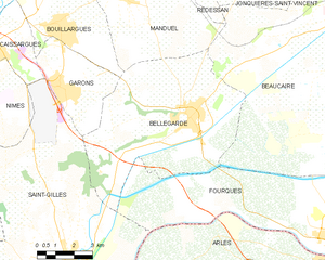
Bellegarde
- commune in Gard, France
- Country:
- Postal Code: 30127
- Coordinates: 43° 45' 13" N, 4° 30' 52" E
- GPS tracks (wikiloc): [Link]
- Area: 44.96 sq km
- Population: 6847
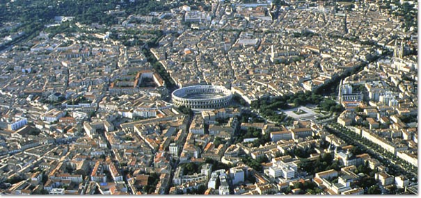
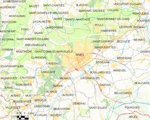
Nîmes
- commune in Gard, France
- Country:
- Postal Code: 30900; 30000
- Local Dialing Code: 466
- Coordinates: 43° 50' 13" N, 4° 21' 36" E
- GPS tracks (wikiloc): [Link]
- AboveSeaLevel: 215 м m
- Area: 161.85 sq km
- Population: 150672
- Web site: [Link]