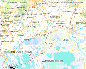
Bellegarde (Bellegarde)

- commune in Gard, France
- Country:

- Postal Code: 30127
- Coordinates: 43° 45' 13" N, 4° 30' 52" E


- GPS tracks (wikiloc): [Link]
- Area: 44.96 sq km
- Population: 6847
- Wikipedia en: wiki(en)
- Wikipedia: wiki(fr)
- Wikidata storage: Wikidata: Q269844
- Wikipedia Commons Category: [Link]
- Freebase ID: [/m/02w9qcz]
- GeoNames ID: Alt: [6455038]
- SIREN number: [213000342]
- BnF ID: [15254675r]
- Library of Congress authority ID: Alt: [n93064333]
- PACTOLS thesaurus ID: [pcrtbXflSwEau9]
- INSEE municipality code: 30034
Shares border with regions:


Garons
- commune in Gard, France
- Country:
- Postal Code: 30128
- Coordinates: 43° 46' 6" N, 4° 25' 42" E
- GPS tracks (wikiloc): [Link]
- AboveSeaLevel: 96 м m
- Area: 12.28 sq km
- Population: 4786
- Web site: [Link]


Beaucaire
- commune in Gard, France
- Country:
- Postal Code: 30300
- Coordinates: 43° 48' 26" N, 4° 38' 36" E
- GPS tracks (wikiloc): [Link]
- Area: 86.52 sq km
- Population: 16094

Saint-Gilles
- commune in Gard, France
- Country:
- Postal Code: 30800
- Coordinates: 43° 40' 40" N, 4° 25' 52" E
- GPS tracks (wikiloc): [Link]
- Area: 153.73 sq km
- Population: 13477
- Web site: [Link]


Manduel
- commune in Gard, France
- Country:
- Postal Code: 30129
- Coordinates: 43° 49' 6" N, 4° 28' 24" E
- GPS tracks (wikiloc): [Link]
- Area: 26.46 sq km
- Population: 6702
- Web site: [Link]


Fourques
- commune in Gard, France
- Country:
- Postal Code: 30300
- Coordinates: 43° 41' 35" N, 4° 36' 38" E
- GPS tracks (wikiloc): [Link]
- AboveSeaLevel: 3 м m
- Area: 38.24 sq km
- Population: 2880
- Web site: [Link]


Bouillargues
- commune in Gard, France
- Country:
- Postal Code: 30230
- Coordinates: 43° 48' 1" N, 4° 25' 37" E
- GPS tracks (wikiloc): [Link]
- Area: 15.77 sq km
- Population: 6316
- Web site: [Link]