Bourgueil (Bourgueil)
- commune in Indre-et-Loire, France
- Country:

- Postal Code: 37140
- Coordinates: 47° 16' 55" N, 0° 10' 6" E


- GPS tracks (wikiloc): [Link]
- Area: 32.95 sq km
- Population: 3896
- Web site: http://www.bourgueil.fr
- Wikipedia en: wiki(en)
- Wikipedia: wiki(fr)
- Wikidata storage: Wikidata: Q504875
- Wikipedia Commons Category: [Link]
- Freebase ID: [/m/04nz5l]
- GeoNames ID: Alt: [3030944]
- SIREN number: [213700313]
- BnF ID: [15257582g]
- VIAF ID: Alt: [123175685]
- Library of Congress authority ID: Alt: [n82058556]
- WOEID: [581259]
- EMLO location ID: [bcd20255-82cd-4291-8fed-b532d2a1358d]
- INSEE municipality code: 37031
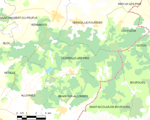
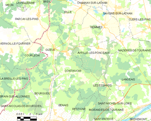
Shares border with regions:


Courléon
- commune in Maine-et-Loire, France
- Country:

- Postal Code: 49390
- Coordinates: 47° 23' 26" N, 0° 8' 36" E


- GPS tracks (wikiloc): [Link]
- Area: 13.77 sq km
- Population: 149


La Breille-les-Pins
- commune in Maine-et-Loire, France
- Country:

- Postal Code: 49390
- Coordinates: 47° 20' 26" N, 0° 4' 40" E


- GPS tracks (wikiloc): [Link]
- Area: 27.57 sq km
- Population: 595
- Web site: [Link]


Continvoir
- commune in Indre-et-Loire, France
- Country:

- Postal Code: 37340
- Coordinates: 47° 23' 18" N, 0° 13' 14" E


- GPS tracks (wikiloc): [Link]
- Area: 41.19 sq km
- Population: 420
- Web site: [Link]


Gizeux
- commune in Indre-et-Loire, France
- Country:

- Postal Code: 37340
- Coordinates: 47° 23' 33" N, 0° 11' 43" E


- GPS tracks (wikiloc): [Link]
- Area: 21.06 sq km
- Population: 409
- Web site: [Link]


Benais
- commune in Indre-et-Loire, France
- Country:

- Postal Code: 37140
- Coordinates: 47° 17' 47" N, 0° 12' 52" E


- GPS tracks (wikiloc): [Link]
- Area: 20.08 sq km
- Population: 949
- Web site: [Link]


Saint-Nicolas-de-Bourgueil
- commune in Indre-et-Loire, France
- Country:

- Postal Code: 37140
- Coordinates: 47° 17' 4" N, 0° 7' 32" E


- GPS tracks (wikiloc): [Link]
- Area: 36.45 sq km
- Population: 1119
- Web site: [Link]


Restigné
- commune in Indre-et-Loire, France
- Country:

- Postal Code: 37140
- Coordinates: 47° 16' 53" N, 0° 13' 42" E


- GPS tracks (wikiloc): [Link]
- Area: 21.31 sq km
- Population: 1262
- Web site: [Link]


La Chapelle-sur-Loire
- commune in Indre-et-Loire, France
- Country:

- Postal Code: 37140
- Coordinates: 47° 14' 55" N, 0° 13' 26" E


- GPS tracks (wikiloc): [Link]
- Area: 19.17 sq km
- Population: 1453
- Web site: [Link]
