Brusio (Brusio)
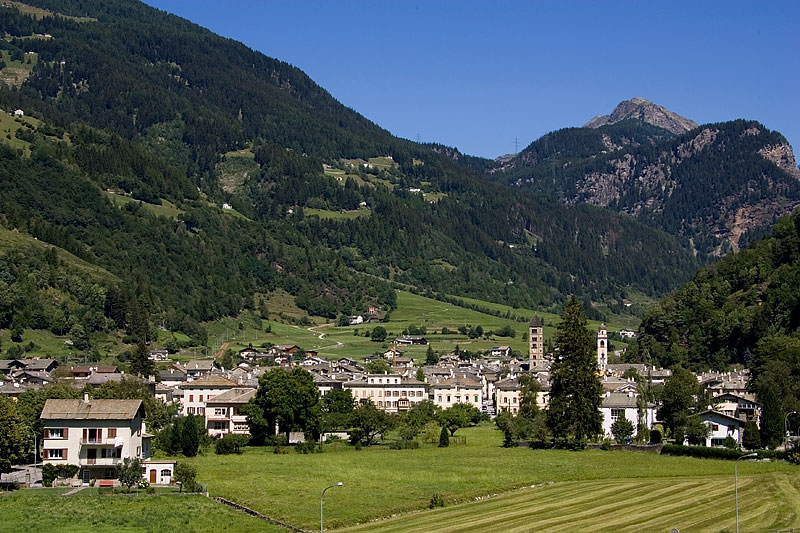
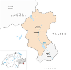
- municipality in Val Poschiavo, Graubünden, Switzerland
Brusio, located in the Graubünden region of Switzerland, offers stunning landscapes and a variety of hiking trails suitable for different skill levels. Here are some highlights and tips for hiking in and around Brusio:
1.
- Bergün-Brusio Trail: This trail offers breathtaking views of the Alps, passing through charming villages and lush meadows.
- Via Albula: Part of the larger long-distance trail, this segment provides a fantastic way to experience the natural beauty of the region, with a mix of easy and moderate hiking sections.
2.
- Many trails in Brusio reward hikers with panoramic vistas of the surrounding mountains and valleys. Be sure to carry a camera!
3.
- The trailheads are typically accessible by public transport, and Brusio is well-connected by train, making it easy to reach different parts of the hiking network.
4.
- Piz Cengalo and Piz Badile are notable peaks in the vicinity, ideal for adventurous hikers looking to summit some of the beautiful local mountains.
5.
- The region is rich in biodiversity, and you may encounter various wildlife species as you hike. Keep your eyes peeled for ibex, chamois, and various bird species.
6.
- Hiking in Brusio is best from late spring to early autumn (May to October). Be aware of changing weather conditions, as mountain weather can be unpredictable.
7.
- Always carry enough water and snacks. A map or GPS device is essential for navigation, as well as first aid supplies in case of emergencies.
- Wear appropriate footwear and dress in layers to adjust to changing temperatures as you gain elevation.
8.
- Take the time to explore Brusio itself, with its historic buildings and the famous circular viaduct that is a marvel of engineering.
9.
- Consider joining a guided hike if you're unfamiliar with the area. Local guides can provide valuable insights into the flora, fauna, and history of the region.
10.
- As with hiking anywhere, practice Leave No Trace principles by staying on marked trails, respecting wildlife, and packing out all trash.
Brusio offers a perfect blend of adventure, scenic beauty, and cultural experiences. Whether you're a seasoned hiker or just starting out, there's something for everyone in this picturesque Swiss locale. Enjoy your hiking adventure!
- Country:

- Postal Code: 7743; 7748; 7747; 7744
- Local Dialing Code: 081
- Licence Plate Code: GR
- Coordinates: 46° 15' 20" N, 10° 7' 8" E


- GPS tracks (wikiloc): [Link]
- AboveSeaLevel: 1042 м m
- Area: 46.29 sq km
- Population: 1135
- Web site: http://www.brusio.ch
- Wikipedia en: wiki(en)
- Wikipedia: wiki(de)
- Wikidata storage: Wikidata: Q64580
- Wikipedia Commons Category: [Link]
- Freebase ID: [/m/026dt8m]
- GeoNames ID: Alt: [7285357]
- VIAF ID: Alt: [1145602313801360766]
- OSM relation ID: [1684052]
- GND ID: Alt: [4090243-2]
- TGN ID: [1063967]
- HDS ID: [1432]
- Swiss municipality code: [3551]
Shares border with regions:


Villa di Tirano
- Italian comune
Villa di Tirano, located in the Valtellina region of northern Italy, is a beautiful area for hiking enthusiasts. Nestled in the Alps, this small town offers access to stunning landscapes, rich history, and diverse trails suitable for various skill levels....
- Country:

- Postal Code: 23030
- Local Dialing Code: 0342
- Licence Plate Code: SO
- Coordinates: 46° 12' 0" N, 10° 8' 0" E


- GPS tracks (wikiloc): [Link]
- AboveSeaLevel: 406 м m
- Area: 24.74 sq km
- Population: 2978
- Web site: [Link]


Teglio
- Italian comune
Teglio, a charming town located in the Valtellina valley of northern Italy, is surrounded by stunning alpine landscapes, making it a fantastic destination for hiking enthusiasts. The area is known for its rich natural beauty, with a diverse range of trails suitable for various skill levels, from leisurely strolls to challenging hikes....
- Country:

- Postal Code: 23036
- Local Dialing Code: 0342
- Licence Plate Code: SO
- Coordinates: 46° 10' 0" N, 10° 4' 0" E


- GPS tracks (wikiloc): [Link]
- AboveSeaLevel: 851 м m
- Area: 115.32 sq km
- Population: 4534
- Web site: [Link]


Vervio
- Italian comune
Vervio is a charming village located in the Valtellina region of northern Italy, which offers beautiful hiking opportunities amidst stunning alpine scenery. Here are some key points about hiking in and around Vervio:...
- Country:

- Postal Code: 23030
- Local Dialing Code: 0342
- Licence Plate Code: SO
- Coordinates: 46° 15' 0" N, 10° 14' 0" E


- GPS tracks (wikiloc): [Link]
- AboveSeaLevel: 549 м m
- Area: 12.41 sq km
- Population: 209
- Web site: [Link]


Bianzone
- human settlement in Italy
Bianzone, a charming village located in the Valtellina valley of Italy, offers some stunning hiking opportunities surrounded by the beautiful landscape of the Italian Alps. Here are some details about hiking in Bianzone:...
- Country:

- Postal Code: 23030
- Local Dialing Code: 0342
- Licence Plate Code: SO
- Coordinates: 46° 11' 0" N, 10° 6' 0" E


- GPS tracks (wikiloc): [Link]
- AboveSeaLevel: 444 м m
- Area: 17.11 sq km
- Population: 1326
- Web site: [Link]


Chiuro
- Italian comune
Chiuro, located in the Valtellina region of northern Italy, is surrounded by stunning landscapes that make it a great destination for hiking enthusiasts. Here’s what you can expect when hiking in and around Chiuro:...
- Country:

- Postal Code: 23030
- Local Dialing Code: 0342
- Licence Plate Code: SO
- Coordinates: 46° 10' 0" N, 9° 59' 0" E


- GPS tracks (wikiloc): [Link]
- AboveSeaLevel: 390 м m
- Area: 51.76 sq km
- Population: 2552
- Web site: [Link]


Tirano
- Italian comune
Tirano, located in the Valtellina region of northern Italy, is a charming town surrounded by stunning Alpine scenery, making it a fantastic base for hiking enthusiasts. The area offers diverse trails that cater to various skill levels, from leisurely walks to challenging hikes....
- Country:

- Postal Code: 23037
- Local Dialing Code: 0342
- Licence Plate Code: SO
- Coordinates: 46° 12' 59" N, 10° 10' 8" E


- GPS tracks (wikiloc): [Link]
- AboveSeaLevel: 441 м m
- Area: 32.37 sq km
- Population: 9050
- Web site: [Link]
Grosotto
- Italian comune
Grosotto, located in the Valtellina valley of northern Italy, is a fantastic destination for hiking enthusiasts. Surrounded by stunning landscapes, this area offers a variety of trails that cater to all levels of hikers, from beginners to experienced mountaineers....
- Country:

- Postal Code: 23034
- Local Dialing Code: 0342
- Licence Plate Code: SO
- Coordinates: 46° 17' 0" N, 10° 16' 0" E


- GPS tracks (wikiloc): [Link]
- AboveSeaLevel: 610 м m
- Area: 53.12 sq km
- Population: 1624
- Web site: [Link]


Poschiavo
- municipality in Switzerland
Poschiavo is a picturesque valley located in the eastern part of Switzerland, with stunning landscapes that make it an excellent destination for hiking enthusiasts. The valley is part of the canton of Graubünden and is known for its blend of Swiss and Italian cultures, reflected in its charming villages and local cuisine....
- Country:

- Postal Code: 7742; 7746; 7741; 7710; 7745
- Local Dialing Code: 081
- Licence Plate Code: GR
- Coordinates: 46° 20' 0" N, 10° 2' 59" E


- GPS tracks (wikiloc): [Link]
- AboveSeaLevel: 1014 м m
- Area: 191.01 sq km
- Population: 3516
- Web site: [Link]

