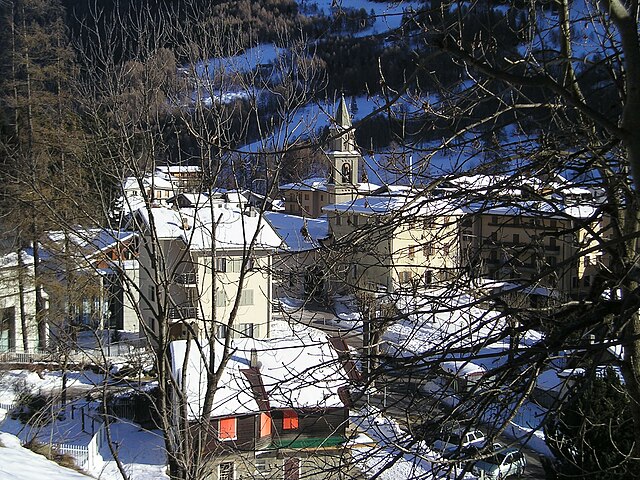
Teglio (Teglio)
.svg)
- Italian comune
 Hiking in Teglio
Teglio, a charming town located in the Valtellina valley of northern Italy, is surrounded by stunning alpine landscapes, making it a fantastic destination for hiking enthusiasts. The area is known for its rich natural beauty, with a diverse range of trails suitable for various skill levels, from leisurely strolls to challenging hikes.
Hiking Trails in Teglio
-
Sentiero Valtellina:
- This is a long-distance trail that runs through the Valtellina valley, providing hikers with breathtaking views of the surrounding mountains and vineyards. Portions of the trail near Teglio allow for scenic walks with opportunities to explore the local flora and fauna.
-
Valle di Teglio:
- The valley offers several hiking routes that branch off from Teglio, leading into the surrounding mountains. Trails vary from easy to moderate, making them accessible for families and beginners, as well as those looking for more strenuous options.
-
Piz Mura:
- For a more challenging hike, consider the trail leading to Piz Mura. This hike typically features steep ascents and offers panoramic views of the Valtellina region and the nearby Alps. Be prepared with proper gear and possibly some hiking poles.
-
Lago di Sassolo:
- A beautiful hike that takes you to a tranquil alpine lake. The trail is generally moderate and offers a peaceful retreat into nature. It’s a great spot for a picnic or simply to enjoy the surroundings.
-
Monte Overa:
- This trail can be more demanding, leading to Monte Overa, where hikers are rewarded with incredible views of both the valley and the surrounding peaks. It's ideal for experienced hikers looking for a challenge.
Best Times to Hike
The best seasons for hiking in Teglio are late spring through early fall (May to October). Summer months can be warm, while spring and fall offer cooler temperatures and fewer crowds. Always check the local weather forecast before heading out, as conditions can change rapidly in the mountains.
Preparation and Tips
- Gear: Make sure to wear appropriate hiking boots and clothing. Layers are essential, as temperatures can fluctuate greatly.
- Water and Snacks: Carry enough water and snacks to keep your energy levels up during hikes.
- Map and GPS: Familiarize yourself with maps and the GPS coordinates of your intended trails. Some areas may have limited cell service.
- Local Regulations: Respect local wildlife and follow any posted guidelines or restrictions. It’s also good practice to inform someone of your plans and expected return time.
Conclusion
Hiking in Teglio offers a variety of trails set against stunning landscapes filled with natural beauty. Whether you’re looking for a leisurely walk or a demanding climb, you can find a suitable trail that allows you to immerse yourself in the serene alpine environment of the region. Enjoy your hiking adventure in Teglio!
- Country:

- Postal Code: 23036
- Local Dialing Code: 0342
- Licence Plate Code: SO
- Coordinates: 46° 10' 0" N, 10° 4' 0" E


- GPS tracks (wikiloc): [Link]
- AboveSeaLevel: 851 м m
- Area: 115.32 sq km
- Population: 4534
- Web site: http://www.comune.teglio.so.it
- Wikipedia en: wiki(en)
- Wikipedia: wiki(it)
- Wikidata storage: Wikidata: Q39794
- Wikipedia Commons Gallery: [Link]
- Wikipedia Commons Category: [Link]
- Freebase ID: [/m/0gj3wh]
- GeoNames ID: Alt: [6539618]
- VIAF ID: Alt: [848145858108023022182]
- OSM relation ID: [46787]
- WOEID: [724763]
- UN/LOCODE: [ITXOL]
- ISTAT ID: 014065
- Italian cadastre code: L084
Shares border with regions:


Schilpario
- Italian comune
Hiking in Schilpario
Schilpario is a charming small village located in the Italian Alps, specifically in the province of Bergamo, Lombardy. It’s nestled within the Seriana Valley and is surrounded by stunning mountain scenery, making it a great destination for hiking enthusiasts....
- Country:
- Postal Code: 24020
- Local Dialing Code: 0346
- Licence Plate Code: BG
- Coordinates: 46° 1' 0" N, 10° 9' 0" E
- GPS tracks (wikiloc): [Link]
- AboveSeaLevel: 1124 м m
- Area: 63.97 sq km
- Population: 1184
- Web site: [Link]


Valbondione
- Italian comune
Hiking in Valbondione
Valbondione is a stunning valley located in the Bergamo Alps of northern Italy, offering a wealth of hiking opportunities for all levels of outdoor enthusiasts. Here are some key highlights and practical tips for hiking in this beautiful area:...
- Country:
- Postal Code: 24020
- Local Dialing Code: 0346
- Licence Plate Code: BG
- Coordinates: 46° 2' 16" N, 10° 0' 47" E
- GPS tracks (wikiloc): [Link]
- AboveSeaLevel: 900 м m
- Area: 96.89 sq km
- Population: 1051
- Web site: [Link]


Vilminore di Scalve
- Italian comune
Hiking in Vilminore di Scalve
Vilminore di Scalve is a picturesque town located in the Val di Scalve region of Italy, nestled in the Alps of Lombardy. The area is known for its stunning scenic beauty and variety of hiking opportunities, making it an excellent destination for outdoor enthusiasts....
- Country:
- Postal Code: 24020
- Local Dialing Code: 0346
- Licence Plate Code: BG
- Coordinates: 46° 0' 0" N, 10° 6' 0" E
- GPS tracks (wikiloc): [Link]
- AboveSeaLevel: 1019 м m
- Area: 41 sq km
- Population: 1479
- Web site: [Link]

Corteno Golgi
- Italian comune
Hiking in Corteno Golgi
Corteno Golgi is a charming village located in the Lombardy region of Italy, nestled in the heart of the Central Alps. It's a great destination for hiking enthusiasts, offering a mix of beautiful landscapes, historical sites, and well-marked trails....
- Country:
- Postal Code: 25040
- Local Dialing Code: 0364
- Licence Plate Code: BS
- Coordinates: 46° 10' 1" N, 10° 14' 40" E
- GPS tracks (wikiloc): [Link]
- AboveSeaLevel: 925 м m
- Area: 82.61 sq km
- Population: 1962
- Web site: [Link]

Paisco Loveno
- Italian comune
Hiking in Paisco Loveno
Paisco Loveno is a picturesque location nestled in the Italian Alps, particularly known for its breathtaking landscapes and diverse hiking trails. Here are some key points to consider if you're planning a hiking trip there:...
- Country:
- Postal Code: 25050
- Local Dialing Code: 0364
- Licence Plate Code: BS
- Coordinates: 46° 4' 48" N, 10° 17' 36" E
- GPS tracks (wikiloc): [Link]
- AboveSeaLevel: 853 м m
- Area: 35.87 sq km
- Population: 190
- Web site: [Link]


Castello dell'Acqua
- Italian comune
Hiking in Castello dell'Acqua
Castello dell'Acqua, located in the province of Sondrio in Lombardy, Italy, offers stunning hiking opportunities with breathtaking views of the surrounding Alps. Nestled in the heart of the Valtellina valley, it’s a great spot for those seeking both scenic beauty and outdoor adventure....
- Country:
- Postal Code: 23030
- Local Dialing Code: 0342
- Licence Plate Code: SO
- Coordinates: 46° 9' 0" N, 10° 1' 0" E
- GPS tracks (wikiloc): [Link]
- AboveSeaLevel: 664 м m
- Area: 14.07 sq km
- Population: 629
- Web site: [Link]
Ponte in Valtellina
- Italian comune
Hiking in Ponte in Valtellina
Ponte in Valtellina is a picturesque town located in the Valtellina Valley in northern Italy, known for its stunning alpine scenery and a variety of outdoor activities, including hiking. Here are some key points about hiking in and around Ponte in Valtellina:...
- Country:
- Postal Code: 23026
- Local Dialing Code: 0342
- Licence Plate Code: SO
- Coordinates: 46° 11' 0" N, 9° 59' 0" E
- GPS tracks (wikiloc): [Link]
- AboveSeaLevel: 500 м m
- Area: 67.73 sq km
- Population: 2294
- Web site: [Link]


Villa di Tirano
- Italian comune
Hiking in Villa di Tirano
Villa di Tirano, located in the Valtellina region of northern Italy, is a beautiful area for hiking enthusiasts. Nestled in the Alps, this small town offers access to stunning landscapes, rich history, and diverse trails suitable for various skill levels....
- Country:
- Postal Code: 23030
- Local Dialing Code: 0342
- Licence Plate Code: SO
- Coordinates: 46° 12' 0" N, 10° 8' 0" E
- GPS tracks (wikiloc): [Link]
- AboveSeaLevel: 406 м m
- Area: 24.74 sq km
- Population: 2978
- Web site: [Link]


Bianzone
- human settlement in Italy
Hiking in Bianzone
Bianzone, a charming village located in the Valtellina valley of Italy, offers some stunning hiking opportunities surrounded by the beautiful landscape of the Italian Alps. Here are some details about hiking in Bianzone:...
- Country:
- Postal Code: 23030
- Local Dialing Code: 0342
- Licence Plate Code: SO
- Coordinates: 46° 11' 0" N, 10° 6' 0" E
- GPS tracks (wikiloc): [Link]
- AboveSeaLevel: 444 м m
- Area: 17.11 sq km
- Population: 1326
- Web site: [Link]

Chiuro
- Italian comune
Hiking in Chiuro
Chiuro, located in the Valtellina region of northern Italy, is surrounded by stunning landscapes that make it a great destination for hiking enthusiasts. Here’s what you can expect when hiking in and around Chiuro:...
- Country:
- Postal Code: 23030
- Local Dialing Code: 0342
- Licence Plate Code: SO
- Coordinates: 46° 10' 0" N, 9° 59' 0" E
- GPS tracks (wikiloc): [Link]
- AboveSeaLevel: 390 м m
- Area: 51.76 sq km
- Population: 2552
- Web site: [Link]

Aprica
- Italian comune
Hiking in Aprica
Aprica, located in the Valtellina region of northern Italy, is a fantastic destination for hiking enthusiasts. Surrounded by the stunning landscapes of the Rhaetian Alps, Aprica offers a variety of trails suitable for all skill levels, from casual walkers to experienced trekkers. Here are some highlights of hiking in this beautiful area:...
- Country:
- Postal Code: 23031
- Local Dialing Code: 0342
- Licence Plate Code: SO
- Coordinates: 46° 9' 0" N, 10° 8' 0" E
- GPS tracks (wikiloc): [Link]
- AboveSeaLevel: 1180 м m
- Area: 20.37 sq km
- Population: 1580
- Web site: [Link]


Brusio
- municipality in Val Poschiavo, Graubünden, Switzerland
Hiking in Brusio
Brusio, located in the Graubünden region of Switzerland, offers stunning landscapes and a variety of hiking trails suitable for different skill levels. Here are some highlights and tips for hiking in and around Brusio:...
- Country:

- Postal Code: 7743; 7748; 7747; 7744
- Local Dialing Code: 081
- Licence Plate Code: GR
- Coordinates: 46° 15' 20" N, 10° 7' 8" E
- GPS tracks (wikiloc): [Link]
- AboveSeaLevel: 1042 м m
- Area: 46.29 sq km
- Population: 1135
- Web site: [Link]