
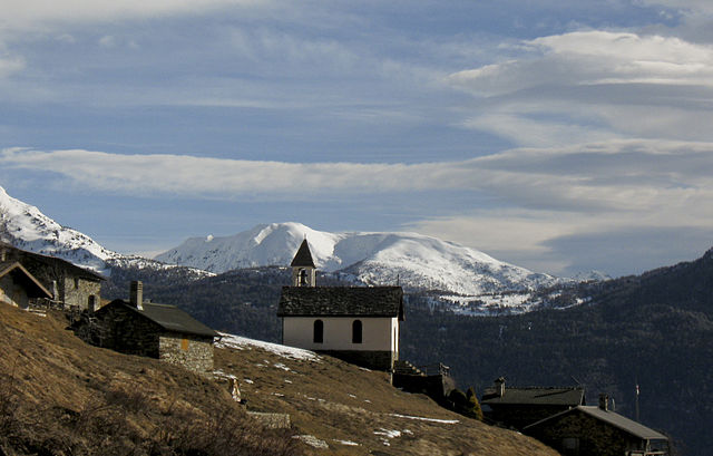
Tirano (Tirano)
.svg)
- Italian comune
 Hiking in Tirano
Tirano, located in the Valtellina region of northern Italy, is a charming town surrounded by stunning Alpine scenery, making it a fantastic base for hiking enthusiasts. The area offers diverse trails that cater to various skill levels, from leisurely walks to challenging hikes.
Popular Hiking Trails:
-
Sentiero del Viandante: This scenic trail winds along the eastern shore of Lake Como, providing breathtaking views of the lake and mountains. Portions of the trail near Tirano offer beautiful landscapes and charming villages.
-
Val di Poschiavo: Just a short distance from Tirano, this valley offers a variety of trails. You can hike to the stunning Lago di Poschiavo or explore the higher routes that lead to panoramic viewpoints.
-
Monte Padrio: A popular hike that provides a rewarding ascent with expansive views of the surrounding area. The trailhead is accessible from Tirano, and the hike can be completed in a few hours.
-
The Valtellina Trail: This long-distance trail spans the entire Valtellina region and can be tackled in sections. It offers diverse landscapes, including vineyards, rivers, and mountain scenery.
Preparation Tips:
-
Check Weather Conditions: The weather in the Alps can change quickly, so it’s crucial to check forecasts and be prepared for various conditions.
-
Proper Gear: Wear appropriate hiking shoes and clothing. Always bring a backpack with water, snacks, a map, and a first-aid kit.
-
Stay Hydrated: Ensure you drink enough water, especially during summer hikes.
-
Trail Markings: Familiarize yourself with local trail markings. In Italy, trails are often marked with color-coded signs.
-
Local Guides: If you’re unfamiliar with the area, consider hiring a local guide. They can enhance your experience with insights into the local flora, fauna, and culture.
Best Time to Hike:
- Spring (April - June): Mild weather and blooming nature make spring one of the best times for hiking.
- Summer (July - August): This is peak season, with longer days and warmer temperatures, but trails can be busier.
- Autumn (September - October): Beautiful fall colors make autumn another ideal time for hiking, and the weather is still pleasant.
Accessibility:
Tirano is well-connected via train and road, making it easy to access from major cities like Milan or Bergamo. The region has good public transport options to reach various trailheads.
In summary, Tirano and its surroundings are a hiking paradise with a variety of trails to explore. Whether you enjoy leisurely walks or more strenuous hikes, the breathtaking landscapes and rich culture of the Valtellina region will enhance your outdoor experience.
- Country:

- Postal Code: 23037
- Local Dialing Code: 0342
- Licence Plate Code: SO
- Coordinates: 46° 12' 59" N, 10° 10' 8" E


- GPS tracks (wikiloc): [Link]
- AboveSeaLevel: 441 м m
- Area: 32.37 sq km
- Population: 9050
- Web site: http://www.comune.tirano.so.it/
- Wikipedia en: wiki(en)
- Wikipedia: wiki(it)
- Wikidata storage: Wikidata: Q40868
- Wikipedia Commons Gallery: [Link]
- Wikipedia Commons Category: [Link]
- Freebase ID: [/m/0dqtfm]
- GeoNames ID: Alt: [6539619]
- VIAF ID: Alt: [167905222]
- OSM relation ID: [47003]
- UN/LOCODE: [ITTNO]
- HDS ID: [7127]
- EMLO location ID: [507520f4-5ea1-4d86-86aa-48f4d800701a]
- ISTAT ID: 014066
- Italian cadastre code: L175
Shares border with regions:

Corteno Golgi
- Italian comune
Hiking in Corteno Golgi
Corteno Golgi is a charming village located in the Lombardy region of Italy, nestled in the heart of the Central Alps. It's a great destination for hiking enthusiasts, offering a mix of beautiful landscapes, historical sites, and well-marked trails....
- Country:
- Postal Code: 25040
- Local Dialing Code: 0364
- Licence Plate Code: BS
- Coordinates: 46° 10' 1" N, 10° 14' 40" E
- GPS tracks (wikiloc): [Link]
- AboveSeaLevel: 925 м m
- Area: 82.61 sq km
- Population: 1962
- Web site: [Link]
Sernio
- Italian comune
Hiking in Sernio
Sernio, located in the Italian region of Lombardy, is a charming destination for hiking enthusiasts. While it may not be as well-known as larger national parks, it offers a variety of trails that can cater to different skill levels, from leisurely walks to more challenging hikes....
- Country:
- Postal Code: 23030
- Local Dialing Code: 0342
- Licence Plate Code: SO
- Coordinates: 46° 13' 0" N, 10° 12' 0" E
- GPS tracks (wikiloc): [Link]
- AboveSeaLevel: 632 м m
- Area: 9.52 sq km
- Population: 474
- Web site: [Link]


Villa di Tirano
- Italian comune
Hiking in Villa di Tirano
Villa di Tirano, located in the Valtellina region of northern Italy, is a beautiful area for hiking enthusiasts. Nestled in the Alps, this small town offers access to stunning landscapes, rich history, and diverse trails suitable for various skill levels....
- Country:
- Postal Code: 23030
- Local Dialing Code: 0342
- Licence Plate Code: SO
- Coordinates: 46° 12' 0" N, 10° 8' 0" E
- GPS tracks (wikiloc): [Link]
- AboveSeaLevel: 406 м m
- Area: 24.74 sq km
- Population: 2978
- Web site: [Link]

Vervio
- Italian comune
Hiking in Vervio
Vervio is a charming village located in the Valtellina region of northern Italy, which offers beautiful hiking opportunities amidst stunning alpine scenery. Here are some key points about hiking in and around Vervio:...
- Country:
- Postal Code: 23030
- Local Dialing Code: 0342
- Licence Plate Code: SO
- Coordinates: 46° 15' 0" N, 10° 14' 0" E
- GPS tracks (wikiloc): [Link]
- AboveSeaLevel: 549 м m
- Area: 12.41 sq km
- Population: 209
- Web site: [Link]


Brusio
- municipality in Val Poschiavo, Graubünden, Switzerland
Hiking in Brusio
Brusio, located in the Graubünden region of Switzerland, offers stunning landscapes and a variety of hiking trails suitable for different skill levels. Here are some highlights and tips for hiking in and around Brusio:...
- Country:

- Postal Code: 7743; 7748; 7747; 7744
- Local Dialing Code: 081
- Licence Plate Code: GR
- Coordinates: 46° 15' 20" N, 10° 7' 8" E
- GPS tracks (wikiloc): [Link]
- AboveSeaLevel: 1042 м m
- Area: 46.29 sq km
- Population: 1135
- Web site: [Link]