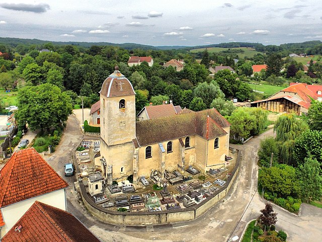
Brussey (Brussey)

- commune in Haute-Saône, France
- Country:

- Postal Code: 70150
- Coordinates: 47° 18' 1" N, 5° 48' 37" E


- GPS tracks (wikiloc): [Link]
- Area: 7.27 sq km
- Population: 276
- Wikipedia en: wiki(en)
- Wikipedia: wiki(fr)
- Wikidata storage: Wikidata: Q596514
- Wikipedia Commons Category: [Link]
- Freebase ID: [/m/03nt7ck]
- GeoNames ID: Alt: [6441843]
- SIREN number: [217001023]
- BnF ID: [152724963]
- INSEE municipality code: 70102
Shares border with regions:


Avrigney-Virey
- commune in Haute-Saône, France
- Country:
- Postal Code: 70150
- Coordinates: 47° 20' 4" N, 5° 46' 43" E
- GPS tracks (wikiloc): [Link]
- AboveSeaLevel: 270 м m
- Area: 22.3 sq km
- Population: 431

Beaumotte-lès-Pin
- commune in Haute-Saône, France
- Country:
- Postal Code: 70150
- Coordinates: 47° 19' 1" N, 5° 49' 51" E
- GPS tracks (wikiloc): [Link]
- Area: 8.43 sq km
- Population: 301
- Web site: [Link]


Chevigney-sur-l'Ognon
- commune in Doubs, France
 Hiking in Chevigney-sur-l'Ognon
Chevigney-sur-l'Ognon, located in the Bourgogne-Franche-Comté region of eastern France, offers a tranquil setting for hiking enthusiasts. The area is characterized by its lush landscapes, rolling hills, and proximity to the Ognon River, making it an excellent destination for both casual walkers and experienced hikers....
- Country:
- Postal Code: 25170
- Coordinates: 47° 17' 52" N, 5° 50' 18" E
- GPS tracks (wikiloc): [Link]
- Area: 4.58 sq km
- Population: 280


Marnay
- commune in Haute-Saône, France
- Country:
- Postal Code: 70150
- Coordinates: 47° 17' 23" N, 5° 46' 18" E
- GPS tracks (wikiloc): [Link]
- Area: 10.37 sq km
- Population: 1464
- Web site: [Link]


Ruffey-le-Château
- commune in Doubs, France
Hiking in Ruffey-le-Château
Ruffey-le-Château, located in the Bourgogne-Franche-Comté region of eastern France, offers a charming setting for hiking enthusiasts. The area is characterized by a combination of gentle hills, forests, and agricultural landscapes that provide a diverse range of hiking routes suitable for different skill levels....
- Country:
- Postal Code: 25170
- Coordinates: 47° 17' 15" N, 5° 47' 54" E
- GPS tracks (wikiloc): [Link]
- Area: 7.25 sq km
- Population: 358