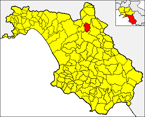
Buccino (Buccino)

- Italian comune
 Hiking in Buccino
Buccino is a town located in the province of Salerno in the Campania region of Italy. Nestled in the Apennine Mountains, it offers a range of outdoor activities, including hiking, thanks to its beautiful landscapes and rich history. Here are some insights about hiking in and around Buccino:
Trails and Terrain
-
Scenic Views: The area surrounding Buccino features rolling hills, rugged mountains, and lush valleys, providing breathtaking views and a diverse range of ecosystems. Hikers can enjoy the beautiful vistas of the surrounding landscape and traditional Italian countryside.
-
Nature Reserves: Explore the nearby nature reserves and parks, which offer marked trails for various skill levels. The region is also home to many species of plants and wildlife, making it an appealing destination for nature enthusiasts.
-
Historical Trails: Buccino has a rich archaeological history, and some hiking paths lead to ancient ruins and historical sites. Exploring these trails can provide insight into the region's past, including remnants from the Samnite and Roman periods.
Hiking Tips
-
Map and Guides: It's advisable to have a detailed map or a local guidebook, as some trails may not be well-marked.
-
Appropriate Gear: Wear sturdy hiking boots, and pack essentials such as water, snacks, a first-aid kit, and sun protection. The weather can change, so consider layering your clothing.
-
Seasonal Considerations: Spring and fall are ideal for hiking due to moderate temperatures. Summer can be hot, while winter may bring snow to higher elevations.
-
Local Regulations: Make sure to check local regulations regarding trail use, as some areas may have restrictions to protect the environment.
Getting There
Buccino is accessible by car and is well-connected by public transportation from larger cities in Campania. Exploring the surrounding area can enhance your hiking experience.
Conclusion
Hiking in Buccino offers a unique blend of natural beauty and historical exploration. Whether you're a seasoned hiker or a novice, there are trails suitable for all levels, making it a wonderful destination for outdoor enthusiasts in Italy.
- Country:

- Postal Code: 84021
- Local Dialing Code: 0828
- Licence Plate Code: SA
- Coordinates: 40° 38' 0" N, 15° 23' 0" E


- GPS tracks (wikiloc): [Link]
- AboveSeaLevel: 663 м m
- Area: 65.92 sq km
- Population: 4889
- Web site: http://www.comune.buccino.sa.it/
- Wikipedia en: wiki(en)
- Wikipedia: wiki(it)
- Wikidata storage: Wikidata: Q80669
- Wikipedia Commons Category: [Link]
- Freebase ID: [/m/05zyqv]
- GeoNames ID: Alt: [6538806]
- VIAF ID: Alt: [249054872]
- OSM relation ID: [40619]
- WOEID: [711500]
- UN/LOCODE: [ITBCO]
- ISTAT ID: 065017
- Italian cadastre code: B242
Shares border with regions:


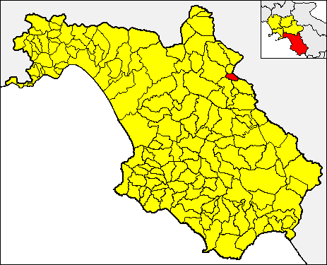
Auletta
- Italian comune
Hiking in Auletta
Auletta, a small town in the province of Salerno in southern Italy, is surrounded by beautiful landscapes and offers several opportunities for hiking enthusiasts. Nestled in the foothills of the Apennines, Auletta provides access to picturesque trails, rolling hills, and views of the surrounding countryside....
- Country:
- Postal Code: 84031
- Local Dialing Code: 0975
- Licence Plate Code: SA
- Coordinates: 40° 33' 40" N, 15° 25' 28" E
- GPS tracks (wikiloc): [Link]
- AboveSeaLevel: 280 м m
- Area: 35.68 sq km
- Population: 2520
- Web site: [Link]


Colliano
- Italian comune
Hiking in Colliano
Colliano, a charming town located in the province of Salerno in the Campania region of southern Italy, offers a variety of hiking opportunities for outdoor enthusiasts. The region is characterized by its scenic landscapes, rich biodiversity, and historical sites, making it an enjoyable destination for hikers of all skill levels....
- Country:
- Postal Code: 84020
- Local Dialing Code: 0828
- Licence Plate Code: SA
- Coordinates: 40° 44' 0" N, 15° 17' 0" E
- GPS tracks (wikiloc): [Link]
- AboveSeaLevel: 630 м m
- Area: 55.16 sq km
- Population: 3590
- Web site: [Link]

Palomonte
- Italian comune
Hiking in Palomonte
Palomonte, a charming town in the Campania region of Italy, offers various hiking opportunities, particularly for those who enjoy exploring the natural beauty and rural landscapes of the area. Here are some highlights about hiking in and around Palomonte:...
- Country:
- Postal Code: 84020
- Local Dialing Code: 0828
- Licence Plate Code: SA
- Coordinates: 40° 40' 0" N, 15° 18' 0" E
- GPS tracks (wikiloc): [Link]
- AboveSeaLevel: 550 м m
- Area: 28 sq km
- Population: 4103
- Web site: [Link]


Romagnano al Monte
- Italian comune
Hiking in Romagnano al Monte
Romagnano al Monte is a small village located in the province of Salerno, in the Campania region of Italy. Nestled in the hills of the Cilento and Vallo di Diano National Park, it offers a variety of hiking opportunities that showcase the stunning natural landscapes and rich biodiversity of the area....
- Country:
- Postal Code: 84020
- Local Dialing Code: 0828
- Licence Plate Code: SA
- Coordinates: 40° 37' 41" N, 15° 27' 29" E
- GPS tracks (wikiloc): [Link]
- AboveSeaLevel: 650 м m
- Area: 9.67 sq km
- Population: 375
- Web site: [Link]

Salvitelle
- Italian comune
Hiking in Salvitelle
Salvitelle is a picturesque village located in the province of Salerno in the Campania region of Italy, nestled in the Apennine Mountains. Hiking in and around Salvitelle offers a fantastic way to explore the natural beauty, rich history, and charming landscapes of this area....
- Country:
- Postal Code: 84020
- Local Dialing Code: 0975
- Licence Plate Code: SA
- Coordinates: 40° 36' 0" N, 15° 28' 0" E
- GPS tracks (wikiloc): [Link]
- AboveSeaLevel: 630 м m
- Area: 9.6 sq km
- Population: 526
- Web site: [Link]
San Gregorio Magno
- Italian comune
Hiking in San Gregorio Magno
San Gregorio Magno is a charming town located in the Campania region of Italy, surrounded by the beautiful landscapes of the Cilento and Vallo di Diano National Park. This area offers a variety of hiking opportunities, ranging from easy walks to more challenging trails through natural parks, mountains, and historical sites....
- Country:
- Postal Code: 84020
- Local Dialing Code: 0828
- Licence Plate Code: SA
- Coordinates: 40° 39' 0" N, 15° 24' 0" E
- GPS tracks (wikiloc): [Link]
- AboveSeaLevel: 508 м m
- Area: 50.05 sq km
- Population: 4221
- Web site: [Link]


Sicignano degli Alburni
- Italian comune
Hiking in Sicignano degli Alburni
Sicignano degli Alburni is a charming town located in the Campania region of southern Italy. It’s nestled in the Alburni Mountains, which offer a diverse range of hiking opportunities, rich natural beauty, and stunning landscapes. Here’s an overview of hiking in and around Sicignano degli Alburni:...
- Country:
- Postal Code: 84029
- Local Dialing Code: 0828
- Licence Plate Code: SA
- Coordinates: 40° 33' 35" N, 15° 18' 25" E
- GPS tracks (wikiloc): [Link]
- AboveSeaLevel: 605 м m
- Area: 81.11 sq km
- Population: 3411
- Web site: [Link]