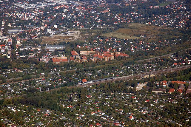
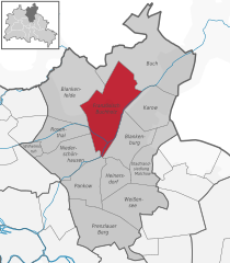
Buch (Buch)

- locality of Berlin
 Hiking in Buch
Buch, located in the northeastern part of Berlin, offers various hiking and outdoor opportunities, although it’s not a sprawling wilderness. Instead, it features accessible paths, parks, and green spaces that provide a pleasant environment for hiking and nature walks.
Key Highlights for Hiking in Buch:
-
Parks and Green Spaces:
- Buchholz Park: A beautiful park where you can enjoy leisurely hikes. The paths are well-maintained, and it’s a great spot for family outings.
- Naturschutzgebiet (Nature Reserve) Schöneberger Südgelände: While not directly in Buch, it's close enough for a day trip. This area combines nature with remnants of industrial history, offering unique landscapes and hiking paths.
-
Nearby Trails:
- The Wuhle Wanderweg: This is a scenic hiking trail that follows the Wuhle River. Although it doesn't start in Buch, you can access it from various points around Berlin. It features diverse landscapes and wildlife, perfect for a day hike.
-
Forest Areas:
- The surrounding regions have several forested areas. Grunewald and Tegeler Forst are a bit further out but provide a wide range of hiking trails if you’re willing to travel a little.
-
Historical Sites:
- Incorporating local history into your hike can be interesting. Buch is known for its historic buildings, including the Klinik für Psychiatrie, which has an interesting architectural style.
-
Accessibility:
- Buch is accessible via public transportation. The S-Bahn and U-Bahn systems can take you close to various hiking starting points, making it easy for city dwellers to escape to nature.
Tips for Hiking in Buch:
- Prepare for Urban Hiking: Since Buch is part of Berlin, expect some urban elements while hiking. The trails may be interspersed with streets and residential areas.
- Check Weather Conditions: Before heading out, check the forecast to ensure you're prepared for any changes in weather.
- Stay Hydrated and Snack Ready: Bring water and snacks, especially if you plan to hike longer trails or spend a full day outdoors.
Conclusion:
While hiking in Buch might not offer extensive wilderness hiking, it presents a nice opportunity to connect with nature within an urban setting. Enjoy local parks, nearby trails, and the beauty of the surrounding areas!
- Country:

- Coordinates: 52° 38' 0" N, 13° 30' 0" E


- GPS tracks (wikiloc): [Link]
- AboveSeaLevel: 57 м m
- Area: 18.2 sq km
- Population: 12674
- Wikipedia en: wiki(en)
- Wikipedia: wiki(de)
- Wikidata storage: Wikidata: Q670751
- Wikipedia Commons Gallery: [Link]
- Wikipedia Commons Category: [Link]
- Wikipedia Commons Maps Category: [Link]
- Freebase ID: [/m/0br_9rf]
- GeoNames ID: Alt: [2942827]
- archINFORM location ID: [43338]
Shares border with regions:


Brandenburg
- state of Germany
Hiking in Brandenburg
Brandenburg, a state in northeastern Germany, is an excellent destination for hiking enthusiasts. It's known for its diverse landscapes, which include vast forests, serene lakes, and rolling hills. Here are some key highlights and tips for hiking in Brandenburg:...
- Country:
- Capital: Potsdam
- Coordinates: 52° 21' 43" N, 13° 0' 29" E
- GPS tracks (wikiloc): [Link]
- AboveSeaLevel: 0 м m
- Area: 29478.63 sq km
- Population: 2449193
- Web site: [Link]
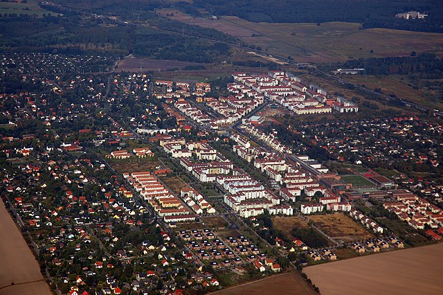
Französisch Buchholz
- locality of Berlin
Hiking in Französisch Buchholz
Französisch Buchholz is a charming district located in the northern part of Berlin, Germany. While it may not be a traditional hiking destination like some of Germany's national parks, there are still several beautiful spots and trails in and around this area that offer pleasant walking and hiking experiences....
- Country:
- Coordinates: 52° 36' 0" N, 13° 26' 0" E
- GPS tracks (wikiloc): [Link]
- AboveSeaLevel: 46 м m
- Area: 12 sq km

Karow
- locality of Berlin
Hiking in Karow
Karow, located in the northeastern part of Berlin, is primarily a residential district, but it offers some opportunities for nature walks and light hiking. While it may not be a primary destination for serious hikers, there are several parks and green spaces nearby that can make for pleasant outdoor activities....
- Country:
- Coordinates: 52° 36' 45" N, 13° 29' 0" E
- GPS tracks (wikiloc): [Link]
- AboveSeaLevel: 55 м m
- Area: 6.65 sq km
Blankenfelde
- locality of Berlin
Hiking in Blankenfelde
Blankenfelde, located in the state of Brandenburg, Germany, offers a variety of hiking opportunities amidst its picturesque landscapes, including forests, fields, and small lakes. Here are some highlights of hiking in the area:...
- Country:
- Coordinates: 52° 37' 7" N, 13° 23' 26" E
- GPS tracks (wikiloc): [Link]
- AboveSeaLevel: 53 м m
- Area: 13.4 sq km