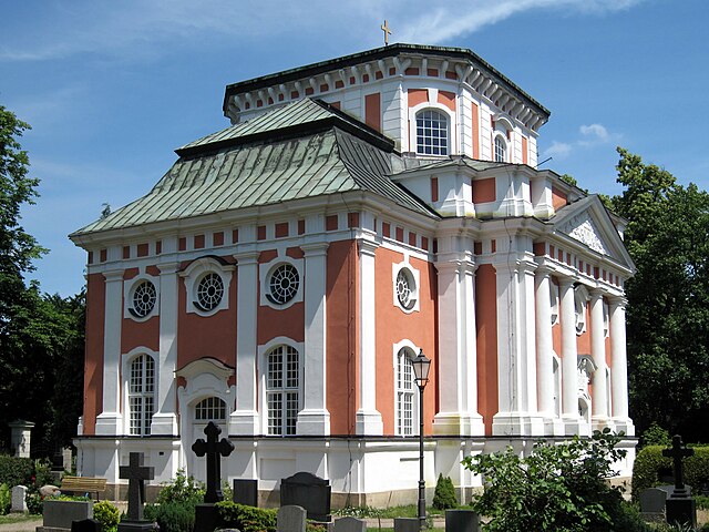
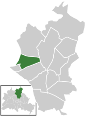
Französisch Buchholz (Französisch Buchholz)

- locality of Berlin
 Hiking in Französisch Buchholz
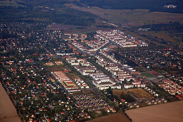
Französisch Buchholz is a charming district located in the northern part of Berlin, Germany. While it may not be a traditional hiking destination like some of Germany's national parks, there are still several beautiful spots and trails in and around this area that offer pleasant walking and hiking experiences.
Hiking Routes and Areas
-
Grunewald Forest: Just a short distance from Französisch Buchholz, the Grunewald Forest offers numerous trails that wind through its dense woods. It's a lovely area for a day hike and connects to several lakes and scenic viewpoints.
-
Tegeler See: To the northwest, Tegeler See is a popular destination for walking. There are trails around the lake that provide beautiful views and a chance to enjoy the natural surroundings.
-
Berlin Parks: Within the district itself and nearby, there are parks that offer walking paths, such as the nearby Schönhauser Allee Park and the more extensive Volkspark Schönholz. These parks can be great for leisurely walks or more active hikes within urban green spaces.
-
Pankow District: The Pankow area, where Französisch Buchholz is located, is known for its parks and green areas. You can make your way through the area, exploring trails and enjoying the natural beauty interspersed with historical landmarks.
Tips for Hiking in the Area
-
Trail Maps: While urban walking paths are usually well-marked, it's always a good idea to bring a map or use a hiking app to guide you.
-
Nature Reserves: Keep an eye out for nature reserves where wildlife can be observed, often improving the experience.
-
Weather: Check the weather before heading out, as certain trails may become muddy or slippery after rain.
-
Footwear: Wear comfortable and sturdy shoes suitable for walking, especially if you plan to explore unpaved paths.
-
Local Amenities: Take note of local amenities such as cafes or rest areas where you can stop for refreshments during your hike.
Exploring the hiking paths in and around Französisch Buchholz could offer a great blend of urban setting and access to nature. Enjoy your hike!
- Country:

- Coordinates: 52° 36' 0" N, 13° 26' 0" E


- GPS tracks (wikiloc): [Link]
- AboveSeaLevel: 46 м m
- Area: 12 sq km
- Wikipedia en: wiki(en)
- Wikipedia: wiki(de)
- Wikidata storage: Wikidata: Q675015
- Wikipedia Commons Gallery: [Link]
- Wikipedia Commons Category: [Link]
- Freebase ID: [/m/0bs6_6f]
- GeoNames ID: Alt: [2942341]
- archINFORM location ID: [43337]
Shares border with regions:


Pankow
- locality of the borough Pankow of Berlin
Hiking in Pankow
Pankow is a district in northeastern Berlin, Germany, known for its charming neighborhoods, parks, and green areas. While it is more urban compared to rural hiking destinations, there are still opportunities for enjoyable walks and hikes within and around the area....
- Country:
- Coordinates: 52° 34' 0" N, 13° 24' 0" E
- GPS tracks (wikiloc): [Link]
- AboveSeaLevel: 47 м m
- Area: 5.66 sq km
- Population: 57113


Niederschönhausen
- locality of Berlin
Hiking in Niederschönhausen
Niederschönhausen is a district located in the Pankow borough of Berlin, Germany. While it may not be as widely known for hiking as some of the more rural areas surrounding Berlin, there are still opportunities for walks and nature exploration in and around the area....
- Country:
- Coordinates: 52° 35' 0" N, 13° 24' 0" E
- GPS tracks (wikiloc): [Link]
- AboveSeaLevel: 48 м m
- Area: 6.49 sq km
- Population: 28313

Buch
- locality of Berlin
Hiking in Buch
Buch, located in the northeastern part of Berlin, offers various hiking and outdoor opportunities, although it’s not a sprawling wilderness. Instead, it features accessible paths, parks, and green spaces that provide a pleasant environment for hiking and nature walks....
- Country:
- Coordinates: 52° 38' 0" N, 13° 30' 0" E
- GPS tracks (wikiloc): [Link]
- AboveSeaLevel: 57 м m
- Area: 18.2 sq km
- Population: 12674

Rosenthal
- locality of Berlin
Hiking in Rosenthal
Rosenthal is a district in the northeastern part of Berlin, known for its natural beauty and green spaces, making it a lovely destination for hiking and outdoor activities. Though it's not a vast or well-known hiking hub compared to some larger parks or forests, it still offers some nice opportunities for nature walks and hikes....
- Country:
- Coordinates: 52° 35' 57" N, 13° 22' 38" E
- GPS tracks (wikiloc): [Link]
- AboveSeaLevel: 47 м m
- Area: 4.9 sq km
Blankenburg
- locality of Berlin
Hiking in Blankenburg
Blankenburg, a district in the northeastern part of Berlin, is not typically known for traditional hiking trails like those found in more mountainous or rural areas. However, it still offers opportunities for outdoor exploration and walking in a more urban and suburban environment. Here are some highlights and suggestions for enjoying the area:...
- Country:
- Coordinates: 52° 35' 35" N, 13° 27' 15" E
- GPS tracks (wikiloc): [Link]
- AboveSeaLevel: 47 м m
- Area: 6.03 sq km
- Population: 6536

Karow
- locality of Berlin
Hiking in Karow
Karow, located in the northeastern part of Berlin, is primarily a residential district, but it offers some opportunities for nature walks and light hiking. While it may not be a primary destination for serious hikers, there are several parks and green spaces nearby that can make for pleasant outdoor activities....
- Country:
- Coordinates: 52° 36' 45" N, 13° 29' 0" E
- GPS tracks (wikiloc): [Link]
- AboveSeaLevel: 55 м m
- Area: 6.65 sq km
Blankenfelde
- locality of Berlin
Hiking in Blankenfelde
Blankenfelde, located in the state of Brandenburg, Germany, offers a variety of hiking opportunities amidst its picturesque landscapes, including forests, fields, and small lakes. Here are some highlights of hiking in the area:...
- Country:
- Coordinates: 52° 37' 7" N, 13° 23' 26" E
- GPS tracks (wikiloc): [Link]
- AboveSeaLevel: 53 м m
- Area: 13.4 sq km