Buchères (Buchères)

- commune in Aube, France
- Country:

- Postal Code: 10800
- Coordinates: 48° 14' 11" N, 4° 6' 41" E


- GPS tracks (wikiloc): [Link]
- Area: 7.14 sq km
- Population: 1581
- Wikipedia en: wiki(en)
- Wikipedia: wiki(fr)
- Wikidata storage: Wikidata: Q753569
- Wikipedia Commons Category: [Link]
- Freebase ID: [/m/03h49c2]
- GeoNames ID: Alt: [6446949]
- SIREN number: [211000625]
- BnF ID: [15246160m]
- PACTOLS thesaurus ID: [pcrtx5toJk80uW]
- INSEE municipality code: 10067
Shares border with regions:


Saint-Thibault
- commune in Aube, France
- Country:
- Postal Code: 10800
- Coordinates: 48° 12' 20" N, 4° 8' 30" E
- GPS tracks (wikiloc): [Link]
- Area: 11.71 sq km
- Population: 539

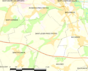
Saint-Léger-près-Troyes
- commune in Aube, France
- Country:
- Postal Code: 10800
- Coordinates: 48° 14' 12" N, 4° 4' 40" E
- GPS tracks (wikiloc): [Link]
- Area: 9.21 sq km
- Population: 863
- Web site: [Link]


Moussey
- commune in Aube, France
- Country:
- Postal Code: 10800
- Coordinates: 48° 12' 51" N, 4° 5' 44" E
- GPS tracks (wikiloc): [Link]
- Area: 7.25 sq km
- Population: 626

Verrières
- commune in Aube, France
- Country:
- Postal Code: 10390
- Coordinates: 48° 13' 58" N, 4° 8' 53" E
- GPS tracks (wikiloc): [Link]
- AboveSeaLevel: 124 м m
- Area: 10.12 sq km
- Population: 1892
- Web site: [Link]


Bréviandes
- commune in Aube, France
- Country:
- Postal Code: 10800
- Coordinates: 48° 15' 22" N, 4° 5' 44" E
- GPS tracks (wikiloc): [Link]
- Area: 6.14 sq km
- Population: 2716
- Web site: [Link]