Moussey (Moussey)

- commune in Aube, France
- Country:

- Postal Code: 10800
- Coordinates: 48° 12' 51" N, 4° 5' 44" E


- GPS tracks (wikiloc): [Link]
- Area: 7.25 sq km
- Population: 626
- Wikipedia en: wiki(en)
- Wikipedia: wiki(fr)
- Wikidata storage: Wikidata: Q388240
- Wikipedia Commons Category: [Link]
- Freebase ID: [/m/03m8tcm]
- GeoNames ID: Alt: [6426489]
- SIREN number: [211002522]
- BnF ID: [15246352j]
- PACTOLS thesaurus ID: [pcrtN4dqTL5TsE]
- INSEE municipality code: 10260
Shares border with regions:


Villemereuil
- commune in Aube, France
- Country:
- Postal Code: 10800
- Coordinates: 48° 11' 58" N, 4° 5' 14" E
- GPS tracks (wikiloc): [Link]
- Area: 7.81 sq km
- Population: 241


Saint-Thibault
- commune in Aube, France
- Country:
- Postal Code: 10800
- Coordinates: 48° 12' 20" N, 4° 8' 30" E
- GPS tracks (wikiloc): [Link]
- Area: 11.71 sq km
- Population: 539

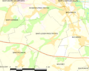
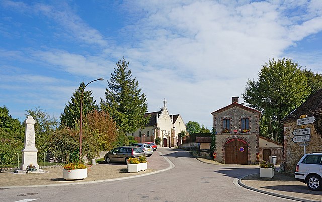
Saint-Léger-près-Troyes
- commune in Aube, France
- Country:
- Postal Code: 10800
- Coordinates: 48° 14' 12" N, 4° 4' 40" E
- GPS tracks (wikiloc): [Link]
- Area: 9.21 sq km
- Population: 863
- Web site: [Link]

Isle-Aumont
- commune in Aube, France
- Country:
- Postal Code: 10800
- Coordinates: 48° 12' 45" N, 4° 7' 28" E
- GPS tracks (wikiloc): [Link]
- Area: 3.48 sq km
- Population: 488
Saint-Pouange
- commune in Aube, France
- Country:
- Postal Code: 10120
- Coordinates: 48° 13' 29" N, 4° 2' 31" E
- GPS tracks (wikiloc): [Link]
- Area: 10.02 sq km
- Population: 905


Buchères
- commune in Aube, France
- Country:
- Postal Code: 10800
- Coordinates: 48° 14' 11" N, 4° 6' 41" E
- GPS tracks (wikiloc): [Link]
- Area: 7.14 sq km
- Population: 1581