Saint-Léger-près-Troyes (Saint-Léger-près-Troyes)

- commune in Aube, France
- Country:

- Postal Code: 10800
- Coordinates: 48° 14' 12" N, 4° 4' 40" E


- GPS tracks (wikiloc): [Link]
- Area: 9.21 sq km
- Population: 863
- Web site: http://www.saintlegerprestroyes.fr
- Wikipedia en: wiki(en)
- Wikipedia: wiki(fr)
- Wikidata storage: Wikidata: Q1362591
- Wikipedia Commons Category: [Link]
- Freebase ID: [/m/03m8vqm]
- GeoNames ID: Alt: [6426556]
- SIREN number: [211003330]
- BnF ID: [15246436k]
- PACTOLS thesaurus ID: [pcrtfR5aTfD8Yt]
- INSEE municipality code: 10344
Shares border with regions:


Rosières-près-Troyes
- commune in Aube, France
- Country:
- Postal Code: 10430
- Coordinates: 48° 15' 37" N, 4° 4' 18" E
- GPS tracks (wikiloc): [Link]
- Area: 6.23 sq km
- Population: 3962

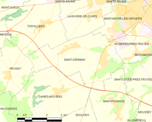
Saint-Germain
- commune in Aube, France
- Country:
- Postal Code: 10120
- Coordinates: 48° 15' 28" N, 4° 1' 55" E
- GPS tracks (wikiloc): [Link]
- Area: 13.8 sq km
- Population: 2298


Moussey
- commune in Aube, France
- Country:
- Postal Code: 10800
- Coordinates: 48° 12' 51" N, 4° 5' 44" E
- GPS tracks (wikiloc): [Link]
- Area: 7.25 sq km
- Population: 626
Saint-Pouange
- commune in Aube, France
- Country:
- Postal Code: 10120
- Coordinates: 48° 13' 29" N, 4° 2' 31" E
- GPS tracks (wikiloc): [Link]
- Area: 10.02 sq km
- Population: 905


Buchères
- commune in Aube, France
- Country:
- Postal Code: 10800
- Coordinates: 48° 14' 11" N, 4° 6' 41" E
- GPS tracks (wikiloc): [Link]
- Area: 7.14 sq km
- Population: 1581


Bréviandes
- commune in Aube, France
- Country:
- Postal Code: 10800
- Coordinates: 48° 15' 22" N, 4° 5' 44" E
- GPS tracks (wikiloc): [Link]
- Area: 6.14 sq km
- Population: 2716
- Web site: [Link]