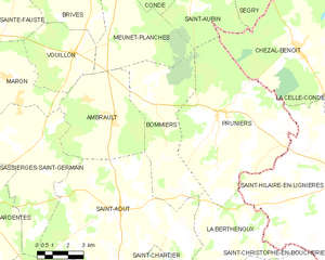
canton of Issoudun-Sud (canton d'Issoudun-Sud)
- canton of France (until March 2015)
- Country:

- Capital: Issoudun
- Coordinates: 46° 57' 39" N, 1° 59' 40" E


- GPS tracks (wikiloc): [Link]
- Wikidata storage: Wikidata: Q864839
- Wikipedia Commons Category: [Link]
- INSEE canton code: [3613]
Includes regions:


Condé
- commune in Indre, France
- Country:
- Postal Code: 36100
- Coordinates: 46° 52' 44" N, 1° 59' 9" E
- GPS tracks (wikiloc): [Link]
- Area: 23.82 sq km
- Population: 251


Ambrault
- commune in Indre, France
- Country:
- Postal Code: 36120
- Coordinates: 46° 47' 5" N, 1° 57' 33" E
- GPS tracks (wikiloc): [Link]
- Area: 25.59 sq km
- Population: 903

Bommiers
- commune in Indre, France
- Country:
- Postal Code: 36120
- Coordinates: 46° 47' 41" N, 1° 59' 7" E
- GPS tracks (wikiloc): [Link]
- Area: 28.38 sq km
- Population: 303
Chouday
- commune in Indre, France
- Country:
- Postal Code: 36100
- Coordinates: 46° 54' 38" N, 2° 3' 54" E
- GPS tracks (wikiloc): [Link]
- Area: 30 sq km
- Population: 148


Vouillon
- commune in Indre, France
- Country:
- Postal Code: 36100
- Coordinates: 46° 49' 18" N, 1° 55' 29" E
- GPS tracks (wikiloc): [Link]
- Area: 14.98 sq km
- Population: 238


Thizay
- commune in Indre, France
- Country:
- Postal Code: 36100
- Coordinates: 46° 53' 53" N, 1° 54' 40" E
- GPS tracks (wikiloc): [Link]
- Area: 16.65 sq km
- Population: 238


Ségry
- commune in Indre, France
- Country:
- Postal Code: 36100
- Coordinates: 46° 53' 26" N, 2° 4' 57" E
- GPS tracks (wikiloc): [Link]
- Area: 33.06 sq km
- Population: 526
Pruniers
- commune in Indre, France
- Country:
- Postal Code: 36120
- Coordinates: 46° 47' 20" N, 2° 3' 5" E
- GPS tracks (wikiloc): [Link]
- Area: 49 sq km
- Population: 537
- Web site: [Link]


Saint-Aubin
- commune in Indre, France
- Country:
- Postal Code: 36100
- Coordinates: 46° 51' 5" N, 2° 1' 27" E
- GPS tracks (wikiloc): [Link]
- Area: 28.32 sq km
- Population: 185


Meunet-Planches
- commune in Indre, France
- Country:
- Postal Code: 36100
- Coordinates: 46° 50' 14" N, 1° 57' 25" E
- GPS tracks (wikiloc): [Link]
- Area: 26.73 sq km
- Population: 178
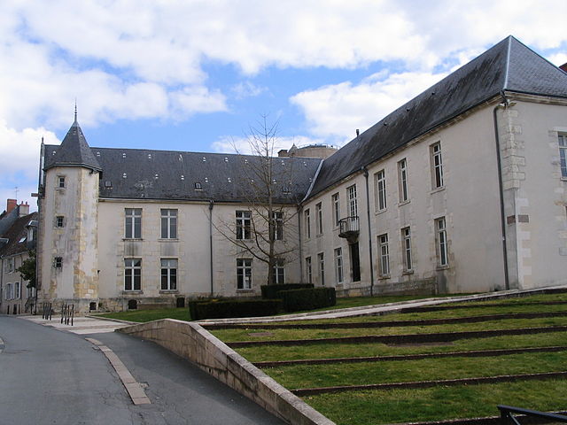

Issoudun
- commune in Indre, France
- Country:
- Postal Code: 36100
- Coordinates: 46° 56' 53" N, 1° 59' 36" E
- GPS tracks (wikiloc): [Link]
- AboveSeaLevel: 129 м m
- Area: 36.6 sq km
- Population: 12029
- Web site: [Link]


Neuvy-Pailloux
- commune in Indre, France
- Country:
- Postal Code: 36100
- Coordinates: 46° 53' 10" N, 1° 51' 37" E
- GPS tracks (wikiloc): [Link]
- Area: 41.81 sq km
- Population: 1223


Brives
- commune in Indre, France
- Country:
- Postal Code: 36100
- Coordinates: 46° 50' 39" N, 1° 56' 50" E
- GPS tracks (wikiloc): [Link]
- Area: 19.61 sq km
- Population: 266


Sainte-Fauste
- commune in Indre, France
- Country:
- Postal Code: 36100
- Coordinates: 46° 51' 26" N, 1° 51' 55" E
- GPS tracks (wikiloc): [Link]
- Area: 23.07 sq km
- Population: 276
- Web site: [Link]