canton of Montrésor (canton de Montrésor)
- canton of France (until March 2015)
- Country:

- Capital: Montrésor
- Coordinates: 47° 9' 24" N, 1° 12' 6" E


- GPS tracks (wikiloc): [Link]
- Wikidata storage: Wikidata: Q947725
- INSEE canton code: [3715]
Includes regions:


Chemillé-sur-Indrois
- commune in Indre-et-Loire, France
- Country:
- Postal Code: 37460
- Coordinates: 47° 9' 40" N, 1° 9' 57" E
- GPS tracks (wikiloc): [Link]
- Area: 24.87 sq km
- Population: 209
- Web site: [Link]

Beaumont-Village
- commune in Indre-et-Loire, France
- Country:
- Postal Code: 37460
- Coordinates: 47° 10' 39" N, 1° 12' 22" E
- GPS tracks (wikiloc): [Link]
- Area: 19.25 sq km
- Population: 282


Le Liège
- commune in Indre-et-Loire, France
- Country:
- Postal Code: 37460
- Coordinates: 47° 13' 43" N, 1° 6' 13" E
- GPS tracks (wikiloc): [Link]
- Area: 11.15 sq km
- Population: 362
- Web site: [Link]


Villeloin-Coulangé
- commune in Indre-et-Loire, France
- Country:
- Postal Code: 37460
- Coordinates: 47° 8' 26" N, 1° 13' 23" E
- GPS tracks (wikiloc): [Link]
- Area: 34.62 sq km
- Population: 631


Orbigny
- commune in Indre-et-Loire, France
- Country:
- Postal Code: 37460
- Coordinates: 47° 12' 37" N, 1° 14' 0" E
- GPS tracks (wikiloc): [Link]
- Area: 65.88 sq km
- Population: 764
- Web site: [Link]


Nouans-les-Fontaines
- commune in Indre-et-Loire, France
- Country:
- Postal Code: 37460
- Coordinates: 47° 8' 10" N, 1° 17' 54" E
- GPS tracks (wikiloc): [Link]
- Area: 63.31 sq km
- Population: 770


Montrésor
- commune in Indre-et-Loire, France
- Country:
- Postal Code: 37460
- Coordinates: 47° 9' 21" N, 1° 12' 3" E
- GPS tracks (wikiloc): [Link]
- Area: 0.98 sq km
- Population: 351
- Web site: [Link]


Loché-sur-Indrois
- commune in Indre-et-Loire, France
- Country:
- Postal Code: 37460
- Coordinates: 47° 5' 32" N, 1° 13' 9" E
- GPS tracks (wikiloc): [Link]
- Area: 74.13 sq km
- Population: 561

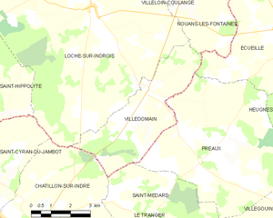
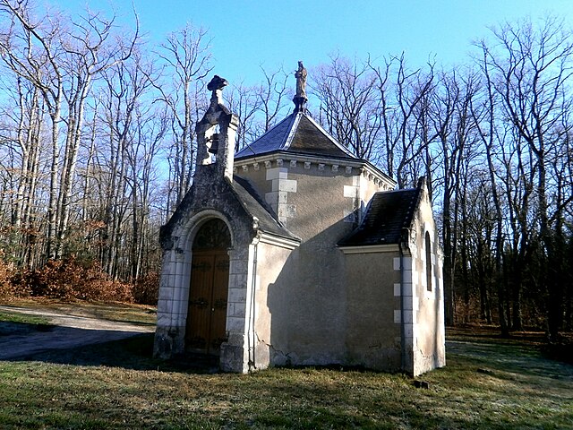
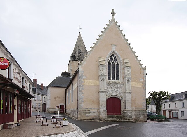
Villedômain
- commune in Indre-et-Loire, France
- Country:
- Postal Code: 37110
- Coordinates: 47° 3' 10" N, 1° 15' 21" E
- GPS tracks (wikiloc): [Link]
- Area: 16.47 sq km
- Population: 118
- Web site: [Link]

Genillé
- commune in Indre-et-Loire, France
- Country:
- Postal Code: 37460
- Coordinates: 47° 11' 8" N, 1° 5' 43" E
- GPS tracks (wikiloc): [Link]
- Area: 63.12 sq km
- Population: 1534
- Web site: [Link]