Loché-sur-Indrois (Loché-sur-Indrois)

- commune in Indre-et-Loire, France
- Country:

- Postal Code: 37460
- Coordinates: 47° 5' 32" N, 1° 13' 9" E


- GPS tracks (wikiloc): [Link]
- Area: 74.13 sq km
- Population: 561
- Wikipedia en: wiki(en)
- Wikipedia: wiki(fr)
- Wikidata storage: Wikidata: Q727795
- Wikipedia Commons Category: [Link]
- Freebase ID: [/m/03nvd_d]
- GeoNames ID: Alt: [6433039]
- SIREN number: [213701337]
- BnF ID: [15257684f]
- PACTOLS thesaurus ID: [pcrtfzEIng4HEB]
- INSEE municipality code: 37133
Shares border with regions:


Chemillé-sur-Indrois
- commune in Indre-et-Loire, France
- Country:
- Postal Code: 37460
- Coordinates: 47° 9' 40" N, 1° 9' 57" E
- GPS tracks (wikiloc): [Link]
- Area: 24.87 sq km
- Population: 209
- Web site: [Link]


Sennevières
- commune in Indre-et-Loire, France
- Country:
- Postal Code: 37600
- Coordinates: 47° 6' 22" N, 1° 6' 7" E
- GPS tracks (wikiloc): [Link]
- Area: 23.54 sq km
- Population: 213
Saint-Cyran-du-Jambot
- commune in Indre, France
- Country:
- Postal Code: 36700
- Coordinates: 47° 0' 59" N, 1° 8' 24" E
- GPS tracks (wikiloc): [Link]
- Area: 14.21 sq km
- Population: 225


Villeloin-Coulangé
- commune in Indre-et-Loire, France
- Country:
- Postal Code: 37460
- Coordinates: 47° 8' 26" N, 1° 13' 23" E
- GPS tracks (wikiloc): [Link]
- Area: 34.62 sq km
- Population: 631


Saint-Hippolyte
- commune in Indre-et-Loire, France
- Country:
- Postal Code: 37600
- Coordinates: 47° 3' 36" N, 1° 6' 0" E
- GPS tracks (wikiloc): [Link]
- Area: 32.99 sq km
- Population: 635


Nouans-les-Fontaines
- commune in Indre-et-Loire, France
- Country:
- Postal Code: 37460
- Coordinates: 47° 8' 10" N, 1° 17' 54" E
- GPS tracks (wikiloc): [Link]
- Area: 63.31 sq km
- Population: 770


Châtillon-sur-Indre
- commune in Indre, France
- Country:
- Postal Code: 36700
- Coordinates: 46° 59' 16" N, 1° 10' 25" E
- GPS tracks (wikiloc): [Link]
- Area: 45.3 sq km
- Population: 2681
- Web site: [Link]

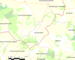
Villedômain
- commune in Indre-et-Loire, France
- Country:
- Postal Code: 37110
- Coordinates: 47° 3' 10" N, 1° 15' 21" E
- GPS tracks (wikiloc): [Link]
- Area: 16.47 sq km
- Population: 118
- Web site: [Link]