canton of Morée (canton de Morée)
- canton of France (until March 2015)
- Country:

- Capital: Morée
- Coordinates: 47° 53' 40" N, 1° 9' 27" E


- GPS tracks (wikiloc): [Link]
- Wikidata storage: Wikidata: Q388468
- INSEE canton code: [4114]
Includes regions:


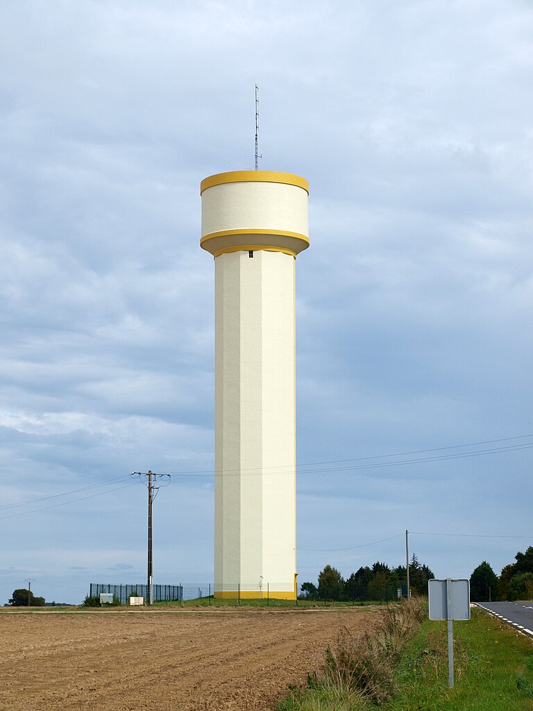
Brévainville
- commune in Loir-et-Cher, France
- Country:
- Postal Code: 41160
- Coordinates: 47° 57' 10" N, 1° 17' 4" E
- GPS tracks (wikiloc): [Link]
- Area: 16.16 sq km
- Population: 169


Busloup
- commune in Loir-et-Cher, France
- Country:
- Postal Code: 41160
- Coordinates: 47° 53' 36" N, 1° 7' 55" E
- GPS tracks (wikiloc): [Link]
- Area: 18.94 sq km
- Population: 431

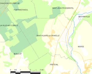
Saint-Hilaire-la-Gravelle
- commune in Loir-et-Cher, France
- Country:
- Postal Code: 41160
- Coordinates: 47° 55' 28" N, 1° 12' 24" E
- GPS tracks (wikiloc): [Link]
- Area: 17.57 sq km
- Population: 716


Saint-Jean-Froidmentel
- commune in Loir-et-Cher, France
- Country:
- Postal Code: 41160
- Coordinates: 47° 57' 24" N, 1° 14' 23" E
- GPS tracks (wikiloc): [Link]
- Area: 17.2 sq km
- Population: 529


Pezou
- commune in Loir-et-Cher, France
- Country:
- Postal Code: 41100
- Coordinates: 47° 51' 58" N, 1° 8' 34" E
- GPS tracks (wikiloc): [Link]
- Area: 13.97 sq km
- Population: 1101
Rahart
- commune in Loir-et-Cher, France
- Country:
- Postal Code: 41160
- Coordinates: 47° 52' 12" N, 1° 4' 3" E
- GPS tracks (wikiloc): [Link]
- Area: 14.23 sq km
- Population: 313


Lignières
- commune in Loir-et-Cher, France
- Country:
- Postal Code: 41160
- Coordinates: 47° 51' 55" N, 1° 10' 59" E
- GPS tracks (wikiloc): [Link]
- Area: 15.77 sq km
- Population: 389
Saint-Firmin-des-Prés
- commune in Loir-et-Cher, France
- Country:
- Postal Code: 41100
- Coordinates: 47° 50' 32" N, 1° 6' 49" E
- GPS tracks (wikiloc): [Link]
- Area: 13.89 sq km
- Population: 843


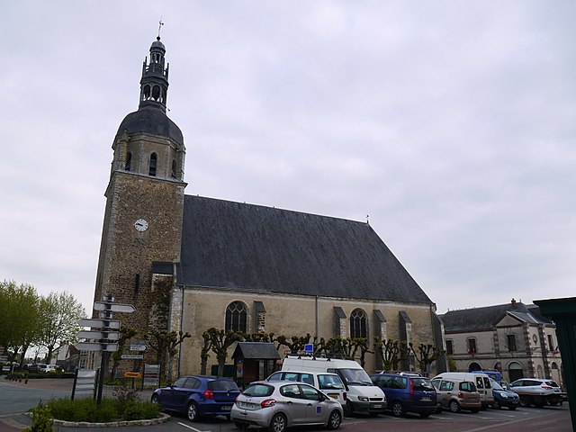
Morée
- commune in Loir-et-Cher, France
- Country:
- Postal Code: 41160
- Coordinates: 47° 54' 11" N, 1° 14' 4" E
- GPS tracks (wikiloc): [Link]
- Area: 25.83 sq km
- Population: 1080

Danzé
- commune in Loir-et-Cher, France
- Country:
- Postal Code: 41160
- Coordinates: 47° 53' 35" N, 1° 1' 40" E
- GPS tracks (wikiloc): [Link]
- Area: 42.26 sq km
- Population: 705
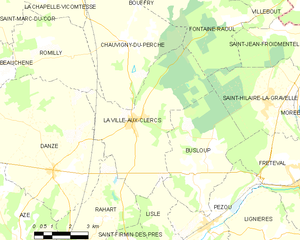
La Ville-aux-Clercs
- commune in Loir-et-Cher, France
- Country:
- Postal Code: 41160
- Coordinates: 47° 55' 6" N, 1° 5' 6" E
- GPS tracks (wikiloc): [Link]
- Area: 26.61 sq km
- Population: 1299


Fréteval
- commune in Loir-et-Cher, France
- Country:
- Postal Code: 41160
- Coordinates: 47° 53' 17" N, 1° 12' 35" E
- GPS tracks (wikiloc): [Link]
- Area: 20.49 sq km
- Population: 1119
Lisle
- commune in Loir-et-Cher, France
- Country:
- Postal Code: 41100
- Coordinates: 47° 51' 11" N, 1° 6' 58" E
- GPS tracks (wikiloc): [Link]
- Area: 6.61 sq km
- Population: 197