canton of Pompey (canton de Pompey)
- canton of France
- Country:

- Capital: Pompey
- Coordinates: 48° 45' 37" N, 6° 7' 18" E


- GPS tracks (wikiloc): [Link]
- Wikidata storage: Wikidata: Q1726762
- Library of Congress authority ID: Alt: [n2012061506]
- INSEE canton code: [5434]
Includes regions:
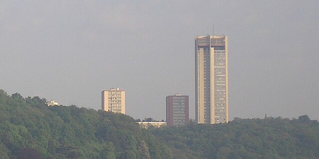
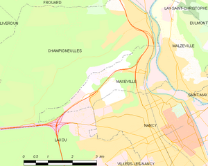
Maxéville
- commune in Meurthe-et-Moselle, France
- Country:
- Postal Code: 54320
- Coordinates: 48° 42' 41" N, 6° 9' 47" E
- GPS tracks (wikiloc): [Link]
- AboveSeaLevel: 365 м m
- Area: 5.63 sq km
- Population: 10091
- Web site: [Link]


Frouard
- commune in Meurthe-et-Moselle, France
- Country:
- Postal Code: 54390
- Coordinates: 48° 45' 38" N, 6° 7' 44" E
- GPS tracks (wikiloc): [Link]
- Area: 12.96 sq km
- Population: 6638
- Web site: [Link]


Marbache
- commune in Meurthe-et-Moselle, France
- Country:
- Postal Code: 54820
- Coordinates: 48° 47' 50" N, 6° 6' 8" E
- GPS tracks (wikiloc): [Link]
- Area: 10.63 sq km
- Population: 1724
- Web site: [Link]

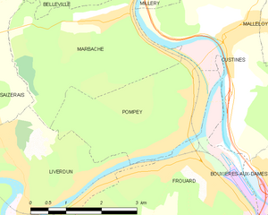
Pompey
- commune in Meurthe-et-Moselle, France
- Country:
- Postal Code: 54340
- Coordinates: 48° 46' 5" N, 6° 7' 39" E
- GPS tracks (wikiloc): [Link]
- Area: 8.13 sq km
- Population: 4878


Champigneulles
- commune in Meurthe-et-Moselle, France
- Country:
- Postal Code: 54250
- Coordinates: 48° 44' 1" N, 6° 9' 52" E
- GPS tracks (wikiloc): [Link]
- Area: 23.99 sq km
- Population: 6808
- Web site: [Link]

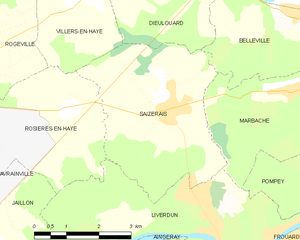
Saizerais
- commune in Meurthe-et-Moselle, France
- Country:
- Postal Code: 54380
- Coordinates: 48° 47' 25" N, 6° 2' 39" E
- GPS tracks (wikiloc): [Link]
- Area: 14.44 sq km
- Population: 1548