Frouard (Frouard)

- commune in Meurthe-et-Moselle, France
- Country:

- Postal Code: 54390
- Coordinates: 48° 45' 38" N, 6° 7' 44" E


- GPS tracks (wikiloc): [Link]
- Area: 12.96 sq km
- Population: 6638
- Web site: http://www.frouard.fr
- Wikipedia en: wiki(en)
- Wikipedia: wiki(fr)
- Wikidata storage: Wikidata: Q195098
- Wikipedia Commons Category: [Link]
- Freebase ID: [/m/03qdhk_]
- Freebase ID: [/m/03qdhk_]
- GeoNames ID: Alt: [3016944]
- GeoNames ID: Alt: [3016944]
- SIREN number: [215402157]
- SIREN number: [215402157]
- BnF ID: [15264284t]
- BnF ID: [15264284t]
- VIAF ID: Alt: [233861070]
- VIAF ID: Alt: [233861070]
- GND ID: Alt: [4386752-2]
- GND ID: Alt: [4386752-2]
- PACTOLS thesaurus ID: [pcrtHXVnkVEFsK]
- PACTOLS thesaurus ID: [pcrtHXVnkVEFsK]
- WOEID: [592225]
- WOEID: [592225]
- INSEE municipality code: 54215
- INSEE municipality code: 54215
Shares border with regions:

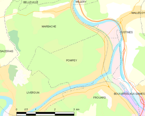
Pompey
- commune in Meurthe-et-Moselle, France
- Country:
- Postal Code: 54340
- Coordinates: 48° 46' 5" N, 6° 7' 39" E
- GPS tracks (wikiloc): [Link]
- Area: 8.13 sq km
- Population: 4878


Champigneulles
- commune in Meurthe-et-Moselle, France
- Country:
- Postal Code: 54250
- Coordinates: 48° 44' 1" N, 6° 9' 52" E
- GPS tracks (wikiloc): [Link]
- Area: 23.99 sq km
- Population: 6808
- Web site: [Link]


Custines
- commune in Meurthe-et-Moselle, France
- Country:
- Postal Code: 54670
- Coordinates: 48° 47' 31" N, 6° 8' 33" E
- GPS tracks (wikiloc): [Link]
- Area: 11.76 sq km
- Population: 2930


Bouxières-aux-Dames
- commune in Meurthe-et-Moselle, France
- Country:
- Postal Code: 54136
- Coordinates: 48° 45' 7" N, 6° 9' 47" E
- GPS tracks (wikiloc): [Link]
- Area: 4.11 sq km
- Population: 4189
- Web site: [Link]

Liverdun
- commune in Meurthe-et-Moselle, France
- Country:
- Postal Code: 54460
- Coordinates: 48° 45' 1" N, 6° 3' 43" E
- GPS tracks (wikiloc): [Link]
- Area: 25.23 sq km
- Population: 6033
- Web site: [Link]