canton of Thiaucourt-Regniéville (canton de Thiaucourt-Regniéville)
- canton of France
- Country:

- Capital: Thiaucourt-Regniéville
- Coordinates: 48° 55' 39" N, 5° 54' 42" E


- GPS tracks (wikiloc): [Link]
- Wikidata storage: Wikidata: Q1727584
- INSEE canton code: [5426]
Includes regions:


Euvezin
- commune in Meurthe-et-Moselle, France
- Country:
- Postal Code: 54470
- Coordinates: 48° 55' 26" N, 5° 50' 17" E
- GPS tracks (wikiloc): [Link]
- Area: 11.28 sq km
- Population: 102

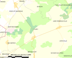
Flirey
- commune in Meurthe-et-Moselle, France
- Country:
- Postal Code: 54470
- Coordinates: 48° 52' 32" N, 5° 50' 51" E
- GPS tracks (wikiloc): [Link]
- Area: 15.77 sq km
- Population: 150


Pannes
- commune in Meurthe-et-Moselle, France
- Country:
- Postal Code: 54470
- Coordinates: 48° 55' 59" N, 5° 48' 9" E
- GPS tracks (wikiloc): [Link]
- Area: 8.37 sq km
- Population: 166
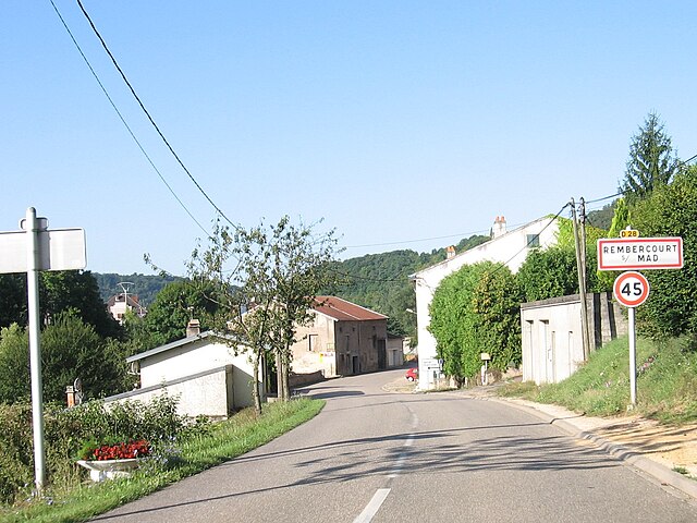

Rembercourt-sur-Mad
- commune in Meurthe-et-Moselle, France
- Country:
- Postal Code: 54470
- Coordinates: 48° 59' 14" N, 5° 54' 11" E
- GPS tracks (wikiloc): [Link]
- Area: 5.04 sq km
- Population: 161

Seicheprey
- commune in Meurthe-et-Moselle, France
- Country:
- Postal Code: 54470
- Coordinates: 48° 52' 12" N, 5° 47' 28" E
- GPS tracks (wikiloc): [Link]
- Area: 8.35 sq km
- Population: 115


Vandelainville
- commune in Meurthe-et-Moselle, France
- Country:
- Postal Code: 54890
- Coordinates: 49° 1' 1" N, 5° 58' 35" E
- GPS tracks (wikiloc): [Link]
- AboveSeaLevel: 195 м m
- Area: 1.36 sq km
- Population: 136


Vilcey-sur-Trey
- commune in Meurthe-et-Moselle, France
- Country:
- Postal Code: 54700
- Coordinates: 48° 56' 2" N, 5° 58' 26" E
- GPS tracks (wikiloc): [Link]
- Area: 13.17 sq km
- Population: 161


Xammes
- commune in Meurthe-et-Moselle, France
- Country:
- Postal Code: 54470
- Coordinates: 48° 58' 29" N, 5° 51' 16" E
- GPS tracks (wikiloc): [Link]
- Area: 8.16 sq km
- Population: 146


Jaulny
- commune in Meurthe-et-Moselle, France
- Country:
- Postal Code: 54470
- Coordinates: 48° 58' 15" N, 5° 53' 13" E
- GPS tracks (wikiloc): [Link]
- AboveSeaLevel: 200 м m
- Area: 8.25 sq km
- Population: 218


Lironville
- commune in Meurthe-et-Moselle, France
- Country:
- Postal Code: 54470
- Coordinates: 48° 52' 6" N, 5° 54' 27" E
- GPS tracks (wikiloc): [Link]
- Area: 8.99 sq km
- Population: 127


Bouillonville
- commune in Meurthe-et-Moselle, France
- Country:
- Postal Code: 54470
- Coordinates: 48° 56' 41" N, 5° 50' 32" E
- GPS tracks (wikiloc): [Link]
- Area: 5.32 sq km
- Population: 147

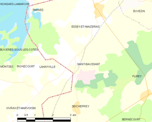
Saint-Baussant
- commune in Meurthe-et-Moselle, France
- Country:
- Postal Code: 54470
- Coordinates: 48° 53' 33" N, 5° 47' 32" E
- GPS tracks (wikiloc): [Link]
- Area: 8.92 sq km
- Population: 74


Arnaville
- commune in Meurthe-et-Moselle, France
- Country:
- Postal Code: 54530
- Coordinates: 49° 0' 41" N, 6° 1' 50" E
- GPS tracks (wikiloc): [Link]
- Area: 5.22 sq km
- Population: 568
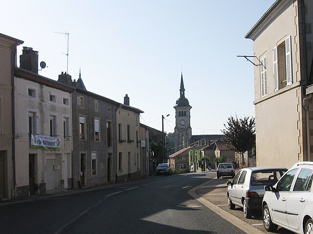

Thiaucourt-Regniéville
- commune in Meurthe-et-Moselle, France
- Country:
- Postal Code: 54470
- Coordinates: 48° 57' 15" N, 5° 51' 58" E
- GPS tracks (wikiloc): [Link]
- AboveSeaLevel: 215 м m
- Area: 19.01 sq km
- Population: 1174

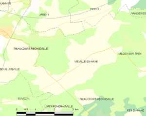
Viéville-en-Haye
- commune in Meurthe-et-Moselle, France
- Country:
- Postal Code: 54470
- Coordinates: 48° 56' 34" N, 5° 55' 36" E
- GPS tracks (wikiloc): [Link]
- Area: 8.54 sq km
- Population: 153


Limey-Remenauville
- commune in Meurthe-et-Moselle, France
- Country:
- Postal Code: 54470
- Coordinates: 48° 53' 11" N, 5° 53' 43" E
- GPS tracks (wikiloc): [Link]
- AboveSeaLevel: 295 м m
- Area: 18.33 sq km
- Population: 269


Bayonville-sur-Mad
- commune in Meurthe-et-Moselle, France
- Country:
- Postal Code: 54890
- Coordinates: 49° 0' 53" N, 5° 59' 24" E
- GPS tracks (wikiloc): [Link]
- Area: 9.39 sq km
- Population: 306
- Web site: [Link]


Charey
- commune in Meurthe-et-Moselle, France
- Country:
- Postal Code: 54470
- Coordinates: 49° 0' 6" N, 5° 52' 48" E
- GPS tracks (wikiloc): [Link]
- Area: 9.31 sq km
- Population: 75