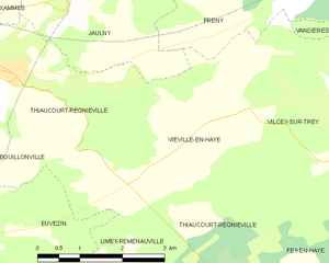
Thiaucourt-Regniéville (Thiaucourt-Regniéville)
- commune in Meurthe-et-Moselle, France
- Country:

- Postal Code: 54470
- Coordinates: 48° 57' 15" N, 5° 51' 58" E


- GPS tracks (wikiloc): [Link]
- AboveSeaLevel: 215 м m
- Area: 19.01 sq km
- Population: 1174
- Wikipedia en: wiki(en)
- Wikipedia: wiki(fr)
- Wikidata storage: Wikidata: Q497719
- Wikipedia Commons Category: [Link]
- Freebase ID: [/m/03qdnbr]
- Freebase ID: [/m/03qdnbr]
- GeoNames ID: Alt: [2972886]
- GeoNames ID: Alt: [2972886]
- SIREN number: [215405184]
- SIREN number: [215405184]
- BnF ID: [152645850]
- BnF ID: [152645850]
- VIAF ID: Alt: [138522234]
- VIAF ID: Alt: [138522234]
- Library of Congress authority ID: Alt: [n93002900]
- Library of Congress authority ID: Alt: [n93002900]
- PACTOLS thesaurus ID: [pcrtG8OPAb3eqH]
- PACTOLS thesaurus ID: [pcrtG8OPAb3eqH]
- INSEE municipality code: 54518
- INSEE municipality code: 54518
Shares border with regions:


Euvezin
- commune in Meurthe-et-Moselle, France
- Country:

- Postal Code: 54470
- Coordinates: 48° 55' 26" N, 5° 50' 17" E


- GPS tracks (wikiloc): [Link]
- Area: 11.28 sq km
- Population: 102


Fey-en-Haye
- commune in Meurthe-et-Moselle, France
- Country:

- Postal Code: 54470
- Coordinates: 48° 54' 10" N, 5° 57' 42" E


- GPS tracks (wikiloc): [Link]
- Area: 7.05 sq km
- Population: 78


Vilcey-sur-Trey
- commune in Meurthe-et-Moselle, France
- Country:

- Postal Code: 54700
- Coordinates: 48° 56' 2" N, 5° 58' 26" E


- GPS tracks (wikiloc): [Link]
- Area: 13.17 sq km
- Population: 161


Xammes
- commune in Meurthe-et-Moselle, France
- Country:

- Postal Code: 54470
- Coordinates: 48° 58' 29" N, 5° 51' 16" E


- GPS tracks (wikiloc): [Link]
- Area: 8.16 sq km
- Population: 146


Jaulny
- commune in Meurthe-et-Moselle, France
- Country:

- Postal Code: 54470
- Coordinates: 48° 58' 15" N, 5° 53' 13" E


- GPS tracks (wikiloc): [Link]
- AboveSeaLevel: 200 м m
- Area: 8.25 sq km
- Population: 218


Beney-en-Woëvre
- commune in Meuse, France
- Country:

- Postal Code: 55210
- Coordinates: 48° 57' 44" N, 5° 49' 32" E


- GPS tracks (wikiloc): [Link]
- Area: 17.2 sq km
- Population: 139


Bouillonville
- commune in Meurthe-et-Moselle, France
- Country:

- Postal Code: 54470
- Coordinates: 48° 56' 41" N, 5° 50' 32" E


- GPS tracks (wikiloc): [Link]
- Area: 5.32 sq km
- Population: 147


Viéville-en-Haye
- commune in Meurthe-et-Moselle, France
- Country:

- Postal Code: 54470
- Coordinates: 48° 56' 34" N, 5° 55' 36" E


- GPS tracks (wikiloc): [Link]
- Area: 8.54 sq km
- Population: 153


Limey-Remenauville
- commune in Meurthe-et-Moselle, France
- Country:

- Postal Code: 54470
- Coordinates: 48° 53' 11" N, 5° 53' 43" E


- GPS tracks (wikiloc): [Link]
- AboveSeaLevel: 295 м m
- Area: 18.33 sq km
- Population: 269
