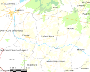
canton of Le Châtelet (canton du Châtelet)
- canton of France (until March 2015)
- Country:

- Capital: Le Châtelet
- Coordinates: 46° 38' 33" N, 2° 17' 2" E


- GPS tracks (wikiloc): [Link]
- Wikipedia en: wiki(en)
- Wikipedia: wiki(fr)
- Wikidata storage: Wikidata: Q1617376
- Freebase ID: [/m/05synpw]
- INSEE canton code: [1811]
Includes regions:


Le Châtelet
- commune in Cher, France
- Country:
- Postal Code: 18170
- Coordinates: 46° 38' 30" N, 2° 16' 59" E
- GPS tracks (wikiloc): [Link]
- Area: 32.8 sq km
- Population: 1041


Ardenais
- commune in Cher, France
- Country:
- Postal Code: 18170
- Coordinates: 46° 38' 50" N, 2° 21' 33" E
- GPS tracks (wikiloc): [Link]
- Area: 17.55 sq km
- Population: 207


Saint-Pierre-les-Bois
- commune in Cher, France
- Country:
- Postal Code: 18170
- Coordinates: 46° 39' 52" N, 2° 16' 44" E
- GPS tracks (wikiloc): [Link]
- Area: 20.38 sq km
- Population: 296


Morlac
- commune in Cher, France
- Country:
- Postal Code: 18170
- Coordinates: 46° 43' 9" N, 2° 18' 30" E
- GPS tracks (wikiloc): [Link]
- Area: 32.38 sq km
- Population: 328


Maisonnais
- commune in Cher, France
- Country:
- Postal Code: 18170
- Coordinates: 46° 38' 24" N, 2° 12' 56" E
- GPS tracks (wikiloc): [Link]
- Area: 26.95 sq km
- Population: 238

Ids-Saint-Roch
- commune in Cher, France
- Country:
- Postal Code: 18170
- Coordinates: 46° 42' 26" N, 2° 14' 27" E
- GPS tracks (wikiloc): [Link]
- Area: 27.83 sq km
- Population: 315

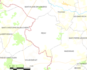
Rezay
- commune in Cher, France
- Country:
- Postal Code: 18170
- Coordinates: 46° 40' 22" N, 2° 10' 43" E
- GPS tracks (wikiloc): [Link]
- Area: 21.26 sq km
- Population: 227
- Web site: [Link]