canton of Loches (canton de Loches)

- canton of France
- Country:

- Capital: Loches
- Coordinates: 47° 8' 33" N, 0° 59' 16" E


- GPS tracks (wikiloc): [Link]
- Population: 25525
- Wikipedia en: wiki(en)
- Wikipedia: wiki(fr)
- Wikidata storage: Wikidata: Q1189428
- INSEE canton code: [3709]
Includes regions:

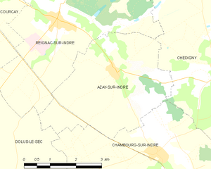
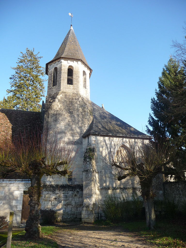
Azay-sur-Indre
- commune in Indre-et-Loire, France
- Country:
- Postal Code: 37310
- Coordinates: 47° 12' 32" N, 0° 56' 43" E
- GPS tracks (wikiloc): [Link]
- Area: 13.89 sq km
- Population: 383


Dolus-le-Sec
- commune in Indre-et-Loire, France
- Country:
- Postal Code: 37310
- Coordinates: 47° 9' 53" N, 0° 53' 34" E
- GPS tracks (wikiloc): [Link]
- Area: 27.27 sq km
- Population: 668


Chédigny
- commune in Indre-et-Loire, France
- Country:
- Postal Code: 37310
- Coordinates: 47° 12' 36" N, 0° 59' 58" E
- GPS tracks (wikiloc): [Link]
- Area: 23.17 sq km
- Population: 567
- Web site: [Link]


Beaulieu-lès-Loches
- commune in Indre-et-Loire, France
- Country:
- Postal Code: 37600
- Coordinates: 47° 7' 43" N, 1° 0' 55" E
- GPS tracks (wikiloc): [Link]
- Area: 3.88 sq km
- Population: 1797
- Web site: [Link]
Chanceaux-près-Loches
- commune in Indre-et-Loire, France
- Country:
- Postal Code: 37600
- Coordinates: 47° 8' 49" N, 0° 56' 17" E
- GPS tracks (wikiloc): [Link]
- Area: 14.58 sq km
- Population: 136


Sennevières
- commune in Indre-et-Loire, France
- Country:
- Postal Code: 37600
- Coordinates: 47° 6' 22" N, 1° 6' 7" E
- GPS tracks (wikiloc): [Link]
- Area: 23.54 sq km
- Population: 213

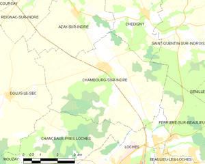
Chambourg-sur-Indre
- commune in Indre-et-Loire, France
- Country:
- Postal Code: 37310
- Coordinates: 47° 10' 53" N, 0° 58' 2" E
- GPS tracks (wikiloc): [Link]
- Area: 28.39 sq km
- Population: 1371


Verneuil-sur-Indre
- commune in Indre-et-Loire, France
- Country:
- Postal Code: 37600
- Coordinates: 47° 3' 22" N, 1° 2' 31" E
- GPS tracks (wikiloc): [Link]
- Area: 39.63 sq km
- Population: 492


Tauxigny
- former commune in Indre-et-Loire, France
- Country:
- Postal Code: 37310
- Coordinates: 47° 12' 50" N, 0° 50' 4" E
- GPS tracks (wikiloc): [Link]
- Area: 36.83 sq km
- Population: 1403
- Web site: [Link]


Ferrière-sur-Beaulieu
- commune in Indre-et-Loire, France
- Country:
- Postal Code: 37600
- Coordinates: 47° 8' 16" N, 1° 2' 15" E
- GPS tracks (wikiloc): [Link]
- Area: 19.63 sq km
- Population: 738
- Web site: [Link]


Saint-Bauld
- former commune in Indre-et-Loire, France
- Country:
- Postal Code: 37310
- Coordinates: 47° 10' 48" N, 0° 50' 14" E
- GPS tracks (wikiloc): [Link]
- Area: 4.11 sq km
- Population: 196


Perrusson
- commune in Indre-et-Loire, France
- Country:
- Postal Code: 37600
- Coordinates: 47° 6' 0" N, 1° 0' 47" E
- GPS tracks (wikiloc): [Link]
- Area: 28.94 sq km
- Population: 1521
- Web site: [Link]


Saint-Hippolyte
- commune in Indre-et-Loire, France
- Country:
- Postal Code: 37600
- Coordinates: 47° 3' 36" N, 1° 6' 0" E
- GPS tracks (wikiloc): [Link]
- Area: 32.99 sq km
- Population: 635

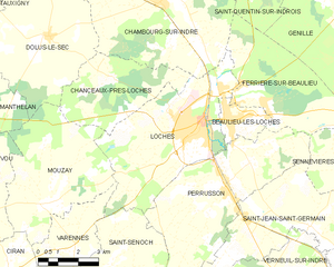
Loches
- commune in Indre-et-Loire, France
- Country:
- Postal Code: 37600
- Coordinates: 47° 7' 43" N, 0° 59' 43" E
- GPS tracks (wikiloc): [Link]
- AboveSeaLevel: 64 м m
- Area: 27.06 sq km
- Population: 6299
- Web site: [Link]

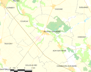
Reignac-sur-Indre
- commune in Indre-et-Loire, France
- Country:
- Postal Code: 37310
- Coordinates: 47° 13' 56" N, 0° 55' 0" E
- GPS tracks (wikiloc): [Link]
- Area: 22.44 sq km
- Population: 1183
- Web site: [Link]

Saint-Jean-Saint-Germain
- commune in Indre-et-Loire, France
- Country:
- Postal Code: 37600
- Coordinates: 47° 4' 58" N, 1° 2' 6" E
- GPS tracks (wikiloc): [Link]
- Area: 21.34 sq km
- Population: 751


Saint-Quentin-sur-Indrois
- commune in Indre-et-Loire, France
- Country:
- Postal Code: 37310
- Coordinates: 47° 12' 13" N, 1° 1' 25" E
- GPS tracks (wikiloc): [Link]
- Area: 27.23 sq km
- Population: 511

Bridoré
- commune in Indre-et-Loire, France
- Country:
- Postal Code: 37600
- Coordinates: 47° 1' 37" N, 1° 4' 57" E
- GPS tracks (wikiloc): [Link]
- Area: 14.54 sq km
- Population: 531