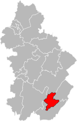
canton of Saint-Claude (canton de Saint-Claude)
- canton of France
 Hiking in canton of Saint-Claude
The Canton of Saint-Claude in the Jura region of France is a stunning area known for its picturesque landscapes, rich biodiversity, and outdoor recreational opportunities, making it a fantastic destination for hiking enthusiasts.
Highlights of Hiking in the Canton of Saint-Claude:
-
Scenic Landscapes: The area offers a mix of dense forests, rolling hills, rugged cliffs, and beautiful valleys. The Jura Mountains are characterized by limestone formations and stunning panoramic views.
-
Varied Trails: There are numerous hiking trails catering to all levels, from easy walks suitable for families to challenging treks for experienced hikers. Popular routes often include scenic overlooks and historical sites.
-
Natural Attractions: The region boasts natural wonders such as the Cascades du Hérisson, stunning waterfalls that can be accessed via well-marked trails. The Haut-Jura Regional Nature Park is also nearby, providing ample opportunities for exploration.
-
Flora and Fauna: Hiking in the Jura Mountains allows you to experience rich biodiversity, including various plant species and wildlife such as chamois, deer, and numerous bird species.
-
Cultural Experiences: Along the trails, hikers can discover charming villages, traditional Jura architecture, and local artisans. Don’t miss the opportunity to sample local cheeses and wines.
-
Weather Considerations: The Jura region can have variable weather conditions, especially in spring and fall. It's important to check the weather forecast and be prepared with appropriate gear, including water-resistant clothing and sturdy footwear.
Tips for Hiking in Saint-Claude:
- Trail Maps: Obtain detailed trail maps from local tourist information centers or hiking associations in the region.
- Local Guidance: Consider joining guided hikes, particularly if you're unfamiliar with the area or want to learn more about its natural history.
- Safety First: Always notify someone of your hiking plans, carry enough water and snacks, and have a first aid kit on hand.
- Respect Nature: Follow local regulations to protect the environment and wildlife, and always practice Leave No Trace principles.
Recommended Trails:
- Sentier des Vergers: A gentle trail perfect for families, offering lovely views and opportunities to explore local orchards.
- Grand Jura Trail: A multi-day trek that traverses various landscapes, offering a taste of the full beauty of the Jura Mountains.
- Les Rousses to the Hauts de Bienne: A moderately challenging hike with beautiful vistas, suitable for those looking to explore more rugged terrain.
Whether you're an avid hiker or just looking for a scenic walk, the Canton of Saint-Claude has something to offer for everyone. Happy hiking!
- Country:

- Capital: Saint-Claude
- Coordinates: 46° 23' 0" N, 5° 52' 0" E


- GPS tracks (wikiloc): [Link]
- Population: 11526
- Wikipedia en: wiki(en)
- Wikipedia: wiki(fr)
- Wikidata storage: Wikidata: Q726468
- INSEE canton code: [3914]
Includes regions:

Saint-Claude
- commune in Jura, France
Saint-Claude, located in the Jura region of France, is a fantastic destination for hiking enthusiasts. Nestled in the mountains, it offers a variety of trails that cater to different skill levels, from leisurely walks to challenging treks. Here are some highlights about hiking in Saint-Claude:...
- Country:

- Postal Code: 39200
- Coordinates: 46° 23' 14" N, 5° 51' 48" E


- GPS tracks (wikiloc): [Link]
- Area: 70.19 sq km
- Population: 9732
- Web site: [Link]
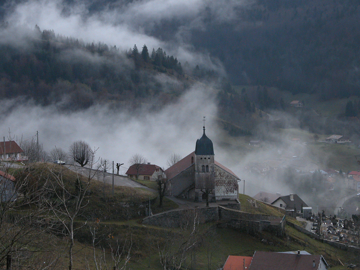

Septmoncel
- former commune in Jura, France
Septmoncel is a picturesque village located in the Jura Mountains of France, known for its beautiful natural landscapes and various outdoor activities, including hiking. Here are some key points to consider if you're planning a hiking trip in Septmoncel:...
- Country:

- Postal Code: 39310
- Coordinates: 46° 22' 14" N, 5° 54' 47" E


- GPS tracks (wikiloc): [Link]
- Area: 19.4 sq km
- Population: 683


Molinges
- commune in Jura, France
Molinges is located in the Jura region of France, known for its stunning natural landscapes, rolling hills, and dense forests. Hiking in Molinges offers a wonderful experience for outdoor enthusiasts, with trails that cater to various skill levels and provide breathtaking views of the surrounding Jura mountains and valleys....
- Country:

- Postal Code: 39360
- Coordinates: 46° 21' 22" N, 5° 45' 55" E


- GPS tracks (wikiloc): [Link]
- Area: 2.57 sq km
- Population: 684
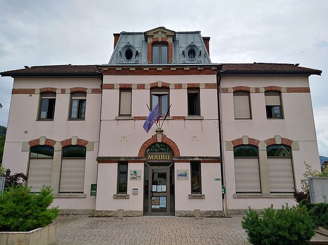

Chassal
- commune in Jura, France
Chassal, nestled in the Jura Mountains of France, is a fantastic destination for hiking enthusiasts. Known for its scenic beauty, the region offers varied terrains, from lush forests to rolling hills and stunning viewpoints....
- Country:

- Postal Code: 39360
- Coordinates: 46° 21' 30" N, 5° 47' 14" E


- GPS tracks (wikiloc): [Link]
- Area: 5.19 sq km
- Population: 443


Villard-sur-Bienne
- commune in Jura, France
Villard-sur-Bienne is a charming village located in the Jura region of France, known for its stunning landscapes, rich natural biodiversity, and picturesque hiking trails. Here are some highlights and tips for hiking in the area:...
- Country:

- Postal Code: 39200
- Coordinates: 46° 28' 30" N, 5° 53' 56" E


- GPS tracks (wikiloc): [Link]
- Area: 10.37 sq km
- Population: 183


Lamoura
- commune in Jura, France
Lamoura is a picturesque village located in the Jura Mountains of France, known for its stunning natural surroundings and excellent hiking opportunities. Here are some key points to consider when hiking in Lamoura:...
- Country:

- Postal Code: 39310
- Coordinates: 46° 23' 43" N, 5° 58' 0" E


- GPS tracks (wikiloc): [Link]
- Area: 22.28 sq km
- Population: 617


Ponthoux
- former commune in Jura, France
Ponthoux is a charming village located in the Alpes-Maritimes region of France, near the French Riviera. The surrounding area offers beautiful landscapes, featuring a mix of forests, hills, and views of the Mediterranean. Here are some key points to consider when hiking in and around Ponthoux:...
- Country:

- Postal Code: 39170
- Coordinates: 46° 23' 45" N, 5° 48' 39" E


- GPS tracks (wikiloc): [Link]
- AboveSeaLevel: 300 м m
- Area: 2.18 sq km
- Population: 75


La Rixouse
- commune in Jura, France
La Rixouse, located in the Jura region of France, is known for its stunning natural beauty and diverse terrain that offers ideal conditions for hiking. Here’s an overview of what you can expect when hiking in this area:...
- Country:

- Postal Code: 39200
- Coordinates: 46° 28' 8" N, 5° 53' 14" E


- GPS tracks (wikiloc): [Link]
- Area: 12.59 sq km
- Population: 189


Leschères
- commune in Jura, France
Leschères is a picturesque area in the Jura region of France, known for its stunning natural landscapes and hiking opportunities. When hiking in Leschères, you can expect to experience a variety of terrains and scenic views, including forests, meadows, and rocky outcrops....
- Country:

- Postal Code: 39170
- Coordinates: 46° 27' 7" N, 5° 49' 37" E


- GPS tracks (wikiloc): [Link]
- Area: 8.28 sq km
- Population: 215
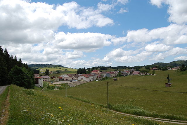

Lajoux
- commune in Jura, France
Lajoux, a charming village located in the Jura region of France, offers a picturesque setting for hiking enthusiasts. Nestled in a stunning landscape characterized by rolling hills, dense forests, and beautiful meadows, it serves as an excellent base for exploring the surrounding natural beauty....
- Country:

- Postal Code: 01410
- Coordinates: 46° 22' 30" N, 5° 58' 18" E


- GPS tracks (wikiloc): [Link]
- Area: 23.65 sq km
- Population: 248
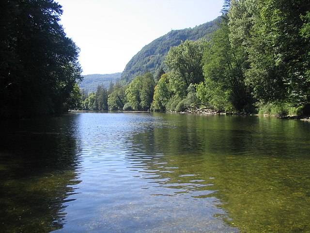

Vaux-lès-Saint-Claude
- commune in Jura, France
 Hiking in Vaux-lès-Saint-Claude
Vaux-lès-Saint-Claude, located in the Jura region of France, offers a variety of hiking opportunities that showcase the stunning natural beauty of the surrounding landscapes. Here are some key points to consider if you're planning a hiking trip there:...
- Country:

- Postal Code: 39360
- Coordinates: 46° 21' 28" N, 5° 44' 14" E


- GPS tracks (wikiloc): [Link]
- Area: 9.36 sq km
- Population: 705


Villard-Saint-Sauveur
- commune in Jura, France
 Hiking in Villard-Saint-Sauveur
Villard-Saint-Sauveur, located in the French Alps, is a fantastic destination for hiking enthusiasts. The area is known for its stunning landscapes, diverse flora and fauna, and a variety of trails that cater to different skill levels. Here are some highlights for hiking in Villard-Saint-Sauveur:...
- Country:

- Postal Code: 39200
- Coordinates: 46° 22' 18" N, 5° 52' 28" E


- GPS tracks (wikiloc): [Link]
- Area: 9.05 sq km
- Population: 614


Avignon-lès-Saint-Claude
- commune in Jura, France
 Hiking in Avignon-lès-Saint-Claude
Avignon-lès-Saint-Claude, located in the Jura Mountains of France, offers a beautiful setting for hiking enthusiasts. The region is characterized by its stunning natural landscapes, including forests, rolling hills, and panoramic views of the surrounding mountains....
- Country:

- Postal Code: 39200
- Coordinates: 46° 23' 26" N, 5° 50' 47" E


- GPS tracks (wikiloc): [Link]
- AboveSeaLevel: 729 м m
- Area: 7.83 sq km
- Population: 390

Cuttura
- former commune in Jura, France
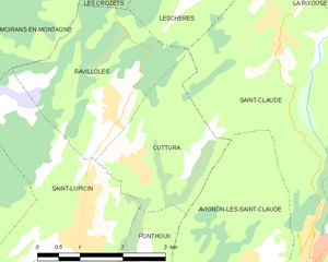
Cuttura, a lesser-known but beautiful area, offers scenic landscapes that are ideal for hiking enthusiasts. While my specific information on Cuttura may be limited, here are some general hiking tips and things to consider when exploring the area:...
- Country:

- Postal Code: 39170
- Coordinates: 46° 24' 48" N, 5° 48' 41" E


- GPS tracks (wikiloc): [Link]
- Area: 5.95 sq km
- Population: 326


Lavans-lès-Saint-Claude
- former commune in Jura, France
 Hiking in Lavans-lès-Saint-Claude
Lavans-lès-Saint-Claude, now part of the commune of Saint-Claude in the Jura department of France, is an area rich in natural beauty and hiking opportunities. The region is renowned for its stunning landscapes, varied terrain, and abundant biodiversity, making it a fantastic spot for outdoor enthusiasts....
- Country:

- Postal Code: 39170
- Coordinates: 46° 23' 10" N, 5° 46' 56" E


- GPS tracks (wikiloc): [Link]
- Area: 11.65 sq km
- Population: 1916
- Web site: [Link]


Lavancia-Epercy
- commune in Jura, France
Lavancia-Épercy is a beautiful village located in the Jura Mountains in eastern France. It offers scenic hiking opportunities amidst lush greenery, rolling hills, and stunning views. Here are some highlights for hiking in the area:...
- Country:

- Postal Code: 01590
- Coordinates: 46° 19' 51" N, 5° 40' 46" E


- GPS tracks (wikiloc): [Link]
- Area: 10.56 sq km
- Population: 665
- Web site: [Link]


Saint-Lupicin
- former commune in Jura, France
Saint-Lupicin is a charming commune located in the Jura department of France, known for its picturesque landscapes and natural beauty. Hiking in this area offers a variety of options for both novice and experienced hikers. Here are some highlights of hiking in and around Saint-Lupicin:...
- Country:

- Postal Code: 39170
- Coordinates: 46° 23' 58" N, 5° 47' 31" E


- GPS tracks (wikiloc): [Link]
- Area: 9.54 sq km
- Population: 2056
- Web site: [Link]


Les Molunes
- former commune in Jura, France
Les Molunes is a picturesque area that offers a range of hiking opportunities, typically situated within the Jura mountain range in France. The region is known for its scenic landscapes, diverse ecosystems, and rich flora and fauna, making it a favored destination for outdoor enthusiasts....
- Country:

- Postal Code: 39310
- Coordinates: 46° 20' 42" N, 5° 55' 25" E


- GPS tracks (wikiloc): [Link]
- AboveSeaLevel: 1274 м m
- Area: 20.51 sq km
- Population: 156


Ravilloles
- commune in Jura, France
Ravilloles is a beautiful destination for hiking enthusiasts, known for its stunning landscapes and diverse trails. Here are some key points about hiking in Ravilloles:...
- Country:

- Postal Code: 39170
- Coordinates: 46° 25' 32" N, 5° 48' 9" E


- GPS tracks (wikiloc): [Link]
- Area: 7.79 sq km
- Population: 491
