canton of Saint-Paul-Trois-Châteaux (canton de Saint-Paul-Trois-Châteaux)
- canton of France (until March 2015)
 Hiking in canton of Saint-Paul-Trois-Châteaux
The Canton of Saint-Paul-Trois-Châteaux, located in the Drôme department of the Auvergne-Rhône-Alpes region in southeastern France, offers a diverse and picturesque landscape ideal for hiking enthusiasts.
Key Highlights:
-
Scenic Routes:
- The area features a range of trails that cater to various skill levels, from easy walks suitable for families to more challenging hikes for experienced trekkers.
- Trails often lead through vineyards, rolling hills, and charming Provençal villages, providing a taste of the region's rich culture and natural beauty.
-
Historical Sites:
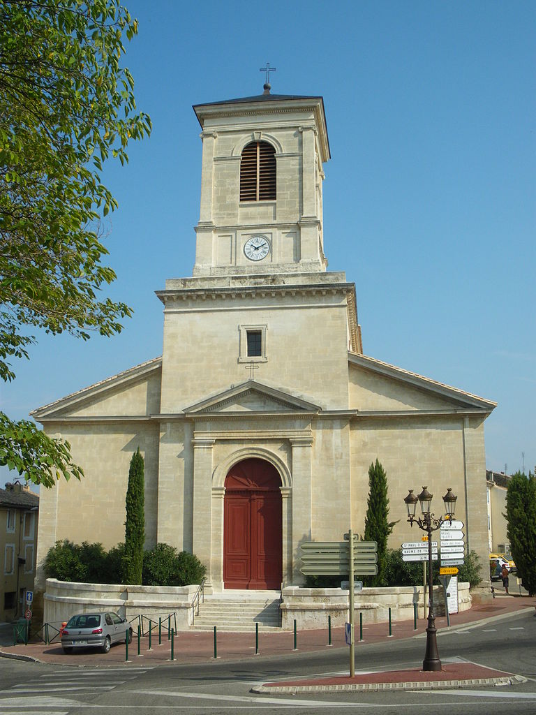
- As you hike, you’ll encounter numerous historical landmarks, such as the ancient Roman ruins and the notable Saint-Paul-Trois-Châteaux church. This adds an educational twist to your outdoor experience.
-
Natural Attractions:
- The nearby landscapes, including the Drôme Valley and the Gorges de l’Ardèche, are perfect for hikers looking to explore stunning natural formations and wildlife.
- Take time to enjoy the diverse flora and fauna, as well as the breathtaking views from elevated points along the trails.
-
Hiking Networks:
- The region is part of a broader network of hiking paths known as "GR" (Grande Randonnée), which connects various towns and attractions. These marked paths can help you navigate and discover more of the area.
-
Best Seasons:
- Spring and autumn are particularly favorable for hiking, as the weather is usually mild and the crowds are smaller compared to summer.
-
Local Culture:
- Don’t miss the opportunity to taste local cuisine and wines after your hikes. The region is known for its gastronomy and wine production, particularly the Côtes du Rhône wines.
Tips for Hiking in the Canton of Saint-Paul-Trois-Châteaux:
- Map and Navigation: Always carry a reliable map or a GPS device. Some trails are not well-marked.
- Prepare for the Weather: Check the forecast, as weather can change quickly in mountainous areas.
- Stay Hydrated and Fueled: Bring enough water and snacks, especially on longer hikes.
- Respect Nature: Stick to designated trails to preserve the natural environment and wildlife.
Whether you're looking for a leisurely stroll or a more vigorous trek, the Canton of Saint-Paul-Trois-Châteaux has something to offer every hiker. Enjoy your adventure!
- Country:

- Capital: Saint-Paul-Trois-Châteaux
- Coordinates: 44° 19' 20" N, 4° 50' 23" E


- GPS tracks (wikiloc): [Link]
- Wikipedia en: wiki(en)
- Wikipedia: wiki(fr)
- Wikidata storage: Wikidata: Q1572651
- Freebase ID: [/m/0cc7x46]
- Freebase ID: [/m/0cc7x46]
- INSEE canton code: [2625]
- INSEE canton code: [2625]
Includes regions:


Saint-Restitut
- commune in Drôme, France
- Country:
- Postal Code: 26130
- Coordinates: 44° 19' 54" N, 4° 47' 24" E
- GPS tracks (wikiloc): [Link]
- Area: 14.48 sq km
- Population: 1359


Solérieux
- commune in Drôme, France
- Country:
- Postal Code: 26130
- Coordinates: 44° 20' 54" N, 4° 49' 55" E
- GPS tracks (wikiloc): [Link]
- Area: 8.55 sq km
- Population: 334

Suze-la-Rousse
- commune in Drôme, France
- Country:
- Postal Code: 26790
- Coordinates: 44° 17' 17" N, 4° 50' 32" E
- GPS tracks (wikiloc): [Link]
- Area: 30.6 sq km
- Population: 2066

Saint-Paul-Trois-Châteaux
- commune in Drôme, France
- Country:
- Postal Code: 26130
- Coordinates: 44° 20' 56" N, 4° 46' 7" E
- GPS tracks (wikiloc): [Link]
- Area: 22.04 sq km
- Population: 8969
- Web site: [Link]


Tulette
- commune in Drôme, France
Hiking in Tulette
Tulette is a charming commune located in the Vaucluse department of the Provence-Alpes-Côte d'Azur region in southeastern France. While it's not a major hiking destination like some of the larger national parks or mountain ranges in France, it offers a lovely setting for those looking to enjoy a more relaxed hiking experience in the French countryside....
- Country:
- Postal Code: 26790
- Coordinates: 44° 17' 11" N, 4° 55' 51" E
- GPS tracks (wikiloc): [Link]
- Area: 23.53 sq km
- Population: 1963

Clansayes
- commune in Drôme, France
- Country:
- Postal Code: 26130
- Coordinates: 44° 22' 16" N, 4° 48' 27" E
- GPS tracks (wikiloc): [Link]
- Area: 14.47 sq km
- Population: 516


Bouchet
- commune in Drôme, France
Hiking in Bouchet
Bouchet is a charming village located in the Drôme department of the Auvergne-Rhône-Alpes region in southeastern France. It is surrounded by stunning landscapes, making it an excellent destination for hiking enthusiasts. Here are some key points to consider when hiking in and around Bouchet:...
- Country:
- Postal Code: 26790
- Coordinates: 44° 17' 57" N, 4° 52' 23" E
- GPS tracks (wikiloc): [Link]
- Area: 11.89 sq km
- Population: 1454

La Baume-de-Transit
- commune in Drôme, France
Hiking in La Baume-de-Transit
La Baume-de-Transit is a charming village located in the Drôme department of southeastern France. It's surrounded by beautiful landscapes, making it an excellent destination for hiking enthusiasts. The area boasts a mix of gentle hills, vineyards, and is near the picturesque Rhône Valley, providing various trails suitable for different skill levels....
- Country:
- Postal Code: 26790
- Coordinates: 44° 20' 18" N, 4° 51' 56" E
- GPS tracks (wikiloc): [Link]
- Area: 12.05 sq km
- Population: 855


Montségur-sur-Lauzon
- commune in Drôme, France
Hiking in Montségur-sur-Lauzon
Montségur-sur-Lauzon is a charming village located in the Drôme department of the Auvergne-Rhône-Alpes region in southeastern France. It offers a variety of hiking opportunities amidst stunning natural scenery, including vineyards, aromatic fields, and the picturesque landscapes of the surrounding hills....
- Country:
- Postal Code: 26130
- Coordinates: 44° 21' 38" N, 4° 51' 34" E
- GPS tracks (wikiloc): [Link]
- Area: 18.24 sq km
- Population: 1268


Rochegude
- commune in Drôme, France
- Country:
- Postal Code: 26790
- Coordinates: 44° 14' 56" N, 4° 49' 43" E
- GPS tracks (wikiloc): [Link]
- Area: 18.3 sq km
- Population: 1582