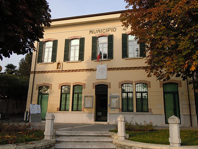
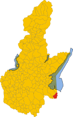
Lonato del Garda (Lonato del Garda)
- Italian comune
Lonato del Garda, located in the Lombardy region of northern Italy, is a beautiful area that offers various hiking opportunities, particularly due to its proximity to Lake Garda and the surrounding hills. Here are some key points to consider if you're planning a hiking trip in this region:
Scenic Views
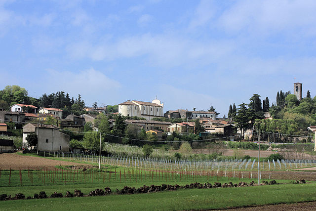
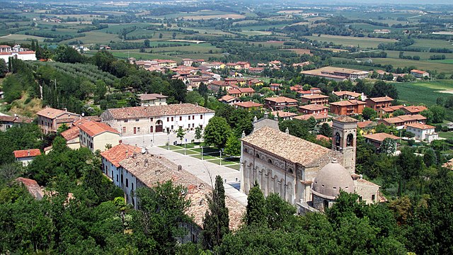
Hiking in Lonato del Garda often provides stunning views of Lake Garda, the surrounding mountains, and the lush Italian countryside. The area features a mix of landscapes, including gentle hills, vineyards, olive groves, and historical sites.
Trails
The region offers a variety of trails suitable for different skill levels. Some popular hiking routes near Lonato include:
-
Monte Croce: A moderate hike that rewards you with panoramic views over Lake Garda. The trail is well-marked and suitable for those looking for a half-day hike.
-
Valtenesi Hills: These trails traverse through vineyards and olive groves, making for a scenic and somewhat relaxed trekking experience.
-
Rocca di Lonato: Visit this historic fortress, and enjoy the trails around it that offer beautiful views of both the town and the lake.
-
Sentiero del Viandante: A long-distance trail that passes through picturesque villages and stunning landscapes, offering opportunities to explore the local flora and fauna.
Best Time to Hike
The optimal time for hiking in Lonato del Garda is during the spring (April to June) and autumn (September to October), when temperatures are mild, and the scenery is particularly beautiful. Summer can be quite hot, so it's essential to start hikes early in the day to avoid the heat.
Preparation
- Footwear: Wear sturdy hiking boots suitable for varying terrain.
- Supplies: Bring plenty of water, snacks, and sunscreen.
- Maps: While many trails are well-marked, it’s a good idea to have a physical map or a hiking app for navigation.
Accessibility
Lonato del Garda is easily accessible by car or public transport from various cities like Brescia or Verona. There are several accommodations in the area ranging from hotels to agriturismos (farm stays), allowing for a comfortable hiking getaway.
Remember to respect the natural environment and local trails, and enjoy your hiking experience in this beautiful part of Italy!
- Country:

- Postal Code: 25017
- Local Dialing Code: 030
- Licence Plate Code: BS
- Coordinates: 45° 27' 39" N, 10° 28' 38" E


- GPS tracks (wikiloc): [Link]
- AboveSeaLevel: 170 м m
- Area: 68.2 sq km
- Population: 16506
- Web site: http://www.comune.lonato.bs.it/
- Wikipedia en: wiki(en)
- Wikipedia: wiki(it)
- Wikidata storage: Wikidata: Q105039
- Wikipedia Commons Gallery: [Link]
- Wikipedia Commons Category: [Link]
- Freebase ID: [/m/044vdh]
- GeoNames ID: Alt: [6541711]
- OSM relation ID: [44893]
- archINFORM location ID: [45533]
- MusicBrainz area ID: [82a4852e-c5fb-4873-ab61-03b0ac3a99f8]
- UN/LOCODE: [ITZMK]
- Digital Atlas of the Roman Empire ID: [42286]
- ISTAT ID: 017092
- Italian cadastre code: M312
Shares border with regions:


Bedizzole
- Italian comune
Bedizzole is a charming town located in northern Italy, near Lake Garda, and surrounded by beautiful landscapes that are ideal for hiking enthusiasts. The area offers a range of trails that cater to different skill levels, from gentle walks suitable for families to more challenging hikes for experienced adventurers....
- Country:

- Postal Code: 25081
- Local Dialing Code: 030
- Licence Plate Code: BS
- Coordinates: 45° 31' 0" N, 10° 25' 0" E


- GPS tracks (wikiloc): [Link]
- AboveSeaLevel: 184 м m
- Area: 26.44 sq km
- Population: 12299
- Web site: [Link]


Calcinato
- Italian comune
Calcinato is a charming town located in the Lombardy region of northern Italy, not far from the city of Brescia. While it may not be as well-known for hiking as some other areas in Italy, it offers opportunities for outdoor activities and exploration in the surrounding region....
- Country:

- Postal Code: 25011
- Local Dialing Code: 030
- Licence Plate Code: BS
- Coordinates: 45° 27' 29" N, 10° 24' 53" E


- GPS tracks (wikiloc): [Link]
- AboveSeaLevel: 171 м m
- Area: 33.3 sq km
- Population: 12894
- Web site: [Link]


Calvagese della Riviera
- Italian comune
 Hiking in Calvagese della Riviera
Calvagese della Riviera, located in the province of Brescia in Northern Italy, offers various hiking opportunities that allow you to explore its picturesque landscapes and natural beauty. Here are some key points to consider when hiking in this area:...
- Country:

- Postal Code: 25080
- Local Dialing Code: 030
- Licence Plate Code: BS
- Coordinates: 45° 32' 3" N, 10° 26' 33" E


- GPS tracks (wikiloc): [Link]
- AboveSeaLevel: 225 м m
- Area: 11.74 sq km
- Population: 3566
- Web site: [Link]


Desenzano del Garda
- Italian comune
Desenzano del Garda, located on the southern shore of Lake Garda in Italy, offers a beautiful landscape for hiking enthusiasts. The area is characterized by a mix of rolling hills, vineyards, olive groves, and stunning lake views, making it a fantastic destination for outdoor activities....
- Country:

- Postal Code: 25015
- Local Dialing Code: 030
- Licence Plate Code: BS
- Coordinates: 45° 28' 8" N, 10° 32' 6" E


- GPS tracks (wikiloc): [Link]
- AboveSeaLevel: 96 м m
- Area: 59.26 sq km
- Population: 28982
- Web site: [Link]


Padenghe sul Garda
- Italian comune
Padenghe sul Garda, located on the southwestern shore of Lake Garda in Italy, offers a beautiful backdrop for hiking enthusiasts. The area is characterized by its stunning lake views, rolling hills, olive groves, and vineyards. Here’s what you can expect when hiking in and around Padenghe sul Garda:...
- Country:

- Postal Code: 25080
- Local Dialing Code: 030
- Licence Plate Code: BS
- Coordinates: 45° 30' 30" N, 10° 30' 59" E


- GPS tracks (wikiloc): [Link]
- AboveSeaLevel: 127 м m
- Area: 26.81 sq km
- Population: 4629
- Web site: [Link]

Pozzolengo
- Italian comune
Pozzolengo is a charming village located in the Lombardy region of Italy, near Lake Garda. The surrounding area offers a variety of hiking opportunities, characterized by beautiful landscapes, vineyards, olive groves, and historic sites....
- Country:

- Postal Code: 25010
- Local Dialing Code: 030
- Licence Plate Code: BS
- Coordinates: 45° 24' 25" N, 10° 38' 2" E


- GPS tracks (wikiloc): [Link]
- AboveSeaLevel: 135 м m
- Area: 21.33 sq km
- Population: 3558
- Web site: [Link]


Cavriana
- Italian comune
Cavriana is a charming town located in the Lombardy region of Italy, surrounded by beautiful landscapes that are perfect for hiking. The area is characterized by gentle hills, vineyards, and historic sites, making it an attractive destination for hikers of all levels....
- Country:

- Postal Code: 46040
- Local Dialing Code: 0376
- Licence Plate Code: MN
- Coordinates: 45° 21' 0" N, 10° 36' 0" E


- GPS tracks (wikiloc): [Link]
- AboveSeaLevel: 170 м m
- Area: 36.91 sq km
- Population: 3828
- Web site: [Link]


Solferino
- Italian comune
Hiking in Solferino, located in the Lombardy region of Italy, is a delightful experience characterized by scenic landscapes, historical significance, and a variety of trails that cater to different skill levels. Here are some key points about hiking in this area:...
- Country:

- Postal Code: 46040
- Local Dialing Code: 0376
- Licence Plate Code: MN
- Coordinates: 45° 22' 20" N, 10° 33' 59" E


- GPS tracks (wikiloc): [Link]
- AboveSeaLevel: 124 м m
- Area: 13.08 sq km
- Population: 2631
- Web site: [Link]


Castiglione delle Stiviere
- Italian comune
 Hiking in Castiglione delle Stiviere
Castiglione delle Stiviere is a charming town located in the Lombardy region of northern Italy, known for its rich history, beautiful landscapes, and proximity to various natural attractions. While it may not be as famous for hiking as other areas in Italy, there are several opportunities for outdoor activities and exploration in the surrounding region....
- Country:

- Postal Code: 46043
- Local Dialing Code: 0376
- Licence Plate Code: MN
- Coordinates: 45° 24' 0" N, 10° 30' 0" E


- GPS tracks (wikiloc): [Link]
- AboveSeaLevel: 111 м m
- Area: 42.02 sq km
- Population: 23570
- Web site: [Link]
