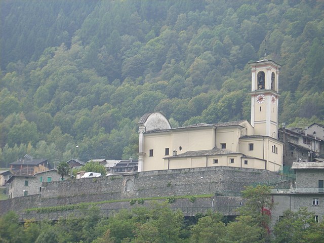
Castione Andevenno (Castione Andevenno)
.svg)
- Italian comune
 Hiking in Castione Andevenno
Castione Andevenno is a charming village located in the Valtellina valley in the Lombardy region of Italy. It offers several hiking opportunities that appeal to various skill levels, providing breathtaking views of the surrounding mountains and countryside.
Hiking Trails in Castione Andevenno:
-
Sentiero dei Parchi:
- This trail is part of a wider network that connects different parks in the area. It offers scenic views and is relatively easy to navigate, making it suitable for families and beginners.
-
Mulini del Dongo:
- A historic trail that takes hikers past ancient water mills. It's a great blend of nature and history, allowing you to appreciate the local culture and scenic landscapes.
-
Trail to Monte Legnone:
- For more experienced hikers, the trek to Monte Legnone provides steep ascents and rewarding views of the lake and the valley below. This trail is physically demanding but offers spectacular panoramas.
-
Val di Mello:
- Though a bit of a drive from Castione Andevenno, this valley is often considered one of the most beautiful in the area. It has a variety of trails that range from easy walks to challenging climbs.
General Tips for Hiking in the Area:
- Safety: Always check the weather conditions before heading out, as mountain weather can change rapidly. Carry a first aid kit and a map or GPS device.
- Footwear: Wear appropriate hiking shoes or boots with good traction, especially on rocky or steep terrains.
- Hydration and Snacks: Make sure to carry enough water and snacks to keep your energy levels up on longer hikes.
- Leave No Trace: Respect nature by following Leave No Trace principles. Dispose of waste properly and avoid disturbing wildlife.
- Local Regulations: Be aware of any local regulations regarding camping and fires, especially in natural parks.
Best Time to Hike:
The best time for hiking in this region is during the late spring through early autumn (May to October) when trails are usually clear, and the scenery is stunning.
Whether you're looking for a leisurely stroll or a challenging hike, Castione Andevenno and its surroundings offer a diverse range of options to explore the beauty of the Valtellina region. Enjoy your hiking adventure!
- Country:

- Postal Code: 23012
- Local Dialing Code: 0342
- Licence Plate Code: SO
- Coordinates: 46° 10' 0" N, 9° 48' 0" E


- GPS tracks (wikiloc): [Link]
- AboveSeaLevel: 468 м m
- Area: 17.03 sq km
- Population: 1575
- Web site: http://www.comune.castioneandevenno.so.it
- Wikipedia en: wiki(en)
- Wikipedia: wiki(it)
- Wikidata storage: Wikidata: Q40853
- Wikipedia Commons Category: [Link]
- Freebase ID: [/m/0gj2s5]
- GeoNames ID: Alt: [6542547]
- VIAF ID: Alt: [238149007]
- OSM relation ID: [46957]
- UN/LOCODE: [ITCDE]
- ISTAT ID: 014015
- Italian cadastre code: C325
Shares border with regions:
Postalesio
- Italian comune
Hiking in Postalesio
Postalesio is a charming destination for hikers, located in the Valtellina valley in northern Italy. It's surrounded by the stunning Alps, and offers a range of hiking trails that cater to different skill levels, from gentle walks to more challenging routes....
- Country:
- Postal Code: 23010
- Local Dialing Code: 0342
- Licence Plate Code: SO
- Coordinates: 46° 10' 0" N, 9° 47' 0" E
- GPS tracks (wikiloc): [Link]
- AboveSeaLevel: 516 м m
- Area: 10.58 sq km
- Population: 666
- Web site: [Link]

Torre di Santa Maria
- Italian comune
Hiking in Torre di Santa Maria
Torre di Santa Maria, located in the beautiful region of Lombardy in northern Italy, is an excellent destination for hiking enthusiasts. Nestled in the Valtellina valley, it is surrounded by stunning landscapes, including mountains, valleys, and lush forests....
- Country:
- Postal Code: 23020
- Local Dialing Code: 0342
- Licence Plate Code: SO
- Coordinates: 46° 14' 0" N, 9° 51' 0" E
- GPS tracks (wikiloc): [Link]
- AboveSeaLevel: 795 м m
- Area: 44.24 sq km
- Population: 752
- Web site: [Link]
Albosaggia
- Italian comune
Hiking in Albosaggia
Albosaggia, located in the Lombardy region of Italy, offers beautiful hiking opportunities with stunning views of the surrounding mountains and valleys. Here are some highlights and tips for hiking in this picturesque area:...
- Country:
- Postal Code: 23010
- Local Dialing Code: 0342
- Licence Plate Code: SO
- Coordinates: 46° 9' 0" N, 9° 51' 0" E
- GPS tracks (wikiloc): [Link]
- AboveSeaLevel: 490 м m
- Area: 34.35 sq km
- Population: 3020
- Web site: [Link]
Caiolo
- Italian comune
Hiking in Caiolo
Caiolo is a charming village located in the Valtellina valley in northern Italy, known for its beautiful landscapes and rich outdoor activities, including hiking. Here are some highlights and tips for hiking in and around Caiolo:...
- Country:
- Postal Code: 23010
- Local Dialing Code: 0342
- Licence Plate Code: SO
- Coordinates: 46° 9' 0" N, 9° 48' 0" E
- GPS tracks (wikiloc): [Link]
- AboveSeaLevel: 335 м m
- Area: 32.97 sq km
- Population: 1085
- Web site: [Link]
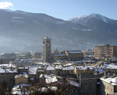

Sondrio
- Italian city in Valtellina
Hiking in Sondrio
Sondrio, located in the Lombardy region of northern Italy, offers a variety of stunning hiking opportunities, particularly in the surrounding Valtellina Valley and the adjacent Stelvio National Park. Here are some highlights and essential information for hiking in the Sondrio area:...
- Country:
- Postal Code: 23100
- Local Dialing Code: 0342
- Licence Plate Code: SO
- Coordinates: 46° 10' 11" N, 9° 52' 12" E
- GPS tracks (wikiloc): [Link]
- AboveSeaLevel: 360 м m
- Area: 20.88 sq km
- Population: 21642
- Web site: [Link]