
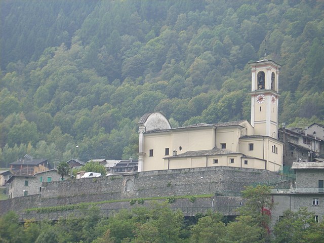
Sondrio (Sondrio)
.svg)
- Italian city in Valtellina
 Hiking in Sondrio
Sondrio, located in the Lombardy region of northern Italy, offers a variety of stunning hiking opportunities, particularly in the surrounding Valtellina Valley and the adjacent Stelvio National Park. Here are some highlights and essential information for hiking in the Sondrio area:
Scenic Trails
-
Sentiero Valtellina: This is a long-distance trail that runs along the Adda River, stretching approximately 114 kilometers. It offers beautiful views of the valley, vineyards, and local flora and fauna. The terrain is generally easy to moderate, making it suitable for hikers of various skill levels.
-
Val Bregaglia: This area features numerous trails with varying difficulty levels. You'll find routes that lead to stunning lakes, waterfalls, and panoramic viewpoints. The trail to the beautiful Lago di Silvaplana is particularly popular.
-
Stelvio National Park: The park offers a wealth of hiking trails that allow you to explore rugged alpine landscapes, glaciers, and rich wildlife. Trails vary in difficulty and length, with some leading to high-altitude passes such as the Passo di Stelvio.
-
Cima di Piazzi: For those seeking a challenge, this hike takes you to one of the higher summits in the area. It features steep paths and offers spectacular views of the surrounding peaks.
Practical Information
-
Best Time to Hike: The best hiking season typically runs from late spring to early autumn (May to October). However, some higher trails may remain snow-covered until late June or even July.
-
Equipment: Appropriate hiking gear is essential. Sturdy hiking boots, layered clothing, and good rain gear are recommended. Depending on the chosen trails, crampons and trekking poles might be helpful.
-
Guided Tours: If you're unfamiliar with the area or prefer a guided experience, there are several local organizations offering guided hikes tailored to various skill levels.
-
Local Amenities: In Sondrio, you will find accommodations, restaurants, and shops catering to hikers. Many local eateries serve traditional Valtellina dishes, especially those featuring polenta, bresaola, and local cheeses.
-
Transportation: The area is accessible by public transportation, including trains and buses that connect Sondrio to various trailheads. Renting a car may provide more convenience for reaching remote locations.
Safety Tips
- Always check weather conditions before heading out.
- Inform someone about your hiking plans and estimated return time.
- Carry enough water, snacks, and a basic first-aid kit.
Whether you're a novice or an experienced hiker, Sondrio offers a beautiful natural landscape to explore with trails that showcase the best of the Italian Alps. Enjoy your hike!
- Country:

- Postal Code: 23100
- Local Dialing Code: 0342
- Licence Plate Code: SO
- Coordinates: 46° 10' 11" N, 9° 52' 12" E


- GPS tracks (wikiloc): [Link]
- AboveSeaLevel: 360 м m
- Area: 20.88 sq km
- Population: 21642
- Web site: https://www.comune.sondrio.it
- Wikipedia en: wiki(en)
- Wikipedia: wiki(it)
- Wikidata storage: Wikidata: Q6274
- Wikipedia Commons Gallery: [Link]
- Wikipedia Commons Category: [Link]
- Freebase ID: [/m/01c4jx]
- GeoNames ID: Alt: [6539617]
- BnF ID: [12011171p]
- OSM relation ID: [46963]
- GND ID: Alt: [4362421-2]
- archINFORM location ID: [4783]
- Library of Congress authority ID: Alt: [n80128347]
- Quora topic ID: [Sondrio]
- UN/LOCODE: [ITSND]
- Encyclopædia Britannica Online ID: [place/Sondrio-Italy]
- HDS ID: [7064]
- ISTAT ID: 014061
- Italian cadastre code: I829
Shares border with regions:


Montagna in Valtellina
- Italian comune
Hiking in Montagna in Valtellina
Montagna in Valtellina, located in the Sondrio province of Lombardy, Italy, is an excellent destination for hiking enthusiasts. This area is part of the Valtellina Valley, which is known for its stunning landscapes, charming villages, and rich cultural heritage....
- Country:
- Postal Code: 23020
- Local Dialing Code: 0342
- Licence Plate Code: SO
- Coordinates: 46° 11' 0" N, 9° 54' 0" E
- GPS tracks (wikiloc): [Link]
- AboveSeaLevel: 567 м m
- Area: 44.97 sq km
- Population: 3041
- Web site: [Link]

Torre di Santa Maria
- Italian comune
Hiking in Torre di Santa Maria
Torre di Santa Maria, located in the beautiful region of Lombardy in northern Italy, is an excellent destination for hiking enthusiasts. Nestled in the Valtellina valley, it is surrounded by stunning landscapes, including mountains, valleys, and lush forests....
- Country:
- Postal Code: 23020
- Local Dialing Code: 0342
- Licence Plate Code: SO
- Coordinates: 46° 14' 0" N, 9° 51' 0" E
- GPS tracks (wikiloc): [Link]
- AboveSeaLevel: 795 м m
- Area: 44.24 sq km
- Population: 752
- Web site: [Link]
Faedo Valtellino
- Italian comune
Hiking in Faedo Valtellino
Faedo Valtellino is a picturesque area located in the Lombardy region of northern Italy, known for its stunning landscapes, charming villages, and proximity to the Alps. Hiking in this region offers a variety of trails that cater to different skill levels, making it a great destination for both casual walkers and experienced hikers....
- Country:
- Postal Code: 23020
- Local Dialing Code: 0342
- Licence Plate Code: SO
- Coordinates: 46° 9' 0" N, 9° 54' 0" E
- GPS tracks (wikiloc): [Link]
- AboveSeaLevel: 557 м m
- Area: 4.8 sq km
- Population: 556
- Web site: [Link]
Albosaggia
- Italian comune
Hiking in Albosaggia
Albosaggia, located in the Lombardy region of Italy, offers beautiful hiking opportunities with stunning views of the surrounding mountains and valleys. Here are some highlights and tips for hiking in this picturesque area:...
- Country:
- Postal Code: 23010
- Local Dialing Code: 0342
- Licence Plate Code: SO
- Coordinates: 46° 9' 0" N, 9° 51' 0" E
- GPS tracks (wikiloc): [Link]
- AboveSeaLevel: 490 м m
- Area: 34.35 sq km
- Population: 3020
- Web site: [Link]
Spriana
- Italian comune
Hiking in Spriana
Spriana, a charming village in the Lombardy region of Italy, is set against the stunning backdrop of the Italian Alps. It offers a variety of hiking opportunities suitable for all skill levels, with scenic trails that showcase the natural beauty of the area....
- Country:
- Postal Code: 23020
- Local Dialing Code: 0342
- Licence Plate Code: SO
- Coordinates: 46° 13' 0" N, 9° 52' 0" E
- GPS tracks (wikiloc): [Link]
- AboveSeaLevel: 754 м m
- Area: 7.69 sq km
- Population: 87
- Web site: [Link]


Castione Andevenno
- Italian comune
Hiking in Castione Andevenno
Castione Andevenno is a charming village located in the Valtellina valley in the Lombardy region of Italy. It offers several hiking opportunities that appeal to various skill levels, providing breathtaking views of the surrounding mountains and countryside....
- Country:
- Postal Code: 23012
- Local Dialing Code: 0342
- Licence Plate Code: SO
- Coordinates: 46° 10' 0" N, 9° 48' 0" E
- GPS tracks (wikiloc): [Link]
- AboveSeaLevel: 468 м m
- Area: 17.03 sq km
- Population: 1575
- Web site: [Link]
Caiolo
- Italian comune
Hiking in Caiolo
Caiolo is a charming village located in the Valtellina valley in northern Italy, known for its beautiful landscapes and rich outdoor activities, including hiking. Here are some highlights and tips for hiking in and around Caiolo:...
- Country:
- Postal Code: 23010
- Local Dialing Code: 0342
- Licence Plate Code: SO
- Coordinates: 46° 9' 0" N, 9° 48' 0" E
- GPS tracks (wikiloc): [Link]
- AboveSeaLevel: 335 м m
- Area: 32.97 sq km
- Population: 1085
- Web site: [Link]