Cendras (Cendras)

- commune in Gard, France
- Country:

- Postal Code: 30480
- Coordinates: 44° 9' 19" N, 4° 3' 13" E


- GPS tracks (wikiloc): [Link]
- AboveSeaLevel: 140 м m
- Area: 12.86 sq km
- Population: 1856
- Web site: http://www.cendras.fr
- Wikipedia en: wiki(en)
- Wikipedia: wiki(fr)
- Wikidata storage: Wikidata: Q630610
- Wikipedia Commons Category: [Link]
- Freebase ID: [/m/03c0t_l]
- GeoNames ID: Alt: [6448222]
- SIREN number: [213000771]
- BnF ID: [152547186]
- MusicBrainz area ID: [c26a0f9a-8a9b-4c83-ab37-1cd927d577f7]
- WOEID: [583588]
- INSEE municipality code: 30077
Shares border with regions:

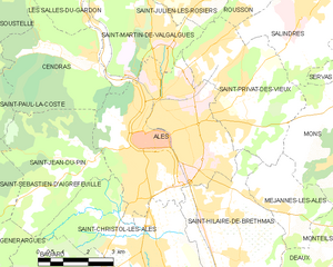
Alès
- commune in Gard, France
- Country:
- Postal Code: 30100
- Coordinates: 44° 7' 38" N, 4° 4' 51" E
- GPS tracks (wikiloc): [Link]
- AboveSeaLevel: 134 м m
- Area: 23.16 sq km
- Population: 39535
- Web site: [Link]

Saint-Paul-la-Coste
- commune in Gard, France
- Country:
- Postal Code: 30480
- Coordinates: 44° 8' 59" N, 3° 58' 10" E
- GPS tracks (wikiloc): [Link]
- AboveSeaLevel: 650 м m
- Area: 18.95 sq km
- Population: 287


Les Salles-du-Gardon
- commune in Gard, France
- Country:
- Postal Code: 30110
- Coordinates: 44° 12' 25" N, 4° 2' 5" E
- GPS tracks (wikiloc): [Link]
- Area: 21.09 sq km
- Population: 2618

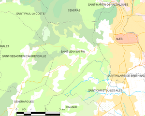
Saint-Jean-du-Pin
- commune in Gard, France
- Country:
- Postal Code: 30140
- Coordinates: 44° 7' 0" N, 4° 3' 2" E
- GPS tracks (wikiloc): [Link]
- AboveSeaLevel: 200 м m
- Area: 13.96 sq km
- Population: 1509
- Web site: [Link]
Soustelle
- commune in Gard, France
- Country:
- Postal Code: 30110
- Coordinates: 44° 10' 30" N, 4° 0' 41" E
- GPS tracks (wikiloc): [Link]
- AboveSeaLevel: 406 м m
- Area: 11.09 sq km
- Population: 131


Saint-Martin-de-Valgalgues
- commune in Gard, France
- Country:
- Postal Code: 30520
- Coordinates: 44° 9' 47" N, 4° 4' 56" E
- GPS tracks (wikiloc): [Link]
- Area: 13.11 sq km
- Population: 4313
- Web site: [Link]