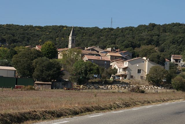
Saint-Martin-de-Valgalgues (Saint-Martin-de-Valgalgues)

- commune in Gard, France
- Country:

- Postal Code: 30520
- Coordinates: 44° 9' 47" N, 4° 4' 56" E


- GPS tracks (wikiloc): [Link]
- Area: 13.11 sq km
- Population: 4313
- Web site: http://www.saintmartindevalgalgues.fr
- Wikipedia en: wiki(en)
- Wikipedia: wiki(fr)
- Wikidata storage: Wikidata: Q863574
- Wikipedia Commons Category: [Link]
- Freebase ID: [/m/03c7zrd]
- GeoNames ID: Alt: [6431426]
- SIREN number: [213002843]
- BnF ID: [15254924p]
- INSEE municipality code: 30284
Shares border with regions:

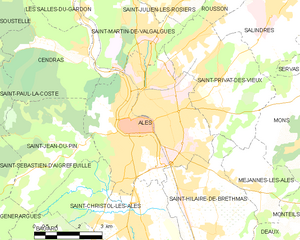
Alès
- commune in Gard, France
- Country:
- Postal Code: 30100
- Coordinates: 44° 7' 38" N, 4° 4' 51" E
- GPS tracks (wikiloc): [Link]
- AboveSeaLevel: 134 м m
- Area: 23.16 sq km
- Population: 39535
- Web site: [Link]


Saint-Privat-des-Vieux
- commune in Gard, France
- Country:
- Postal Code: 30340
- Coordinates: 44° 8' 39" N, 4° 7' 45" E
- GPS tracks (wikiloc): [Link]
- Area: 15.8 sq km
- Population: 5117
- Web site: [Link]


Laval-Pradel
- commune in Gard, France
- Country:
- Postal Code: 30110
- Coordinates: 44° 13' 54" N, 4° 3' 32" E
- GPS tracks (wikiloc): [Link]
- Area: 17.68 sq km
- Population: 1160
- Web site: [Link]


Les Salles-du-Gardon
- commune in Gard, France
- Country:
- Postal Code: 30110
- Coordinates: 44° 12' 25" N, 4° 2' 5" E
- GPS tracks (wikiloc): [Link]
- Area: 21.09 sq km
- Population: 2618


Cendras
- commune in Gard, France
- Country:
- Postal Code: 30480
- Coordinates: 44° 9' 19" N, 4° 3' 13" E
- GPS tracks (wikiloc): [Link]
- AboveSeaLevel: 140 м m
- Area: 12.86 sq km
- Population: 1856
- Web site: [Link]

Saint-Julien-les-Rosiers
- commune in Gard, France
- Country:
- Postal Code: 30340
- Coordinates: 44° 10' 26" N, 4° 6' 33" E
- GPS tracks (wikiloc): [Link]
- Area: 14.01 sq km
- Population: 3311