Cerdon (Cerdon)

- commune in Loiret, France
- Country:

- Postal Code: 45620
- Coordinates: 47° 38' 9" N, 2° 21' 40" E


- GPS tracks (wikiloc): [Link]
- Area: 67.07 sq km
- Population: 967
- Web site: http://www.cerdonduloiret.fr
- Wikipedia en: wiki(en)
- Wikipedia: wiki(fr)
- Wikidata storage: Wikidata: Q1432411
- Wikipedia Commons Category: [Link]
- Freebase ID: [/m/03c6yrk]
- GeoNames ID: Alt: [6449165]
- SIREN number: [214500639]
- BnF ID: [152604565]
- INSEE municipality code: 45063
Shares border with regions:


Brinon-sur-Sauldre
- commune in Cher, France
- Country:
- Postal Code: 18410
- Coordinates: 47° 33' 53" N, 2° 15' 18" E
- GPS tracks (wikiloc): [Link]
- Area: 116.3 sq km
- Population: 1004

Clémont
- commune in Cher, France
- Country:
- Postal Code: 18410
- Coordinates: 47° 34' 5" N, 2° 18' 26" E
- GPS tracks (wikiloc): [Link]
- Area: 50.11 sq km
- Population: 724


Isdes
- commune in Loiret, France
- Country:
- Postal Code: 45620
- Coordinates: 47° 40' 19" N, 2° 15' 20" E
- GPS tracks (wikiloc): [Link]
- Area: 43.89 sq km
- Population: 549
- Web site: [Link]

Coullons
- commune in Loiret, France
- Country:
- Postal Code: 45720
- Coordinates: 47° 37' 14" N, 2° 29' 33" E
- GPS tracks (wikiloc): [Link]
- Area: 78.97 sq km
- Population: 2489
- Web site: [Link]


Argent-sur-Sauldre
- commune in Cher, France
- Country:
- Postal Code: 18410
- Coordinates: 47° 33' 24" N, 2° 26' 35" E
- GPS tracks (wikiloc): [Link]
- Area: 67.35 sq km
- Population: 2142
- Web site: [Link]


Villemurlin
- commune in Loiret, France
- Country:
- Postal Code: 45600
- Coordinates: 47° 41' 6" N, 2° 20' 8" E
- GPS tracks (wikiloc): [Link]
- Area: 48.95 sq km
- Population: 600
- Web site: [Link]
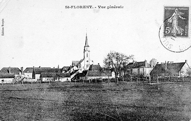

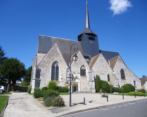
Saint-Florent
- commune in Loiret, France
- Country:
- Postal Code: 45600
- Coordinates: 47° 41' 0" N, 2° 29' 0" E
- GPS tracks (wikiloc): [Link]
- Area: 37.78 sq km
- Population: 448