Châteaumeillant (Châteaumeillant)
- commune in Cher, France
- Country:

- Postal Code: 18370
- Coordinates: 46° 33' 43" N, 2° 12' 2" E


- GPS tracks (wikiloc): [Link]
- Area: 42.48 sq km
- Population: 1933
- Web site: http://www.chateaumeillant.fr/
- Wikipedia en: wiki(en)
- Wikipedia: wiki(fr)
- Wikidata storage: Wikidata: Q639610
- Wikipedia Commons Category: [Link]
- Freebase ID: [/m/03mfcgn]
- GeoNames ID: Alt: [3026258]
- SIREN number: [211800578]
- BnF ID: [15249403b]
- VIAF ID: Alt: [130632137]
- Library of Congress authority ID: Alt: [nr95040646]
- WOEID: [584957]
- Digital Atlas of the Roman Empire ID: [2239]
- INSEE municipality code: 18057
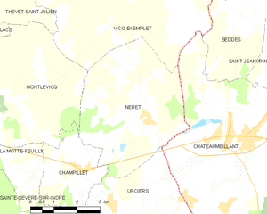
Shares border with regions:


Vicq-Exemplet
- commune in Indre, France
- Country:

- Postal Code: 36400
- Coordinates: 46° 37' 44" N, 2° 8' 28" E


- GPS tracks (wikiloc): [Link]
- Area: 38.74 sq km
- Population: 318


Urciers
- commune in Indre, France
- Country:

- Postal Code: 36160
- Coordinates: 46° 32' 7" N, 2° 7' 51" E


- GPS tracks (wikiloc): [Link]
- Area: 19.02 sq km
- Population: 242


Néret
- commune in Indre, France
- Country:

- Postal Code: 36400
- Coordinates: 46° 34' 8" N, 2° 8' 55" E


- GPS tracks (wikiloc): [Link]
- Area: 19.05 sq km
- Population: 202


Lignerolles
- commune in Indre, France
- Country:

- Postal Code: 36160
- Coordinates: 46° 29' 45" N, 2° 8' 38" E


- GPS tracks (wikiloc): [Link]
- Area: 13 sq km
- Population: 104


Beddes
- commune in Cher, France
- Country:

- Postal Code: 18370
- Coordinates: 46° 36' 21" N, 2° 12' 47" E


- GPS tracks (wikiloc): [Link]
- Area: 12.92 sq km
- Population: 87


Saint-Saturnin
- commune in Cher, France
- Country:

- Postal Code: 18370
- Coordinates: 46° 30' 27" N, 2° 14' 16" E


- GPS tracks (wikiloc): [Link]
- Area: 39.04 sq km
- Population: 418


Saint-Maur
- commune in Cher, France
- Country:

- Postal Code: 18270
- Coordinates: 46° 34' 48" N, 2° 17' 55" E


- GPS tracks (wikiloc): [Link]
- AboveSeaLevel: 273 м m
- Area: 25.62 sq km
- Population: 284


Saint-Jeanvrin
- commune in Cher, France
- Country:

- Postal Code: 18370
- Coordinates: 46° 35' 44" N, 2° 14' 2" E


- GPS tracks (wikiloc): [Link]
- Area: 17.53 sq km
- Population: 161
