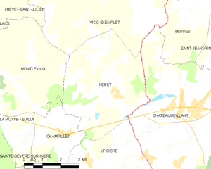
Vicq-Exemplet (Vicq-Exemplet)

- commune in Indre, France
- Country:

- Postal Code: 36400
- Coordinates: 46° 37' 44" N, 2° 8' 28" E


- GPS tracks (wikiloc): [Link]
- Area: 38.74 sq km
- Population: 318
- Wikipedia en: wiki(en)
- Wikipedia: wiki(fr)
- Wikidata storage: Wikidata: Q1069989
- Wikipedia Commons Category: [Link]
- Freebase ID: [/m/0c07zj]
- GeoNames ID: Alt: [2969374]
- SIREN number: [213602360]
- BnF ID: [15257540j]
- INSEE municipality code: 36236
Shares border with regions:


Saint-Christophe-en-Boucherie
- commune in Indre, France
- Country:
- Postal Code: 36400
- Coordinates: 46° 40' 41" N, 2° 7' 16" E
- GPS tracks (wikiloc): [Link]
- Area: 26.89 sq km
- Population: 250

Néret
- commune in Indre, France
- Country:
- Postal Code: 36400
- Coordinates: 46° 34' 8" N, 2° 8' 55" E
- GPS tracks (wikiloc): [Link]
- Area: 19.05 sq km
- Population: 202


Montlevicq
- commune in Indre, France
- Country:
- Postal Code: 36400
- Coordinates: 46° 34' 38" N, 2° 4' 12" E
- GPS tracks (wikiloc): [Link]
- Area: 18.79 sq km
- Population: 115


Maisonnais
- commune in Cher, France
- Country:
- Postal Code: 18170
- Coordinates: 46° 38' 24" N, 2° 12' 56" E
- GPS tracks (wikiloc): [Link]
- Area: 26.95 sq km
- Population: 238

Beddes
- commune in Cher, France
- Country:
- Postal Code: 18370
- Coordinates: 46° 36' 21" N, 2° 12' 47" E
- GPS tracks (wikiloc): [Link]
- Area: 12.92 sq km
- Population: 87

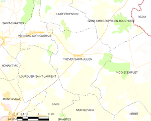
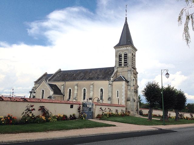
Thevet-Saint-Julien
- commune in Indre, France
- Country:
- Postal Code: 36400
- Coordinates: 46° 38' 14" N, 2° 4' 8" E
- GPS tracks (wikiloc): [Link]
- Area: 30.94 sq km
- Population: 402


Châteaumeillant
- commune in Cher, France
- Country:
- Postal Code: 18370
- Coordinates: 46° 33' 43" N, 2° 12' 2" E
- GPS tracks (wikiloc): [Link]
- Area: 42.48 sq km
- Population: 1933
- Web site: [Link]

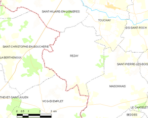
Rezay
- commune in Cher, France
- Country:
- Postal Code: 18170
- Coordinates: 46° 40' 22" N, 2° 10' 43" E
- GPS tracks (wikiloc): [Link]
- Area: 21.26 sq km
- Population: 227
- Web site: [Link]