Châtillon-Coligny (Châtillon-Coligny)

- commune in Loiret, France
- Country:

- Postal Code: 45230
- Coordinates: 47° 49' 22" N, 2° 50' 47" E


- GPS tracks (wikiloc): [Link]
- Area: 25.53 sq km
- Population: 1911
- Web site: http://www.chatillon-coligny.fr
- Wikipedia en: wiki(en)
- Wikipedia: wiki(fr)
- Wikidata storage: Wikidata: Q732483
- Wikipedia Commons Category: [Link]
- Freebase ID: [/m/03nwfx1]
- GeoNames ID: Alt: [3026076]
- SIREN number: [214500852]
- BnF ID: [15260478g]
- VIAF ID: Alt: [316741927]
- Library of Congress authority ID: Alt: [n93065539]
- EMLO location ID: [5670689a-3576-4565-a37f-5c1151af1fbe]
- INSEE municipality code: 45085
Shares border with regions:


La Chapelle-sur-Aveyron
- commune in Loiret, France
- Country:
- Postal Code: 45230
- Coordinates: 47° 52' 0" N, 2° 51' 44" E
- GPS tracks (wikiloc): [Link]
- Area: 19.03 sq km
- Population: 661

Dammarie-sur-Loing
- commune in Loiret, France
- Country:
- Postal Code: 45230
- Coordinates: 47° 47' 2" N, 2° 52' 50" E
- GPS tracks (wikiloc): [Link]
- Area: 20.94 sq km
- Population: 503


Montbouy
- commune in Loiret, France
- Country:
- Postal Code: 45230
- Coordinates: 47° 51' 41" N, 2° 49' 12" E
- GPS tracks (wikiloc): [Link]
- Area: 26.73 sq km
- Population: 745
- Web site: [Link]

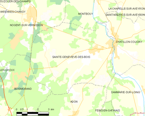
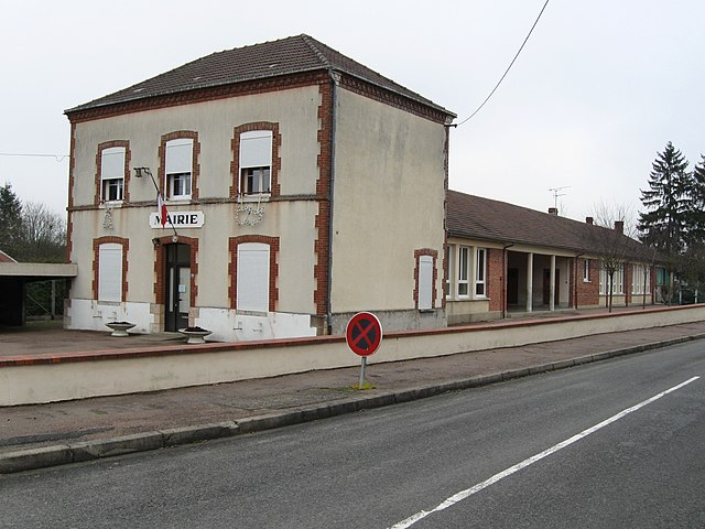
Sainte-Geneviève-des-Bois
- commune in Loiret, France
- Country:
- Postal Code: 45230
- Coordinates: 47° 49' 5" N, 2° 49' 6" E
- GPS tracks (wikiloc): [Link]
- Area: 40.74 sq km
- Population: 1083
- Web site: [Link]


Aillant-sur-Milleron
- commune in Loiret, France
- Country:
- Postal Code: 45230
- Coordinates: 47° 47' 34" N, 2° 55' 47" E
- GPS tracks (wikiloc): [Link]
- Area: 26.93 sq km
- Population: 404
- Web site: [Link]


Saint-Maurice-sur-Aveyron
- commune in Loiret, France
- Country:
- Postal Code: 45230
- Coordinates: 47° 51' 4" N, 2° 55' 38" E
- GPS tracks (wikiloc): [Link]
- Area: 53.76 sq km
- Population: 859
- Web site: [Link]